This page covers the whole circuit: the roads and their numbers, the length of each leg, the famous curve count, which direction to choose, how to do it by car, motorbike, van or private driver, and 3, 4 and 5 day plans with a bed for every night. Details of each stop, such as temples, caves, waterfalls, fees and opening hours, sit on the other pages of this section. Pai is a section of its own, and this page links to it when you pass through.
Distances and times are approximate. Van timetables are as of 6 Nov 2026 and change, so check with the operator before you go. In the rainy season road conditions change fast, so look at the highway news on the morning you drive.
We earn a commission if you book through our links. The price you pay does not change. How we choose
The route and the length of each leg
The loop is built from two main highways. The Pai side is Route 1095, which runs from Mae Malai through Pai and Pang Mapha to Mae Hong Son: a two-lane road that climbs and drops almost all the way, built by the Japanese army in the Second World War. The other side is Route 108, from Chiang Mai through Hang Dong, San Pa Tong, Chom Thong, Hot, Mae Sariang, Mae La Noi and Khun Yuam, meeting Route 1095 in Mae Hong Son town. Chiang Mai to Hot is a wide four to six lane road. The mountains start after Hot.
| Chiang Mai to Pai | About 130 km, Route 1095, uphill almost all the way |
|---|---|
| Pai to Mae Hong Son | About 110 km, through Pang Mapha, Soppong and a high pass |
| Mae Hong Son to Mae Sariang | About 160 km, Route 108 through Khun Yuam and Mae La Noi |
| Mae Sariang to Chiang Mai | About 190 km via Hot, not via Doi Inthanon |
| Whole loop | About 570 to 600 km without side trips |
| Doi Inthanon | A detour of about 90 km extra, not on the main line |
| Real speed in the hills | Roughly 30 to 45 km/h average before stops |
Figures differ a little depending on where you start measuring, for example the centre of Chiang Mai or the Mae Malai junction. Plan with the numbers above and add about a third to your driving time, because mountain speeds are lower than people expect. A 100 km stretch of hill road usually takes about two and a half to three and a half hours, before lunch and photos.
How many curves
The number you will hear most is about 1,864 curves on Highway 1095, a popular figure rather than an official count. The figure of 762 curves is used for the Chiang Mai to Pai stretch alone. A conqueror-of-the-curves certificate has been handed out at special events only, and no body issues one on a regular basis, so check before you go if you want one.
Where the curves are worst
- Chiang Mai to Pai (Mae Malai to Pai) is the hardest stretch for anyone not used to mountain roads: tight bends back to back, long climbs, and fast vans coming the other way.
- Pai to Pang Mapha and down to Mae Hong Son is a high pass with sharp hairpins and morning mist.
- Mae Hong Son to Khun Yuam and Mae La Noi on Route 108 has long flowing bends with some steep sections, and it is slippery in rain.
- Mae Sariang to Hot follows the river with few bends, and Hot to Chiang Mai is a wide highway, the easiest part of the circuit.
There is a shortcut through Mae Chaem that skips Mae Sariang, using Route 1088 or 4009 and then Route 1263 into Khun Yuam. It is paved but narrow, steep and twisty, and Route 4009 has no petrol station. It suits only people who want to continue to Doi Inthanon, not anyone new to mountain riding.
What there is to see on each leg
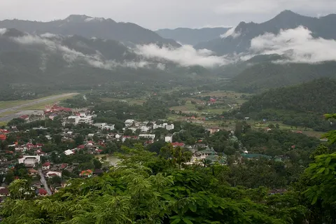
Chiang Mai to Pai: fewer stops than people expect, mostly roadside viewpoints, coffee shops and small waterfalls. Pai is a good place to sleep; read the Pai section and the Pai page on the loop, which is written for people who base themselves in Pai.
Pai to Mae Hong Son: stop at Tham Lod, Ban Luk Khao Lam and the viewpoints around Pang Mapha. See Pang Mapha and the caves. Arrive at Tham Lod before late afternoon, because the cave walk and the bamboo raft need time.
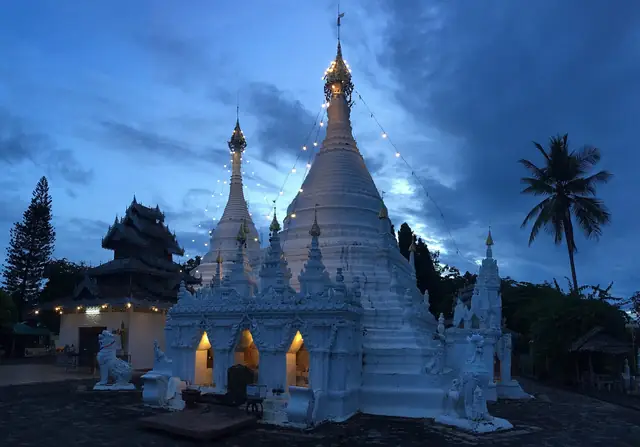
In Mae Hong Son town: Chong Kham lake, Wat Chong Kham and Wat Chong Klang, Doi Kong Mu, the night market and Tai Yai food are on Mae Hong Son town and temples. If you still need a bed, see where to stay.
A day north of town: Pang Ung, Ban Rak Thai, Pha Suea waterfall, the fish cave, the Su Tong Pae bamboo bridge and Ban Jabo are on Pang Ung and Ban Rak Thai. This is a side trip off the main road and takes half a day to a full day.
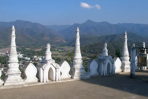
Mae Hong Son to Mae Sariang: Khun Yuam is the base for Doi Mae U Kho and Mae Surin waterfall, followed by Wat To Phae and the Second World War museum. See Khun Yuam and Mae Sariang.

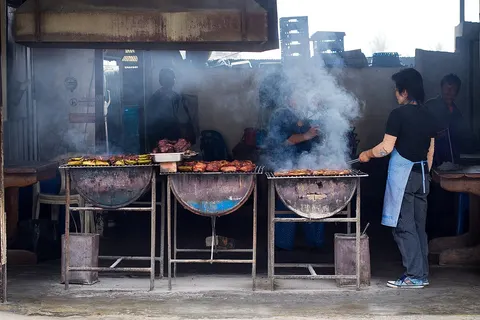
Mae Sariang is a quiet town on the Yuam River, good for one night before the last leg, with an evening market and roadside grills. The Salween River on the border is further in, towards Ban Mae Sam Laep, and needs another half day from Mae Sariang.
Mae Sariang back to Chiang Mai: a straight, fast road through Hot into the city. If you have energy and time, turn up Doi Inthanon at Chom Thong (see the Doi Inthanon section in the plans below).
Clockwise or anticlockwise: which way to go
The most common question is whether to go via Pai first or via Mae Sariang first. Both work. The difference is when you want the hardest curves to arrive and what you want to reach first.
Clockwise means Chiang Mai, Hot, Mae Sariang, Khun Yuam, Mae Hong Son, Pai and back to Chiang Mai. Anticlockwise runs the same stops in the opposite order, starting with Pai.
| Point | Clockwise | Anticlockwise |
|---|---|---|
| Day one | Route 108: long sweeping bends and easier going, a warm-up | Route 1095 from the start, about 762 curves to Pai |
| Last day | Ends with Pai to Chiang Mai, when you are tired, with fast vans | Ends on an easy highway, the gentlest part of the loop |
| Pai | Arrive at the end, a rest before going home | Arrive early, with a risk of staying too long |
| Khun Yuam sunflowers | Passed on day two or three | Passed near the end of the trip |
| Vans and private drivers | Possible, but you buy several separate legs | Easier, because Chiang Mai to Pai has many departures |
| Best for | Beginners, anyone unused to mountain roads | Confident riders, short trips |
Which to choose by rider level
- First time on mountain roads: go clockwise. Let two days on Route 108 build your confidence, then take on Route 1095 when you know the bike or car. If the last day feels heavy, leave Mae Hong Son early so you ride Pai to Chiang Mai before you are tired.
- Confident on a bike with enough power: go anticlockwise. You get the famous road fresh and in good light, and finish on a straight highway.
- Short on time (3 days): go anticlockwise and treat Pai as a stop, not a base. Pai is a town people plan to stay in for one night and end up staying three.
- Using vans or private drivers: go anticlockwise, Chiang Mai, Pai, Mae Hong Son, then back via Mae Sariang. Van tickets are easier to find on that order.
- Dislike mountain roads altogether: hire a private driver who knows the road. See the section on vans and private drivers below.
Whichever way you go, follow the same rule: leave the hotel in the morning, arrive before dark, and never plan a day with more than about half a day of driving.
Driving yourself: car and motorbike
By car
An ordinary sedan can do the whole loop, since the main roads are all paved and there is no gravel on the main line. Brakes and tyres must be in good condition. An automatic is easier on long climbs and descents, and if you take a manual you need to be comfortable using low gears downhill. You can rent in Chiang Mai all year. If you want to drop the car somewhere else, ask the shop whether that is allowed and what it costs. Read the insurance terms, especially the part you pay yourself, and photograph the whole car before you leave the lot.
If you do not want to drive, a private car between towns can be booked, see the van and private driver section.
By motorbike
For the whole loop, a 125 to 150 cc automatic is the minimum. Two people with luggage should look at 250 to 400 cc. A 125 to 150 cc scooter does climb the passes but will labour on long steep hills with a full load. Bigger bikes of 500 cc and up are available from specialist shops in Chiang Mai.
- Rental in Chiang Mai is about 300 to 350 baht a day for an ordinary scooter, and rises for 150 to 160 cc bikes and touring bikes. Prices vary by shop and season, so confirm before you book.
- Deposits run about 1,000 to 5,000 baht for scooters and a lot more for big bikes. Some shops ask for a copy of your passport. Do not leave the original.
- Film the bike from every side before you take it, including scratches, lights, brakes, tyres and the fuel gauge.
- A helmet is compulsory for rider and passenger. Ask for a full-face helmet if the shop has one, because the hills are dusty and misty.
- Ask about one-way returns. Some shops will take the bike back in Pai and send it to Chiang Mai for an extra fee.
Licence, insurance and fines
Foreigners riding a motorbike should carry an International Driving Permit that includes the motorcycle category (A) together with their home licence. A car-only permit does not cover a motorbike, and riding without the right category can void insurance. Fines are about 500 to 2,000 baht, so check before you travel. There are checkpoints on Route 1095 that may ask to see your licence and helmet.
Many travel insurance policies do not cover motorbikes if the licence is not the right category, and the insurance a rental shop offers usually covers damage to the bike, not your medical costs. Ask exactly what is covered and read your own policy before you leave. The Tourist Police number is 1155.
Fuel, light and overtaking
- Fill up in every big town you pass, such as Chom Thong, Mae Sariang, Mae Hong Son and Pai, and never wait for the needle to get low. The road up to Doi Mae U Kho and the road to Mae Sam Laep have no petrol on the way, so leave with a full tank.
- Avoid driving at night. The roads are unlit, villages are far apart, mobile signal drops in places, and there is mist in the early morning.
- Never overtake on a blind bend or near a crest. Trucks climb slowly but vans come down fast, so keep left and let them pass.
- Use low gears downhill and avoid dragging the brakes, because brakes overheat on long descents.
- Carry cash, since cash machines outside the bigger towns are few. Bring a rain jacket, a windproof layer, sunglasses, water, a first aid kit, a power bank and an offline map.
Mornings bring mist and dew on the road. Start after the mist lifts, or ride slowly. In the cool season, early mornings in the hills are properly cold, so wear a windproof jacket and gloves.
Not driving: vans, private drivers and tours
If you do not drive, you can do the loop leg by leg or hire one car for the whole route. You do not need to worry about bends or licences, but you cannot stop as freely as with your own vehicle.
Vans and buses
| Leg | Time about | Notes | Book |
|---|---|---|---|
| Chiang Mai to Mae Hong Son | About 6 hours | Minivans from the Chiang Mai Arcade bus terminal, several departures a day, such as 08:30, 09:30 and 13:30 | See vans and prices |
| Chiang Mai to Mae Sariang | About 4.5 hours | Departures around 08:00, 13:00 and 15:00, the gateway to the Khun Yuam side of the loop | See vans and prices |
| Chiang Mai to Pai | A little over 4 hours | Nearly hourly, and seats sell out fast in the cool season | See vans and prices |
| Pai to Mae Hong Son | About 2 to 3 hours | The public van leaves from the Pai bus station and drops in Mae Hong Son. Departure times are not fixed, so ask the day before. Private cars are an option | See vans and prices |
There is no van to book online for the Mae Sariang to Mae Hong Son leg. If you need this stretch, ask at the Mae Sariang bus station or choose a private car below. Prices and timetables change by day (as of 6 Nov 2026), and the counter at the station can be a little cheaper than online, but in the cool season booking ahead guarantees a seat. Some operators charge extra for a suitcase larger than cabin size, so ask before you board.
If you get carsick, take a tablet before you leave, sit in the front row, open a vent and do not eat a big meal. Vans on this road often go fast. If it worries you, ask the driver to slow down. If speed bothers you a lot, hire a private car and tell the driver in advance.
Private transfers
A hotel to hotel private transfer suits a group of two to four who do not drive. You can choose a sedan, an SUV or a van, seating about 1 to 2, 1 to 4 and 1 to 9 people respectively, with small differences between operators. Chiang Mai to Mae Hong Son takes 5 to 6 hours. Choose whether to go via Mae Sariang or via Pai to suit your plan. Some operators charge a surcharge at festival peaks, so check the terms before you book.
 KKday
Private transfer between Chiang Mai and Mae Hong Son
From US$162.04 (Sedan, as of 6 Nov 2026)
Price as of 6 Nov 2026A private car between Chiang Mai and Mae Hong Son, hotel to hotel in either direction, about 5 to 6 hours
Book on KKday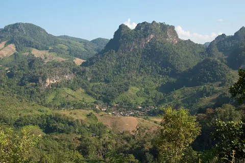 KKday
Private transfer between Chiang Mai and Mae Sariang
From US$162.04 (Sedan, as of 6 Nov 2026)
Price as of 6 Nov 2026A private car between Chiang Mai and Mae Sariang, useful when you continue to Khun Yuam on a clockwise plan
Book on KKdayPhotos, prices and reviews from Klook
Private transfers between Chiang Mai, Chiang Rai and Mae Hong Son, where you choose pick-up and drop-off zones on a map
Book on KlookDay tours that fit the loop
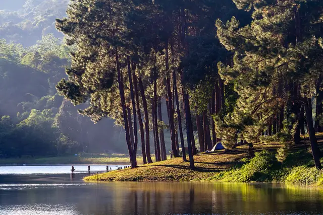
Tours do not cover the whole circuit, but they help when you sleep in Mae Hong Son and would rather not drive the hills to Ban Rak Thai. A day tour leaves from Mae Hong Son town for the Yunnan Chinese village of Ban Rak Thai, Pha Suea waterfall and Pang Ung, takes 7.5 hours and includes lunch. Read more on Pang Ung and Ban Rak Thai.
 KKday
Day Tour from Mae Hong Son: KMT Village (Ban Rak Thai), Pha Sua Waterfall, Pang Oung
From US$118.26 (Starting price per person)
Price as of 5 Nov 2026A day tour from Mae Hong Son town to Ban Rak Thai, Pha Suea waterfall and Pang Ung, with lunch at Ban Rak Thai
Book on KKdayPhotos, prices and reviews from Klook
The same programme from Mae Hong Son town, with a Thai or English speaking guide
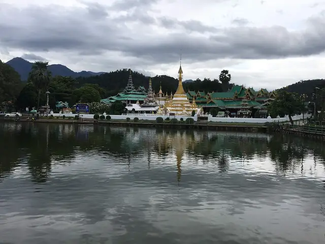
Book on KlookIf you sleep in Pai, a private car tour covers the Mae Hong Son highlights in a single day from Pai, taking in Ban Rak Thai, Pang Ung, the Su Tong Pae bamboo bridge, Wat Phra That Doi Kong Mu, Pha Suea waterfall and the fish cave. It is about a 9 hour day and not a good choice for anyone prone to motion sickness.
 KKday
Pai: Discover Mae Hong Son's Highlights Full-Day Private Car Tour
From US$152.08 (Starting price. Options by group size are on the booking page)
Price as of 5 Nov 2026A full-day private car from Pai to the Mae Hong Son highlights: Ban Rak Thai, Pang Ung, Su Tong Pae, Doi Kong Mu and the fish cave
Book on KKdayPhotos, prices and reviews from Klook
A full-day private car tour from Pai to the Mae Hong Son highlights, about 9 hours
Book on KlookMulti-day loop packages sold by tour companies are often assembled from several vehicles. If you are tempted, ask where you sleep each night, what vehicle you use and where you stop before you commit.
3, 4 and 5 day plans, clockwise and anticlockwise
The loop starts to make sense at 4 days. A 3 day version works only for confident drivers who ride 5 to 6 hours a day or more and skip most stops. Five days is the number that lets you both ride and see things without hurrying. The tables are a guide. Distances are approximate and exclude the side trips named in the stops column.
3 days clockwise (sleep Mae Sariang and Mae Hong Son)
| Day | Route and distance | Stops | Sleep |
|---|---|---|---|
| 1 | Chiang Mai, Hot, Mae Sariang, about 190 km | Lunch at Hot, evening market in Mae Sariang | Mae Sariang |
| 2 | Mae Sariang, Khun Yuam, Mae Hong Son, about 160 km | Doi Mae U Kho in sunflower season (about 52 km there and back from Khun Yuam), Doi Kong Mu at sunset | Mae Hong Son |
| 3 | Mae Hong Son, Pai, Chiang Mai, about 110 km then 130 km, about 240 km in all | Tham Lod, Pang Mapha | Home in Chiang Mai in the evening |
3 days anticlockwise (sleep Pai and Mae Hong Son)
| Day | Route and distance | Stops | Sleep |
|---|---|---|---|
| 1 | Chiang Mai, Pai, about 130 km | Roadside viewpoints, Pai in the evening | Pai |
| 2 | Pai, Mae Hong Son, about 110 km | Tham Lod, Doi Kong Mu, night market | Mae Hong Son |
| 3 | Mae Hong Son, Mae Sariang, Chiang Mai, about 160 km then 190 km, about 350 km in all | Leave before 07:00, lunch at Khun Yuam, little time to stop, about 8 to 10 hours of pure riding | Home in Chiang Mai in the evening |
Day three of the anticlockwise plan is the longest of any plan and needs a day without rain or thick mist. If you are unsure, choose 4 days.
4 days clockwise (sleep Mae Sariang, Mae Hong Son, Pai)
| Day | Route and distance | Stops | Sleep |
|---|---|---|---|
| 1 | Chiang Mai, Hot, Mae Sariang, about 190 km | Hot, the evening market in Mae Sariang by the Yuam River | Mae Sariang |
| 2 | Mae Sariang, Khun Yuam, Mae Hong Son, about 160 km | Doi Mae U Kho, Mae Surin waterfall, Wat To Phae, Doi Kong Mu | Mae Hong Son |
| 3 | Mae Hong Son, Pai, about 110 km | Tham Lod, Ban Luk Khao Lam, Pang Mapha viewpoints | Pai |
| 4 | Pai, Chiang Mai, about 130 km | Leave late if you like, and stop at a waterfall or coffee shop if you have energy | Back in Chiang Mai |
4 days anticlockwise (sleep Pai, Mae Hong Son, Mae Sariang)
| Day | Route and distance | Stops | Sleep |
|---|---|---|---|
| 1 | Chiang Mai, Pai, about 130 km | Coffee shops and viewpoints on the way, Pai in the evening | Pai |
| 2 | Pai, Mae Hong Son, about 110 km | Tham Lod, Pang Mapha, Doi Kong Mu, night market | Mae Hong Son |
| 3 | Mae Hong Son, Mae Sariang, about 160 km | Doi Mae U Kho (about 52 km there and back from Khun Yuam), Mae Surin waterfall, Wat To Phae | Mae Sariang |
| 4 | Mae Sariang, Chiang Mai, about 190 km | Hot. For Doi Inthanon add about 90 km | Back in Chiang Mai |
5 days clockwise with Doi Inthanon
| Day | Route and distance | Stops | Sleep |
|---|---|---|---|
| 1 | Chiang Mai, Doi Inthanon, Chom Thong, about 150 km depending on the route | The summit and the waterfalls on Route 1009 | Chom Thong |
| 2 | Chom Thong, Hot, Mae Sariang, about 130 km | Evening market in Mae Sariang, by the Yuam River | Mae Sariang |
| 3 | Mae Sariang, Khun Yuam, Mae Hong Son, about 160 km | Doi Mae U Kho, Mae Surin waterfall, Wat To Phae | Mae Hong Son |
| 4 | Second day in Mae Hong Son, the north of town, about 90 to 100 km there and back | Pang Ung, Ban Rak Thai, Pha Suea, Su Tong Pae, Doi Kong Mu | Mae Hong Son |
| 5 | Mae Hong Son, Pai, Chiang Mai, about 110 km then 130 km, about 240 km in all | Tham Lod, Pang Mapha, Pai in the afternoon | Back in Chiang Mai |
5 days anticlockwise
| Day | Route and distance | Stops | Sleep |
|---|---|---|---|
| 1 | Chiang Mai, Pai, about 130 km | Roadside viewpoints, Pai in the evening | Pai |
| 2 | Pai, Mae Hong Son, about 110 km | Tham Lod, Ban Luk Khao Lam, Doi Kong Mu at sunset | Mae Hong Son |
| 3 | Second day in Mae Hong Son, the north of town, about 90 to 100 km there and back | Pang Ung, Ban Rak Thai, Pha Suea, the fish cave, Su Tong Pae | Mae Hong Son |
| 4 | Mae Hong Son, Khun Yuam, Mae Sariang, about 160 km | Doi Mae U Kho, Mae Surin waterfall, Wat To Phae | Mae Sariang |
| 5 | Mae Sariang, Chiang Mai, about 190 km | Hot, or continue to Doi Inthanon for about 90 km more | Back in Chiang Mai |
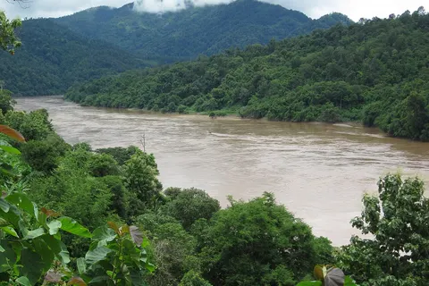
If you have an extra day in Mae Sariang, take the road towards Ban Mae Sam Laep to see the Salween River. It is about 46 km from Mae Sariang on a narrow, steep road, about an hour and a half each way, so fill the tank before you leave, and you should be back before dark. Details are on Khun Yuam and Mae Sariang.
Doi Inthanon: how far to go
Doi Inthanon is not on the main line of the loop, but it is close to Chom Thong, the first town you pass on Route 108. On a clockwise trip you turn up Route 1009 to the summit and come back down to Route 108, which adds about 90 km and roughly half a day. It suits the 5 day plan. The 4 day plans lose nothing important by skipping it. Nights on the summit can be close to freezing in the cool season, so bring a warm layer if you go at dawn.
Do not cram in too many side trips
A loop that is not packed is better than one that visits every stop. If you have an extra day, spend it by sleeping two nights in Mae Hong Son or Khun Yuam rather than adding side trips. The section pages linked above carry their own half day and full day plans, and where to stay helps you choose a town for each night.
Staying safe on the loop
The problem with the loop is not broken roads. It is tiredness, fast vans, mist and rain.
- Keep each day to about 200 km or less at a pace you enjoy. If a day has to be longer, such as the last day of the 3 day plan, drop stops rather than sleep.
- Stop every hour and a half to two hours to drink water, eat something and stretch, especially on Route 1095.
- The road is paved all round and in generally good condition, but in the rainy season sand and branches lie on the surface after rain, so slow down.
- Do not drive at night and do not drive after drinking.
- There are hospitals in Mae Hong Son, Mae Sariang, Pai and some larger districts, but they are far apart. Save the Tourist Police number, 1155, in your phone and ask your hotel for the local emergency number.
- Do not rush to finish. No one is handing out prizes for arriving first.
- On the morning you drive, check road status through the highway department news or local news pages, especially in the rainy season.
Tell your next hotel roughly when you expect to arrive. If rain or mist slows you down, you will not feel you must hurry to make check-in.
When to go: cool season, sunflowers, haze and rain
| Months | Conditions | Advice |
|---|---|---|
| Nov to Jan | Cool, clear skies, busy, cold early mornings in the hills | Best time. Book ahead, especially Khun Yuam, Mae Hong Son and Pai |
| Feb to Apr | Burning season, haze, views disappear, 2026 was severe | Avoid mid-February to the end of April |
| May | Hot, the first rain | Fine if you can handle afternoon rain |
| Jun to Oct | Green and quiet, but rain, slippery roads and a risk of landslides | Drive slowly and check news every morning |
The sunflower fields at Doi Mae U Kho, right now
The Mexican sunflowers (known in Thai as bua tong) at Doi Mae U Kho in Khun Yuam district began blooming gradually from 1 Nov 2026. The official opening is on 11 Nov 2026, full bloom is expected in mid-November, and the season runs to about mid-December depending on the weather. The field is about 26 km up Highway 1263 from Khun Yuam town, and there is no petrol on the way, so fill up in Khun Yuam first. The light is best before about 09:00 and again in the late afternoon, with a sea of mist in the morning, while haze can spoil the view around midday. Entry is usually free; check before you go. Opening hours are about 07:00 to 17:00, so check with the local authority too.
Mae Surin waterfall is on the same road, about 9 km away. Entry to the national park is 200 baht for a foreign adult, 100 baht for a foreign child and 40 baht for a Thai visitor. See Khun Yuam and Mae Sariang. There is nowhere to stay near the field, so use Khun Yuam as your base, and during full bloom rooms in Khun Yuam go quickly.
Haze in 2026
The 2026 dry season was a heavy one. Mae Hong Son closed nine national reserved forest areas in seven districts to visitors from 7 to 30 April 2026. If you want views and clear skies, avoid mid-February to the end of April.
Rain in 2026
The rainy season is green and quiet, but rain changes the roads quickly. In 2026 there was a landslide on Route 108 between Mueang Pon (Khun Yuam) and Mae La Noi on 5 June, and flash flooding and fallen trees on Route 108 near Mae La Noi on 17 and 18 September, which were cleared that same night. If you go in the rainy months, leave a spare day, carry a proper rain jacket and do not ride after heavy rain.
Festivals to know
Loy Krathong in 2026 is on 24 Nov 2026. The town holds events around Chong Kham lake and rooms get tighter. The Poy Sang Long ordination festival falls in late March to April and the dates change each year, so check with the municipality before you plan.
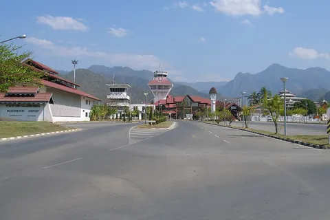
There is no scheduled passenger flight to Mae Hong Son airport at the moment. Check the airlines' own websites before you plan. The airport is about 2 km from the town centre. Most visitors from Bangkok fly to Chiang Mai and continue by van or private car. See how to get to Mae Hong Son.
Frequently asked questions
How many days does the Mae Hong Son Loop take?
At least 4 days if you drive yourself, covering about 570 to 600 km without side trips. Three days works only for confident drivers who cut most stops. Five days is the comfortable option and leaves time for Ban Rak Thai or Doi Inthanon.
Should I do the Mae Hong Son Loop clockwise or anticlockwise?
Go clockwise if you are new to mountain roads, so the easier Route 108 comes first and the tough Route 1095 comes later. Confident riders or anyone short of time can go anticlockwise to ride the famous road first and finish on an easy highway.
How many curves are there really?
About 1,864 curves on Highway 1095 is the often quoted figure, a popular figure rather than an official count. The figure of 762 curves is used for the Chiang Mai to Pai stretch only. Neither is an official count.
Do I need an International Driving Permit for the loop?
Foreigners on a motorbike should carry an International Driving Permit that includes the motorcycle category (A) together with their home licence. A car-only permit does not cover a motorbike and riding without the right category can void insurance. Fines are about 500 to 2,000 baht, so check before you travel.
What size motorbike do I need?
At least 125 to 150 cc. For two people with luggage, 250 to 400 cc is more comfortable. The loop is not the place to learn to ride.
Is there a flight to Mae Hong Son?
At the moment no airline is selling a scheduled flight into Mae Hong Son airport. Check the airlines' own websites before you plan. Most visitors go by road: about 6 hours by van from Chiang Mai, 5 to 6 hours by private car.
Can I drive the loop at night?
It is not recommended. The roads are unlit, villages are far apart, mobile signal drops in places, and mist settles in the early morning. Arrive before dark.
When is the best time to avoid the haze?
November to January has the clearest skies. In 2026 the haze was heavy from mid-February to the end of April, so avoid that period. The rainy season is green but brings a risk of landslides.
Is Doi Inthanon part of the Mae Hong Son Loop?
Not on the main line. It is a detour from Chom Thong of about 90 km extra and suits a 5 day plan.
How do I do the loop without driving?
Take vans leg by leg, Chiang Mai, Pai, Mae Hong Son, then back via Mae Sariang, or hire a private car between towns and add day tours from Mae Hong Son or Pai.
Where the facts come from
- Thailand Route 1095 (Wikipedia)
- Mae Hong Son Loop (Wikivoyage)
- Mae Hong Son Loop four day guide (Nomadasaurus)
- Landslide on Route 108, Mueang Pon to Mae La Noi (Thai PBS)
- Flash flood and fallen trees near Mae La Noi (Thai PBS)
- Reserved forests closed in Mae Hong Son (The Nation)
- International Driving Permit in Thailand (Thaiger)
Keep planning
 Plan Mae Hong SonThe loop, sunflowers, Pang Ung, Tham Lod, where to stay, getting there
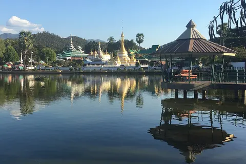 Mae Hong Son town and templesChong Kham lake, twin temples, Doi Kong Mu, night market, Tai Yai food
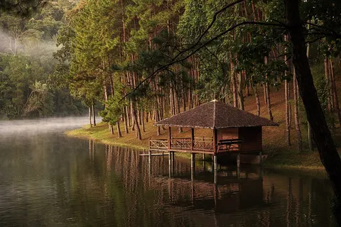 Pang Ung and Ban Rak ThaiPang Ung lake, Ban Rak Thai tea, Pha Suea, fish cave, bamboo bridge
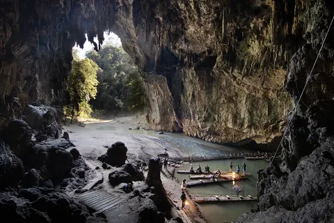 Pang Mapha and Tham LodRaft tour, costs, Ban Luk Khao Lam, viewpoints
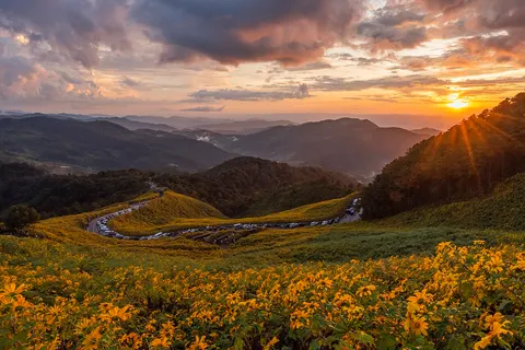 Khun Yuam, Mae Sariang and the sunflowersDoi Mae U Kho sunflowers, Mae Surin, Wat To Phae, Mae Sariang, Salween
 Getting to Mae Hong SonVans, buses, private cars, airport, from Chiang Mai, Pai and Bangkok
 Where to stay in Mae Hong SonTown, Ban Rak Thai, Pang Mapha, Khun Yuam, Mae Sariang
 Mae Hong Son deals this monthTours, transfers, vans and hotels worth booking ahead