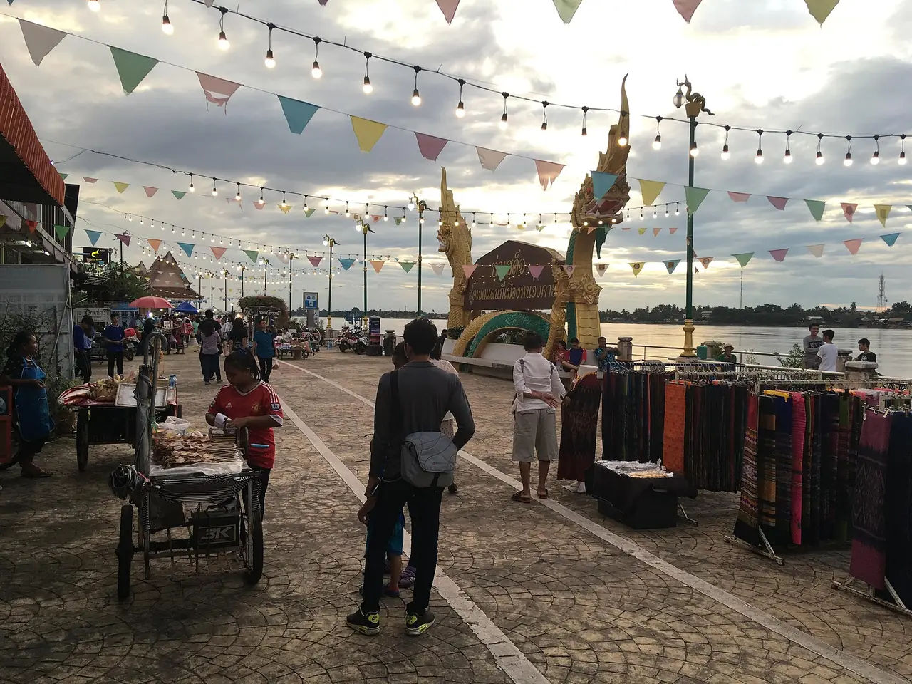
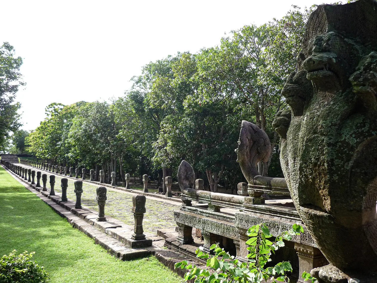
Surin is a province in lower Isaan known for its elephants, its silk and a scatter of old Khmer temples. Wikipedia places it between the Mun River in the north and the Dangrek Mountains in the south, bordering Buriram, Maha Sarakham, Roi Et and Sisaket, with Oddar Meanchey in Cambodia to the south. The province covers 8,854 square kilometres. The town itself is small and quiet; Wikivoyage calls it a nondescript town, and says the reasons to come are the elephants, the Khmer ruins, the silk and the jasmine rice.
This guide uses only what we could check on 16 October 2026 against the sources listed below, and it says where they disagree. We give no fees, opening hours or prices that we did not read on an official page. There is no hotel guide for Surin yet; the reason is in the where-to-stay section.
If you searched for "Surin" and found beach resorts, you want Surin Beach in Phuket or the Surin Islands in Phang Nga, not this province. For the islands, see the Surin Islands guide.
What Surin is like
Wikivoyage puts the town's population at about 40,000 and says it lies about 450 km east of Bangkok and 50 km from the Cambodian border. Wikipedia gives 434 km from Bangkok to the city. The two sources round differently. On the airport, Wikipedia says Surin Bhakdi Airport is the only airport in Thailand owned by a local government.
Wikivoyage explains that the Kuy (Suay) people migrated along the Mekong to settle around the Dangrek range and have a long tradition of catching and training elephants, which became the province's icon. It says the town was founded in the Khmer era, was neglected after the empire fell, and was resettled in 1763 by Luang Surin Pakdi, the headman of Muang Tee village.
A short history of Surin
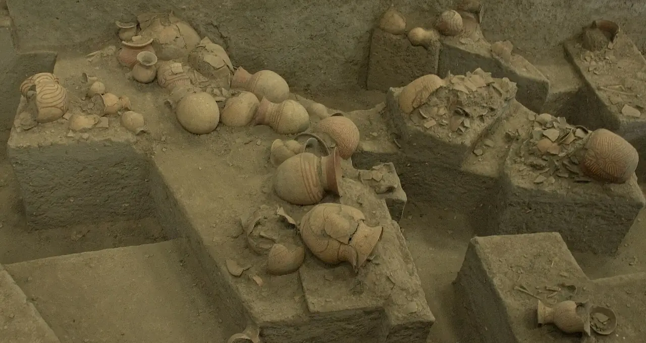
Wikipedia says archaeological sites on the Khorat Plateau have produced some of the earliest evidence of pottery, metallurgy and developed wet-rice cultivation in Southeast Asia, and that the Mun River basin has supported rice-growing cultures since prehistoric times. The first evidence of settlement in Surin itself comes from the Iron Age, with about 60 known sites, and Wikipedia assumes those settlers were ancestors of the Mon-Khmer peoples who live in the province today. The Dvaravati culture follows, with evidence dated between the 7th and 11th centuries, and it was in that period that Buddhism became the dominant religion of the region.
The Khmer Empire then extended its influence over southern Isaan between the 7th and 13th centuries. Wikipedia says Surin was an important part of that empire, that Khmer stone inscriptions date from about 600 CE, and that before the 14th century the area was part of the empire's province of Kok Khan. Sites such as Prasat Sikhoraphum belonged to a network of Khmer infrastructure centred on Prasat Phanom Rung. The same article cites seven Sanskrit inscriptions of 1186 that record hospital foundations by the Angkorian king Jayavarman VII, one of them found in this province, and reads the Khorat Plateau as having stayed within the Angkorian sphere in those years.
After the Khmer Empire collapsed in the 15th century, Wikipedia says Surin faded from history until the 18th century. By legend, a Kuy leader named Chiangpum presented a rare white elephant to the future King Rama I and was given the title Luang Surin Phakdi. In 1763 his village moved about 15 kilometres to the present site and became a town, and in 1786 the name was changed to Surin in honour of its governor. Thai Wikipedia gives the same move as a request to leave the cramped village of Mueang Thi for Ban Khu Prathai, the site of today's town, and says the town was renamed Surin in 1786 after the governor's title. The name itself comes from the Sanskrit words sura, "god", and Indra.
Thai Wikipedia adds that the old town has three rings of moats with earth ramparts and was probably a Khmer frontier town. It quotes Prince Damrong Rajanubhab, who judged the town well built because it guarded several passes through the Dangrek range to the east and south. English Wikipedia says the province stayed largely self-sufficient and somewhat isolated until the railway arrived, and gives the year as 1922. The Surin railway station article gives May 1926 as the opening month, so the two Wikipedia pages disagree. We cannot tell you which date is right, and the difference does not matter for a visit.
The people of Surin: Kuy, Northern Khmer and Lao
Surin is one of the few Thai provinces where three languages are in everyday use. Wikipedia says the primary culture is that of the ethnic Lao, with Lao-influenced dress, music such as the khene and mor lam, and sticky rice. It adds that Surin has a sizeable Northern Khmer population, with the Northern Khmer language and the kantrum and chrieng brunh music forms, and that because Khmer people prefer jasmine rice, much of the province's rice is jasmine. A third group is the Kuy.
The figures differ by source and by year. English Wikipedia reports that 47.2 percent of the population could speak Khmer in the 2000 census, down from 63.4 percent in 1990, and that a 1985 study found 9.6 percent Kuy, 9.2 percent mixed Lao-Kuy and 3.1 percent mixed Khmer-Kuy. Thai Wikipedia gives a different breakdown of first languages, with about 30 percent Kuy, about 50 percent Khmer, 12 percent Lao and 8 percent Chinese and others, and describes Chinese and Vietnamese communities as well. These are different counts made at different times, so treat them as a sense of the mix, not as exact current numbers.
Wikipedia describes the Kuy, also written Kui, Guay or Suay, as a Mon-Khmer people distantly related to the Khmer and thought by some scholars to be among the original inhabitants of the area. It estimates that about 220,000 of the roughly 400,000 Kuy in Thailand, Cambodia and Laos live in Thailand, mostly in the southern Isaan provinces including Surin, Buriram, Sisaket, Nakhon Ratchasima and Ubon Ratchathani. The subgroup tied to elephants is the Kuy Ajiang, or "elephant Kuy", who live mainly in Surin. Wikipedia says they traditionally caught elephants along the Dangrek range, including across the border, until that practice ended in the late 1950s because of tension between the two countries. It also says Surin is the source of roughly a quarter of all domesticated elephants in Thailand.
Several details from the Kuy article explain what you see at the Round-up. The Kuy Ajiang venerate the spirit of Phra Khru Pakam, which is said to live in the Pakam rope, the lasso used to catch elephants. Kuy elephant wisdom was registered on Thailand's national intangible cultural heritage list in 2012. Thai Wikipedia describes a special ritual language called Phi Pakam, used only between the elephant-catching specialists and the spirits during an expedition; in a list of 365 words it found about 20 percent matching Pali and Sanskrit and 40 to 50 percent that look like ancient Khmer. The Kuy article also notes the Klae Mo healing ceremony, held in January and February, and says the Kuy language is considered endangered, although many Kuy in Thailand also speak Lao and Central Thai and about 40 percent use Northern Khmer. A short summary of two Wikipedia pages is no substitute for meeting people in the villages, and a homestay or a visit run by the community is the more respectful way to learn.
The Surin Elephant Round-up
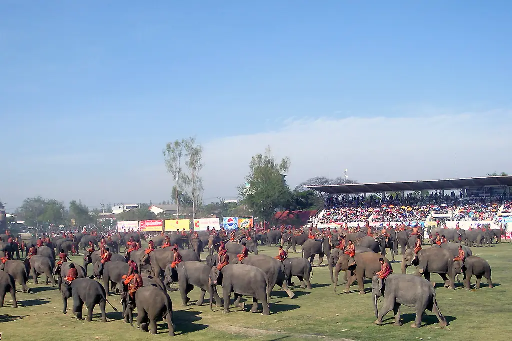
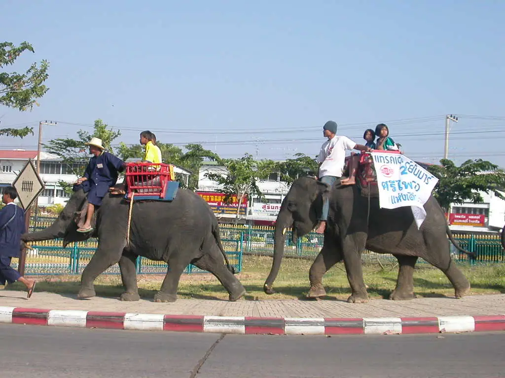
Wikipedia describes the Round-up as an annual cultural festival, usually on the weekend of the third week of November. It grew out of royal elephant hunts, which the Kuy conducted; under Ayutthaya the hunts became a public spectacle with tame elephants, and the festival in its present form began in the 1960s. Wikivoyage describes a three-day event at Si Narong Stadium alongside the Surin Red Cross Fair, where elephants walk the streets and perform football matches, beauty contests and battle re-enactments.
If the third-weekend rule holds, 2026 would fall on 21 and 22 November. That is our own calculation, not an announced date, so confirm with the provincial office or the Tourism Authority of Thailand before booking. Wikivoyage warns to book a room in advance.
Other dated events in Wikivoyage: Thai Elephant Day, a light and sound show in the second week of November; the Si Khoraphum temple celebration combined with Loy Krathong on the third weekend of November; the jasmine rice and silk fair each January; the Phanom Sawai mountain festival in March; and an ordination parade on elephant back at Ban Ta Klang around mid-May, which it says involves more than 50 elephants crossing the Mun River.
What happens at the Round-up
English Wikipedia gives a detailed account of the programme, and we repeat it with the warning that schedules change from year to year. It says the Kuy hunters chosen to perform hold a morning ritual called Pak Kum Luang almost a week beforehand, praying at the Pakam shrine, and that the elephants then travel to town, usually by truck, and arrive at least five days early to roam the streets and rehearse. On the Friday it describes a procession of about 300 elephants from the railway station towards the elephant roundabout on Prasat Road, with some mahouts in replicas of battle dress, followed by a banquet on tables 400 metres long. Wikipedia records that on 14 November 2003 the buffet set a Guinness World Record for the largest elephant buffet, with 269 Asian elephants eating more than 50 tonnes of fruit and vegetables.
On the Saturday, per the same article, the elephants gather at the stadium shortly after daybreak. Baby elephants are paraded, then the bulls, and the Kuy hunters pray to the lasso and show how elephants were captured. Acrobatics, football and polo follow, then logging demonstrations and an elephant against army tug of war that starts with 50 soldiers and adds more until 100 face one bull. The finale is a re-enactment of a battle between Siamese and Burmese forces, and the show is repeated on Sunday morning. Wikipedia says the Tourism Authority of Thailand has called Si Narong Stadium the world's largest domestic elephant village. It describes a modern two-day event, whereas Wikivoyage describes three days, so check the announced programme.
The same article tells the longer story. It says the old hunts were highly ritualistic, became a royally sponsored spectacle under Ayutthaya, and grew more and more staged until they were abandoned in 1938, apart from a special round-up in 1962 for the visiting King Frederik IX of Denmark. The modern festival began on a modest scale in Tha Tum in the 1950s or 1960s, depending on the source, and then moved to Surin town. Wikipedia concludes that the ritual elements have almost disappeared and the festival has become a tourist event, an honest framing to keep in mind when you decide whether to go.
Ban Ta Klang and the ethics question
Wikivoyage lists the Elephant Study Centre at Ban Ta Klang in Tha Tum, about 60 km from Surin, open 8:30 to 16:30 daily at THB 100. Those figures come from Wikivoyage and we did not check them against an official page, so verify before you go. It also notes ethical questions about how the elephants are ridden and chained for cultural shows. If animal welfare matters to you, look at what is offered and choose what you are comfortable with.
More about the elephant villages around Tha Tum
Thai Wikipedia lists three elephant-related places in Tha Tum district. The Elephant Study Centre at Ban Ta Klang, in Kra Pho subdistrict, is run under the Surin Provincial Administrative Organisation. Next to it, in the Dong Phu Din national forest reserve, is the Kasat Anachak elephant kingdom of the Zoological Park Organization under Royal Patronage, which the article says covers 3,000 rai. Wang Thalu is described as only 3 kilometres from the elephant village; it is where the Mun River and the Chi stream meet before flowing on towards the Mekong, with wide forest around it. Thai Wikipedia also lists the ordination-on-elephant-back tradition in Kra Pho subdistrict and a long-boat race on the Mun River in Tha Tum. Wikivoyage places the ordination parade at Wat Chaeng Sawang in Ban Ta Klang and says it begins with homage to the Chao Pho Wang Thalu shrine.
Wikivoyage explains why the ordination matters. Khmer, Lao and Suay people in the area are all Buddhist, families want their sons to study the dhamma before marriage, and ordaining many men together on elephant back brings great merit to their families. Participants dress in mat-mi silk. As with the Round-up, check the date locally, because it follows the lunar calendar.
Khmer temples around Surin
Wikivoyage says the Khmer-era temples stretch from the border westwards to Buriram, that few organised tours run, and that you can hire a car with a driver through your hotel or use cheap local transport.
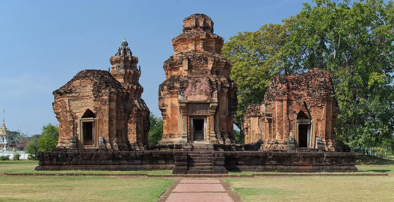
Prasat Sikhoraphum. Wikipedia says it was built in the 12th century between Surin and Sisaket, converted to Buddhist use in the 16th century, and shows Lao influence on the tower roofs. Wikivoyage describes five prang on a laterite base, all facing east, a lintel of the Dance of Shiva that it calls the most beautiful of those found in Thailand and Cambodia, and a moat on three sides.
Ta Muen group. Wikivoyage says three structures from the 12th and 13th centuries, in the time of Jayavarman VII: Ta Muen Thom, Ta Muen Toht and Ta Muen. It lists entry as free, notes there is little on-site information in English, and says a return taxi trip costs about THB 2,000, which may be out of date. It also warns that there may still be unexploded mines from the Khmer Rouge era near the border and tells visitors to stay on the paths. Ask locally for current conditions before you go.
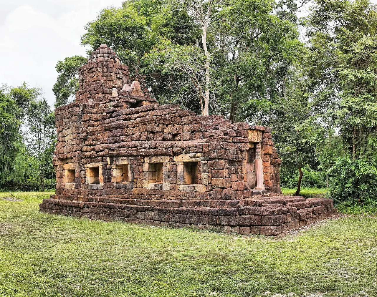
Prasat Ban Phluang. Wikivoyage calls it a small sanctuary with excellent stone carving: a single tower on a laterite base, with one real door and three false ones. The Commons description of our photo dates it to the reign of Udayadityavarman II, 1050 to 1066.
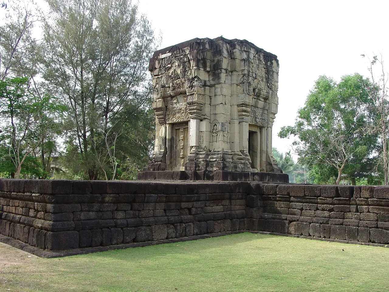
Wikivoyage also lists Mueang Thi, Ban Phlai, Yai Ngao, Chom Phra and Phum Pon, and says the northern and largest towers at Phum Pon are among the oldest Khmer ruins found in Thailand, around the 8th century. For the better-known temples in the next province, read our Phanom Rung and Phimai guide.
The Ta Muen group in more detail
The three Ta Muen sanctuaries sit in a pass through the Dangrek range in Phanom Dong Rak district, and English Wikipedia says they formed an important stop on the Ancient Khmer Highway that ran from Angkor to the administrative centre at Phimai, now in Thailand. The largest, Prasat Ta Muen Thom, is built of laterite and, unusually for a Khmer temple, faces south instead of east. Thai Wikipedia explains the south-facing layout as a response to the route coming up from the lowlands of Cambodia, and says the temple was built over a sacred natural rock in the form of a self-arisen lingam. English Wikipedia says recent excavations inside the main tower found a natural lingam protruding from the hill, comparable to the one at Vat Phou in Laos. The Khmer name means roughly "grandfather chicken", and the three buildings are named for their size: Thom (big), Toch or Tot (small) and plain Ta Muen, also called Bai Kriem.
Both Wikipedia pages agree on the roles of the buildings. Ta Muen Thom was the main sanctuary, with two sandstone towers and two laterite libraries on its north side and two small ponds. Ta Muen Toch has a wall and a pond and is thought to be an arogayasala, one of the hospital chapels built under Jayavarman VII. Ta Muen, the smallest, is a long room believed to be a rest house, a dharmasala, for travellers. Thai Wikipedia calls the group remarkable for providing for travellers in a way not seen elsewhere, and says Ta Muen Thom was registered as an ancient monument in the Royal Gazette on 8 March 1935. The two pages disagree on distances: English Wikipedia says Toch lies two and a half kilometres northwest of Thom, while Thai Wikipedia says about 750 metres, so rely on a local guide or map for walking plans. Both say the name Ta Muen is easily confused among the three, because the northern building was renamed.
Access is the part to check carefully. Wikipedia says Khmer Rouge forces looted the temples in the 1980s and 1990s, and that access was temporarily closed during the 2008 to 2013 Cambodia-Thailand border crisis. It adds that visitors may not wander more than a few metres south of the main entrance, where armed Thai border police stand guard, and Thai Wikipedia says visitors should stay inside the temple area because the surroundings are still not fully safe. Wikivoyage warns of possible unexploded mines and tells visitors to stay on the paths. Thai Wikipedia also records that in late July 2025 Cambodian soldiers entered the area near Ta Muen Thom and were turned back by Thai troops. Treat this as a sensitive border zone: ask your hotel or the provincial tourism office whether the temples are open and what rules apply on the day, and do not go if you cannot confirm.
Prasat Sikhoraphum in more detail
Thai Wikipedia, which calls it the most beautiful temple in the province, describes five brick prang built without mortar on one laterite platform measuring 25 by 26 metres and 1.5 metres high. A moat 125 metres wide surrounds three sides, leaving the east, the entrance, open. The main prang is about 32 metres tall. Over the door sits a lintel of the ten-armed Shiva dancing above a kirtimukha face, under an arch of garland scrolls carved with Ganesha, Brahma, Vishnu and Uma, and the article calls it one of the most beautiful and complete lintels in Thailand. The door frames carry apsaras holding lotus flowers and guardians holding clubs. Thai Wikipedia says the apsaras resemble those at Angkor Wat in Cambodia and are found at no other ancient Khmer temple in Thailand.
On dates, Thai Wikipedia puts the original build in the 17th century of the Buddhist era, as a Shaivite shrine, and says the southern rear tower was restored in the Lan Xang style in the 22nd century of that era, with an inscription in Tham script still present. English Wikipedia places the build in the 12th century and the Buddhist conversion in the 16th. Thai Wikipedia also records that Prince Damrong visited with his three daughters in early 1929 by the old year count, calling it the finest temple in the province, and that Princess Sirindhorn brought instructors of the Chulachomklao Royal Military Academy to study it in 1988, when it was restored. The provincial seal, Indra on the elephant Airavata in front of a stone temple, is based on this site. The Si Khoraphum celebration with Loy Krathong is held here in November.
Prasat Phum Pon, the oldest in Thailand
Prasat Phum Pon is in Dom subdistrict, Sangkha district. Thai Wikipedia describes three brick towers and the base of a laterite one, in a row from north to south. The largest brick tower and the northernmost are described as the oldest Khmer-style sanctuaries found in Thailand, dated to the late 12th to early 13th centuries of the Buddhist era, around the 7th century CE and the reign of Jayavarman I. English Wikipedia cites Sarah Talbot in calling it the oldest known Khmer structure in Thailand in good original condition, with a lintel from the late seventh century, and Wikivoyage also puts the oldest towers around the 8th century, so the sources vary by about a century. The main tower is built of unmortared brick with a single door to the east, and its top now has three stepped tiers. Archaeologists in 1988 found two sandstone inscription fragments in Pallava script and Sanskrit dated by letter form to about the 12th Buddhist century. The same article says the real name from the inscriptions is Kritchayanakhon.
For getting there, Thai Wikipedia says to take Highway 2077 from Surin towards Sangkha for 50 kilometres, continue to Buachet on Highway 2124, and drive 12 more kilometres to Ban Phum Pon, where the temple stands on the left of the road. The article says the name is a later reworking and that the original Kuy word was "phon", meaning the olive tree. A legend festival with a light and sound show is listed for 8 to 12 April.
Ban Phluang, Yai Ngao, Chom Phra and Mueang Thi
Ban Phluang. Thai Wikipedia gives its location in Prasat district and says it was built in the Baphuon style of white sandstone on a laterite base, inside a U-shaped moat. The tower is 4 by 4 metres on a base of about 8 by 23 metres, a size that suggests three towers were planned, and it has one real door, with the other sides false doors (Wikivoyage counts three). It is unfinished: the east and south lintels show Indra on the elephant Airavata, the north lintel Shiva subduing the naga Kaliya, and the west lintel is blank. The article notes carvings of squirrels and a deer above the leaf finials that it says appear at no other temple. It was restored in 1971 to 1973 by anastylosis, taking the stones apart and rebuilding them like a jigsaw.
Yai Ngao. Thai Wikipedia puts it in Sangkha district on Highway 24 between kilometre markers 189 and 190, about 800 metres from the road. Two brick prang stand on a laterite base facing east, with gables carved in brick as a makara holding a five-headed naga. The folk legend is that an old woman built it while waiting for a husband who never came home from war, and that is why it was left unfinished. A late-April festival retelling the legend is listed.
Chom Phra. Thai Wikipedia and Wikivoyage describe an arogayasala, one of 102 hospital shrines that the article says Jayavarman VII had built across the kingdom, with evidence from the Ta Prohm inscription. It is a 5 by 5 metre laterite tower with a library in the south-east corner, a wall with a gate on the east and a pond outside the north-east corner. Finds include a four-armed Avalokiteshvara, a Vajrasattva, a naga-sheltered Buddha and an inscribed sandstone stele.
Mueang Thi. Five brick prang with plaster once stood on a single base, and three remain: the centre one, the north-east corner and the south-west corner. Thai Wikipedia classes the slender towers as Khmer. This is also the older village from which the town's founder moved in 1763. Wikivoyage's other town-side sites include Ban Phlai, three brick towers in a row with a moat on all but the east side, dated to the 11th century by its source, and the Ta Piang Tia sanctuary with five lotus-shaped peaks in the Lao style of the late Ayutthaya period.
Thai Wikipedia lists dozens of other Khmer sites by district, among them Prasat Sang Sinlachai, Muen Chai and Tao Thong in Sangkha, Thanong and Angkan Pho in Prasat district, Nang Bua Tum in Tha Tum, Ban That in Rattanaburi, and Phanom Sawai inside Wat Phanom Silaram. It adds a note that the names of these monuments were assigned later and the true names still need research from inscriptions.
Silk, baskets and snacks
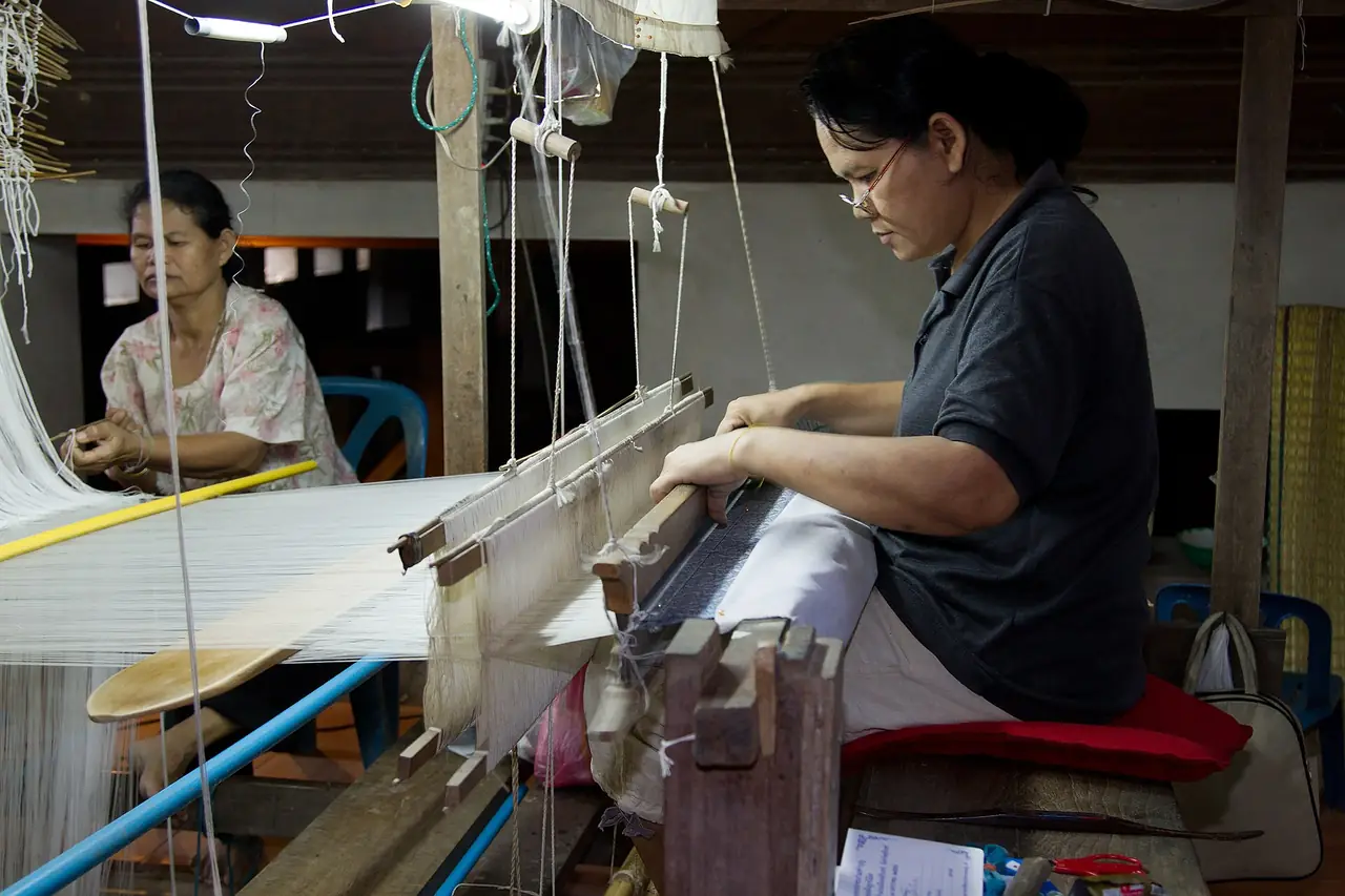
Wikivoyage describes Ban Tha Sawang as known for gold-brocaded silk woven on a 1,416-heddle loom, and says the village was chosen to weave cloth for the shirts of 21 APEC leaders. Khwao Sinarin is described as famous for "hol" silk, and Ban Chok for silver buttons called luk pa kueam. Ban Buthom is a rattan basketry village that does not lacquer its work but soaks it in lemon, carambola or kaffir lime to make it glossy.
For food, Wikivoyage recommends the night market, Isaan sausage and Lao-style grilled chicken, with a warning about the papaya salad, and names dried lotus-seed snacks as a local souvenir that it says Condé Nast Traveller once listed among 50 gourmet souvenirs worldwide.
More silk and craft villages
The provincial slogan that Thai Wikipedia prints reads, in summary, "Surin, home of big elephants, beautiful silk, lovely silver beads, wealth of temples, sweet pickled mustard greens and fragrant rice, rich in culture". The silk line points to Ban Tha Sawang in Mueang Surin district, which the article says is ranked among the ten best silk-weaving towns in Thailand for its gold-embroidered cloth. The silver line points to the Khwao Sinarin district, where Ban Chok is a silver-making village for the traditional pa kuem beads. Thai Wikipedia's list of tourist villages also names Ban Sawai in Mueang district for ancient mat-mi and brocade-pattern silk, Ban Muang Bun Mi in Rattanaburi district for mat-mi silk, and the Kuy agricultural and cultural village of Ban Mueang Ling in Chom Phra district. It adds a homestay at Ban Alue in Samrong Thap district that is presented as a way to experience Kuy culture, and the traditional khit pillows among local crafts.
Wikivoyage's list adds Ban Buthom for rattan basketry, and Thai Wikipedia mentions a thousand-year-old clay Buddha at Wat Ta Tom Chom Sawai in Sawai subdistrict. Silk prices vary enormously by weave and by how much hand work is in it, so we quote none. Ask to see the loom, ask how many days a piece takes, and compare the same pattern in two shops before paying.
Food and local products
Surin does not have a famous single dish, and our sources say little about restaurants, so this section is mostly about products. Thai Wikipedia lists Surin jasmine rice as a geographical indication (GI) product, described as fragrant, long, white and soft, and explains the slogan's "fragrant rice" as rice grown on the Thung Kula Rong Hai plain, which it calls the best in the world, a claim we cannot verify. The same article names Tha Tum as a major jasmine-rice district and lists a Thung Kula lake in Chumphon Buri district. English Wikipedia says the province produces high-quality jasmine rice and is also known for silk, with a quality owed to the weaving process, patterns and dyes.
The slogan also mentions sweet pickled mustard greens (phak kat wan), a local pickle. The souvenir list in Thai Wikipedia adds crispy roasted lotus seeds (mai), a snack Wikivoyage says Condé Nast Traveller once listed among the 50 best gourmet souvenirs in the world, kalamae sweets from Sikhoraphum district, shredded pork (moo yong) and sausage. Wikivoyage says the night market is excellent, recommends Isaan sausage and Lao-style flattened grilled chicken, and warns to be careful with the som tam. Wikivoyage also says the larger hotels have bars and restaurants and that small restaurants are plentiful. Eel is the focus of a December festival in Chumphon Buri district, held after the harvest when the eels are big enough to catch.
Festivals through the year
The calendar below combines Wikivoyage and Thai and English Wikipedia. Dates for lunar and local events move, so use it to plan the season and then confirm the exact days with the Tourism Authority of Thailand or the provincial office.
| When | What | Where | Source |
|---|---|---|---|
| January | Surin Jasmine Rice and Silk Cloth Fair; Surin International Cultural Exchange (formerly the folklore festival) | Surin town | Wikivoyage |
| January to February | Kuy Klae Mo healing ceremony (second and third lunar months) | Kuy villages | Wikipedia (Kuy people) |
| February | Magha Puja merit-making and a light and sound show on the history of Rattanaburi (3 to 5 days) | Rattanaburi | Thai Wikipedia |
| March | Ascending Phanom Sawai Mountain festival | Phanom Sawai | Wikivoyage |
| April | Legend festivals at Prasat Phum Pon (8 to 12 April) and Prasat Yai Ngao (late April) | Sangkha | Thai Wikipedia |
| Mid-May | Ordination parade on elephant back | Ban Ta Klang, Tha Tum | Wikivoyage |
| May | Rocket festival with parades | Rattanaburi | Thai Wikipedia |
| October | Long-boat racing for the royal trophy on the Mun River | Tha Tum | Wikivoyage |
| Before the end of Buddhist lent | Kuan Khao Thip rice-offering ritual | Wat Klang, Surin town | Thai Wikipedia |
| Lunar month 12 | Moon-worship ritual at Wat Daradhiwas, Ban Khanat Mon | Sangkha | Thai Wikipedia |
| November, 2nd week | Thai Elephant Day light and sound show | Surin town | Wikivoyage |
| November, 3rd weekend | Surin Elephant Round-up and Red Cross Fair; Si Khoraphum celebration with Loy Krathong | Surin town; Sikhoraphum | Wikipedia; Wikivoyage |
| Late November | Worship of the Chao Pho Ta Dan shrine | Sangkha | Thai Wikipedia |
| December, 3rd week | Eel festival and new jasmine rice | Chumphon Buri | Wikivoyage; Thai Wikipedia |
Thai Wikipedia also lists festivals without dates in our source: the Kantrum folk music festival, the Sen Donta ancestor-honouring tradition, a parade to worship at the Ta Muen temples, and the Sanom "city of the dok chan flower" festival with ancestor-spirit worship. If one of these matters to your plans, ask locally.
Nature and parks
Wikipedia says the Dangrek range averages about 500 metres in elevation and that its southern face drops in steep cliffs to the plains of Cambodia. The main pass in the region runs between Chong Chom and O Smach. Forest covers 748 square kilometres, 8.4 percent of the province, and the one wildlife sanctuary is Huai Thap Than - Huai Samran at 501 square kilometres. Wikivoyage describes it as a lush border area with an education centre and says wildflowers are in full bloom from October to December.
Wikivoyage also describes Phanom Sawai Forest Park, a hill with three peaks: the first, Yot Khao Chai (the Man Peak), has Wat Phanom Sawai, the second, Yot Khao Ying (the Lady Peak), has a medium-size Buddha image, and the third, Yot Khao Kok, has an octagonal pavilion. It lists Huai Saneng Reservoir, with water lilies in the south and flocks of birds, and Pa Son Nong Khu Forest Park, where pines grow among dry dipterocarp forest and small animals live. Thai Wikipedia's list of natural sites adds many waterfalls in the southern districts, for instance Pa-ao in Kabchoeng district, Wang Takhian in Phanom Dong Rak district, and several at Khao Sala near Ban Charat in Buachet district, together with a view point at Chong Plod Tang, the Thung Kula lake and the Ban San Pan Nam community. We did not verify access or condition for any of these.
In town
Wikivoyage says the town is small, so most trips in the centre can be made on foot, with samlors and tuk-tuks available. Its list of sights includes the City Pillar Shrine, Wat Burapharam, the monument to Phaya Surin Phakdi, the Surin National Museum on Highway 214 about 4 km south of the city, and the Lower Isaan Art and Crafts Centre. Beyond town it describes Huai Saneng reservoir and Phanom Sawai Forest Park, which has three peaks with a temple on the first, and the Huai Thap Than - Huai Samran wildlife sanctuary on the border.
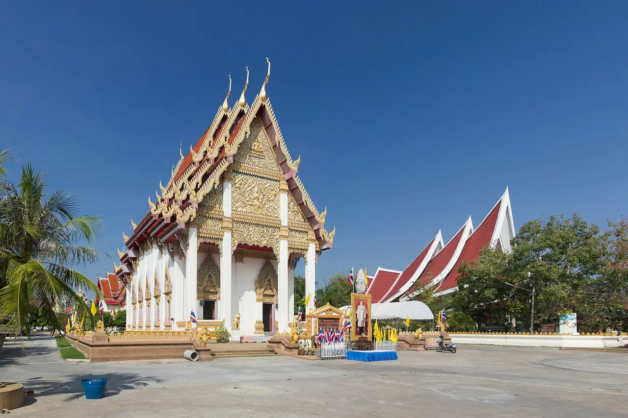
The sights in town, one by one
The Surin National Museum is on Highway 214 in Ban Nong Tao, Chaniang subdistrict, about 4 kilometres south of the city. Wikivoyage says it was established in 1974, first housed in the city hall and later the education office, and that the Fine Arts Department proposed a dedicated building in 1992. Construction began in 1995 and finished in 2010. The museum covers five topics: natural science, history and archaeology, local history, ethnology and local heritage. Wikivoyage warns that the road has no sidewalk and that walking is not recommended, and says a songthaew from the city goes there, so ask your hotel about current options.
The City Pillar Shrine (Lak Mueang) is the tutelary shrine of the city and the province. Wikivoyage says it had no pillar until 1968, when the Fine Arts Department designed a new shrine and the pillar was made from a golden cassia log. The monument to Phaya Surin Phakdi Si Narong Changwang, called Pum, stands at the southern entrance to the city on what is now a traffic roundabout and was once the line of the inner wall. The black brass statue is 2.2 metres high and was dedicated in 1968. It shows him holding a curved-bladed pike, an elephant-control tool, to recognise his skill with war elephants and the role of elephants in Surin's history and economy. Wat Burapharam on Chit Bamrung Road was built by the same founder, and Wikivoyage says it houses a Buddha image, Luang Pho Phra Chi, made at the same time as the temple. The Lower Isaan Art and Crafts Centre, on a bypass road south-east of the city, displays art and culture of the lower Isaan region.
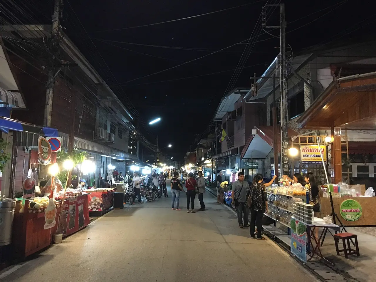
Wikivoyage describes the night market, the small restaurants and the street vendors, and says the streets near the Thong Tarin Hotel hold small bars. It also lists a few expat-run restaurants near the bus station. We list no individual restaurants because we could not check them.
Suggested itineraries
These plans are our own suggestions built from the district locations in Thai Wikipedia and the distances in Wikivoyage. We give no travel times, because the sources do not, so ask your driver or hotel to confirm the route before you commit. The temple days assume the border sites are open, which you should check first.
Two days, from the town.
- Day 1, town and silk: the Surin National Museum in the morning, then the City Pillar Shrine, the Phaya Surin Phakdi monument and Wat Burapharam, with Ban Tha Sawang for the weaving in the afternoon. End at the night market.
- Day 2, the great temple: Prasat Sikhoraphum in Sikhoraphum district, then Prasat Ban Phluang in Prasat district. On a Round-up or Loy Krathong weekend, swap in the festival.
Three days, adding the elephants or the south.
- Day 1 and Day 2: as above.
- Day 3, Tha Tum: the Ban Ta Klang Elephant Study Centre, which Wikivoyage places about 60 kilometres from Surin, and Wang Thalu, which Thai Wikipedia puts 3 kilometres from the elephant village. In mid-May, add the ordination parade.
- Day 3, alternative, the south: Sangkha district for Prasat Yai Ngao and Prasat Phum Pon, about 50 kilometres from Surin on Highway 2077 plus 12 kilometres, per Thai Wikipedia. Add the Ta Muen group only if you have confirmed it is open.
Four days, if you like temples. Add a day for Prasat Chom Phra, Prasat Mueang Thi, Ban Phlai and Ta Piang Tia, and a day for the Khmer sites in the neighbouring province of Buriram with our Phanom Rung and Phimai guide.
If you are only passing through. Take an hour for Wat Burapharam and the City Pillar Shrine, buy lotus-seed snacks at the market, and if you have a car go to Sikhoraphum.
Getting to Surin
Wikivoyage says the drive from Bangkok takes just over six hours: one route via Saraburi and Nang Rong is 457 km, another via Korat and Buriram is 434 km. Buses leave Bangkok's Mo Chit 2 terminal. Minibuses run from the town to the Chong Chom border crossing with O'Smach in Cambodia; Wikivoyage gives THB 60, which is an old figure.
| Way in | What we found |
|---|---|
| Train | Wikivoyage says ordinary trains take about 8.5 hours. Wikipedia puts Surin station 419.75 km from Bangkok station and says it opened in May 1926. Check times and tickets with the State Railway of Thailand. |
| Bus | Several operators from Mo Chit 2, per Wikivoyage. Fares and times change; check with the operator. |
| Car | 434 to 457 km depending on the route, just over six hours. |
| Booking online | The 12Go page, described below. |
The 12Go page for Bangkok to Surin was opened in a real browser on 16 October 2026 for Sunday 18 October and two travellers. It showed 53 trips, from THB 230 to 15,750: 8 trains from THB 230, 18 buses from THB 446 (Transport Co), 6 flights from THB 2,006 and 21 taxis from THB 4,083. Those are the figures the page displayed on that day, not guarantees. We did not check which airport the flights use, so look at the page for your own date. Some links on this site may earn us a commission, which does not change the price you see.
For onward travel around Isaan and Thailand, see Getting around Thailand.
The Chong Chom border crossing
Wikipedia calls the pass between Chong Chom on the Thai side and O Smach in Cambodia the main pass through the Dangrek range in this region. Wikivoyage describes the crossing in its "Go next" section: the drive into Cambodia becomes very scenic as the road descends the mountains, a couple of casino hotels stand between the two countries' immigration offices, and O Smach town is less than a kilometre down the hill, with at least three guesthouses, a market with cafes and a bank branch without an ATM. It says buses to Samraong and beyond leave from O Smach, and that minibuses run from Chong Chom back to Surin, at an old price of THB 60.
That description is a travel-wiki entry of uncertain date. Border rules, visa procedures and even whether the crossing is open can change, and Thai Wikipedia records border incidents in this part of the Dangrek range as recently as July 2025. Before planning a crossing, check the current position with the official immigration services of both countries, not this page. For most visitors the better use of the border area is the Ta Muen temples and the view of the escarpment, if and when they are open.
When to go
We found no official source we could read with climate figures for Surin, so we give no temperatures or rainfall. What we can confirm is the calendar: the Round-up and the Sikhoraphum celebration in November, the jasmine rice and silk fair in January, the Phanom Sawai festival in March and the elephant ordination parade around mid-May, all per Wikivoyage. English Wikipedia adds one qualitative point: because Surin sits on the Khorat Plateau, the surrounding mountains block much of the rain the monsoons would otherwise bring, which gives lower annual rainfall and a bigger contrast between the rainy and dry seasons than areas outside the plateau. Check the Thai Meteorological Department before you travel.
Where to stay
There is no where-to-stay guide for Surin yet. Our guides only name hotels whose own websites we can read and quote, and we could not reach eight such hotels in Surin, so we name none here. What the sources support:
- In town: Wikivoyage describes a small town that can mostly be walked, with a night market and small restaurants. It is the practical base for the whole province.
- Round-up and Sikhoraphum weekends: Wikivoyage tells you to book a room in advance.
- For the border temples: use the town as your base and hire a car with a driver, because the temples are spread far apart.
Room prices change by date, so compare booking platforms for your own dates.
Nearby destinations
- Isaan: the whole region
- Phanom Rung and Phimai: Khmer temples in Buriram and Korat
- Buriram: the neighbouring province to the west
- Ubon Ratchathani: the big city to the east
- Khon Kaen: the hub of upper Isaan
- Thailand travel guide
FAQ
When is the Surin Elephant Round-up?
Wikipedia says it is usually held on the weekend of the third week of November. Wikivoyage describes three days at Si Narong Stadium. On that rule 2026 would be 21 and 22 November, but confirm the announced dates before booking.
How do I get to Surin from Bangkok?
By train, by bus from Mo Chit 2, or by car, 434 to 457 km depending on the route. The 12Go page showed 53 trips combining trains, buses, flights and taxis when we opened it on 16 October 2026. Check prices and times with the operator.
How long does it take from Bangkok?
Wikivoyage says just over six hours by car and about 8.5 hours on an ordinary train. We found no reliable bus time, so we give none.
How do I get to the Ta Muen temples?
Wikivoyage says tours run only occasionally when there is enough interest, and that a return taxi costs about THB 2,000, which may be out of date. Ask your hotel or driver for current prices and routes, and stay on the paths, because the same source warns of possible unexploded mines near the border.
What is at Ban Ta Klang?
Wikivoyage describes a Kuy village with a long elephant-keeping tradition and an Elephant Study Centre. It notes ethical concerns about riding and chaining. The THB 100 fee and 8:30 to 16:30 hours come from Wikivoyage and we did not verify them officially.
Where can I see silk being woven?
Wikivoyage names Ban Tha Sawang for gold-brocaded silk and Khwao Sinarin for hol silk. Visit the villages directly and ask prices before you buy.
Is Surin the same as Surin Beach or the Surin Islands?
No. Surin Beach is in Phuket and the Surin Islands are a marine park in Phang Nga. See the Surin Islands guide for the islands.
Who are the Kuy?
Wikipedia describes the Kuy as a Mon-Khmer people, also written Kui, Guay or Suay, whose native lands run from the southern Khorat Plateau to the Mekong. The elephant Kuy of Surin, the Kuy Ajiang, are the people behind the Round-up. See the section on the people of Surin above.
Which is the oldest Khmer temple in Surin?
Thai Wikipedia names Prasat Phum Pon in Sangkha district, dating its oldest brick towers to about the 7th century CE. English Wikipedia quotes Sarah Talbot in calling it the oldest known Khmer structure in Thailand in good original condition, with a lintel of the late seventh century. Wikivoyage gives about the 8th century.
Why does the Surin seal show an elephant?
The provincial seal shows Indra on the three-headed elephant Airavata in front of Prasat Sikhoraphum, according to Thai Wikipedia, and the Wikipedia page for the province says the design is based on a famous Khmer temple in the province.
Are the Ta Muen temples open?
We cannot say. Wikipedia reports closures during the 2008 to 2013 border crisis and restrictions on how far visitors can walk, and Thai Wikipedia mentions an incident in July 2025. Ask your hotel or the provincial tourism office on the day, stay inside the temple area if you go, and follow any instructions from the border police.
What language do people speak in Surin?
Many people in the province speak Thai together with Northern Khmer, Kuy or Isaan Lao. English Wikipedia reports that 47.2 percent of people could speak Khmer in the 2000 census, and Thai Wikipedia gives a different breakdown of first languages. See the section above for the numbers and their limits.
What can I buy in Surin?
Wikivoyage and Thai Wikipedia name silk from Ban Tha Sawang and the Khwao Sinarin villages, silver beads from Ban Chok, rattan baskets from Ban Buthom, crispy lotus seeds, jasmine rice, sweet pickled mustard greens and kalamae sweets. We quote no prices; compare shops and ask how an item was made.
Is there a good route for two days?
Our suggestion in the itineraries section is the town and Ban Tha Sawang on day one and Prasat Sikhoraphum with Prasat Ban Phluang on day two, adding the elephant villages if you have a third day. It is our plan, built from the sources, not an official route.
Official sources and further reading
- Surin Province (Wikipedia)
- Surin (Wikivoyage)
- Prasat Sikhoraphum (Wikipedia)
- Surin Elephant Round-up (Wikipedia)
- Surin railway station (Wikipedia)
- Surin Bhakdi Airport (Wikipedia)
- State Railway of Thailand
- Kuy people (Wikipedia)
- Prasat Ta Muen Thom (Wikipedia)
- Surin province (Thai Wikipedia)
- Prasat Sikhoraphum (Thai Wikipedia)
- Prasat Ta Muen Thom (Thai Wikipedia)
- Prasat Ta Muen Tot (Thai Wikipedia)
- Prasat Ta Muen (Thai Wikipedia)
- Prasat Phum Pon (Thai Wikipedia)
- Prasat Ban Phluang (Thai Wikipedia)
- Prasat Mueang Thi (Thai Wikipedia)
- Prasat Yai Ngao (Thai Wikipedia)
- Prasat Chom Phra (Thai Wikipedia)
- Tha Tum district (Thai Wikipedia)
- 12Go: Bangkok to Surin
Prices, schedules and entry rules change. Figures here are approximate as of 2026; always confirm on the official or operator page before you book. Spotted something out of date? Tell us.