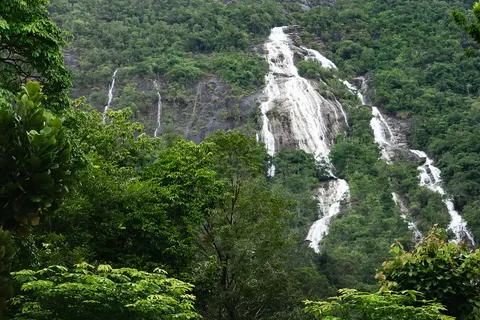
Ranong is known as the province of eight months of rain and four of sun, and one of the wettest places in Thailand. The payoff is green forest, full streams and waterfalls that run almost all year. This page covers every waterfall and nature stop you can reach from Ranong town: Ngao Waterfall, Punyaban Waterfall, Ton Phet Waterfall, Chum Saeng Waterfall, Lam Nam Kra Buri National Park, Khlong Nakha, and the place many travellers search for as "Grand Canyon Ranong". You get distances, opening hours, fees, the best months, how to reach each by car or motorbike, a one-day loop, budgets, and the safety rules for flash floods and slippery rock.
Information is as of 7 Nov 2026. Many fees and hours belong to national parks or villages and can change, so figures marked "about" are worth checking again before you go. None of these waterfalls has a tour you can book online, so you need your own transport or a driver, and the options for reaching Ranong sit where you need to decide. For the province overview see the Ranong guide, for hot springs and the town see Ranong town and hot springs, and for islands see Koh Phayam.
We earn a commission if you book through our links. The price you pay does not change. How we choose
Waterfalls and Ranong Canyon around Ranong town: where, how far, worth it?
| Easiest waterfalls | Ngao Waterfall (about 13 km south of town) and Punyaban Waterfall (about 14 km north of town). Both sit right beside Highway 4 (Phetkasem Road) and need very little walking. |
|---|---|
| Waterfall that needs a hike | Ton Phet Waterfall, about 29 km from town, then about 2 km of village road and about 1.5 km on foot. Allow 30 to 45 minutes each way on the trail. |
| Farthest waterfall | Chum Saeng (Rainbow) Waterfall in Kra Buri district, about 80 km from Ranong town. Best if you are already driving north to Chumphon. |
| "Grand Canyon Ranong" | Not an official place name. People mean Ranong Canyon, also called Emerald Pond (Bueng Morakot): a flooded former tin-mine pit at Hat Som Paen, about 15 km from town. No lifeguard. |
| Best season | The most water falls from about May to October, but heavy rain and flash floods make that the risky half of the year. The comfortable window is about November to April, when falls still run and roads are drier. |
| Waterfall tours | There is no bookable waterfall tour. You need your own wheels or a driver. See "How to reach each place from Ranong town" below. |
With half a day, pick Ngao Waterfall plus the Pornrang hot spring that sits in the same national park. With a full day, add Punyaban or Ranong Canyon in the afternoon. If you like jungle walking and have a driver you trust, try Ton Phet. Chum Saeng and Khlong Nakha are not worth squeezing into a day based in town.
| Place | Direction from town | Distance (about) | Walking | Time needed | Entry |
|---|---|---|---|---|---|
| Ngao Waterfall | South, Highway 4 | 13 km, then about 1 km on a paved road | About 500 m to the viewpoint | 1 to 2 h | Thai adults about 20 baht; ask at the gate for foreigners |
| Pornrang hot spring | South, inside Ngao park | About 5 to 10 km | Short | 1 to 2 h | Foreigners 100 baht, Thais 20 baht |
| Punyaban Waterfall | North, Highway 4 | About 14 km | About 300 m nature trail | 45 min to 1 h | Ask at the entrance |
| Ranong Canyon (Emerald Pond) | East, Hat Som Paen road | About 15 km | Short | 30 min to 1 h | Free |
| Ton Phet Waterfall | South, Highway 4 km 640 to 641 | About 29 km plus 2 km village road | About 1.5 km jungle trail | Half a day | Usually none; contact the community first |
| Chum Saeng Waterfall | North, Pak Chan, Kra Buri | About 80 km | Short | Half a day with travel | Ask on the spot |
Distances are estimates by car from Ranong town, without stops or rain delays. Information as of 7 Nov 2026. Check fees and opening times before you go.
Ngao Waterfall (Namtok Ngao) and Ngao Waterfall National Park
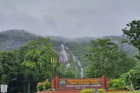
Ngao is the waterfall most visitors to Ranong see first, because you can spot the white ribbon of water falling down a tall cliff from the main road before you even reach the park gate. The park was formerly Khlong Phrao National Park, declared in 1999, and covers land in both Ranong and Chumphon. Its highest peak, Nom Sao, is about 1,089 m. The park office is in Ngao sub-district, Mueang Ranong.
Getting there and opening hours
From Ranong town, drive south on Highway 4 (towards Ratchakrut) for about 13 km, then turn onto a paved road for about 1 km to the park office. Allow roughly 15 to 25 minutes by car without traffic. From Ranong airport it takes about 10 minutes. The park office is open daily from about 08:30 to 16:30, so plan to arrive before 15:00 to leave time to walk. There is no regular public bus that you can rely on to reach the gate, so use your own car, a rented motorbike or a car arranged by your hotel.
Entry fee
Thai adults pay about 20 baht, a car about 30 baht, and Thais over 60 get in free. Ask for the foreigner rate at the gate before you buy a ticket, and check again before you go. Carry cash with small coins, because the gate may not take transfers or cards.
What to do at Ngao Waterfall
- Walk the viewpoint trail from the car park, about 500 m, suitable for all ages. Taken slowly it needs no more than half an hour, and the water drops down a steep rock face roughly 300 m high.
- Take a nature trail through shady forest. Ask staff at the office which trail is open.
- Photograph the park sign with the waterfall appearing out of the mist. Mornings after rain usually give the best view.
- Stop at the Pornrang hot spring in the same park (see below).
Ngao has the most water in the rainy season, from about May to October, and is strongest around June. But rainy season in Ranong means rain almost every day, and forest trails get slippery. For easy walking and a good view, come between November and April. Some trails in the park may close seasonally, so call before you go on 077 848 181 or 077 810 651.
Pornrang hot spring inside the park
Pornrang hot spring lies inside Ngao Waterfall National Park, about 5 to 10 km south of town, roughly 15 to 20 minutes by car. It is open daily from about 06:00 to 18:00. Foreigners pay 100 baht and Thais 20 baht. This is a natural hot spring with about 13 springs; the water is about 35 to 40 degrees C, clear, with no sulphur smell. There are foot-soaking pools, whole-body soaking pools, outdoor showers, toilets, a pavilion and parking. It sits in a valley beside a stream, about 60 m above sea level, with handrails, a gentle ramp and emergency call points about every 50 m.
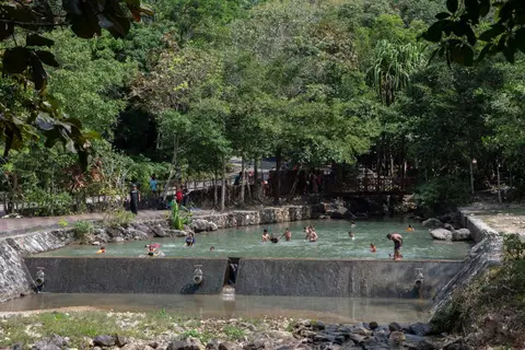
There are no lockers, so bring a towel and sandals with good grip, because the stone edges are slippery. A shallow stream lets small fish nibble your feet for free. Ask at the gate whether a single ticket also covers Ngao Waterfall, and if you are unsure, ask before paying. For the hot springs in town and everything else, see Ranong town and hot springs.
The Chao Fa crab and the provincial flower
The Chao Fa crab is a species first found at Ngao, with a white body and dark purple legs. So in Ranong, "Chao Fa" means a crab, not a coffee. Watch it if you spot one in a stream, but do not catch or take it. The komasum orchid (Dendrobium formosum), Ranong's provincial flower, blooms from about late rainy season to early cool season, roughly October to December.
Long trails and park accommodation
A longer trail called "16 Rang" runs about 7 km round trip from the hot spring area and takes about 5 to 6 hours. Ask staff whether it is open and whether you need a guide. The park has a limited number of houses and a camping area, booked through the national parks department. For Khlong Phrao Waterfall on the Chumphon side of the same park, see south Chumphon and caves.
Wear trainers or hiking shoes and bring drinking water, a rain jacket and a waterproof bag for your phone. Forest paths are slippery after rain.
There is no bookable Ngao Waterfall tour. Planning a car and a bed is covered in "How to reach each place from Ranong town".
Punyaban Waterfall beside Highway 4
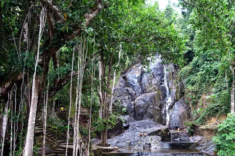
Punyaban Waterfall is inside Lam Nam Kra Buri National Park, beside Phetkasem Road (Highway 4) at about kilometre marker 597, roughly 14 km north of Ranong town on the side that leads to Kra Buri and Chumphon. You can see the fall from the road, and a sign marks the turn-in, which makes it one of the easiest waterfalls in the province. It lies in Bang Non sub-district.
What the waterfall is like
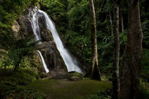
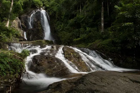
Punyaban has water all year, fed by streams from the Pa La-un and Ratchakrut forests. It has three tiers: the main Punyaban fall plus two more named after bamboo and ferns. The main drop is about 20 m high. The setting is shady and the forest light is fairly dark, which suits slow-shutter photos of silky water.
Hours, fees and facilities
- Open about 06:30 to 19:00 daily. That makes it a good late-afternoon stop after other parks have closed.
- The Lam Nam Kra Buri National Park fee is 20 baht for Thais, and 100 baht for foreign adults and 50 baht for children. Whether it is collected at the waterfall entrance is worth asking on the spot, and check again before you go.
- A nature trail of about 300 m, a car park, a restaurant and toilets are at the entrance.
- Allow about 45 minutes to 1 hour.
Safety at Punyaban
The fall is close to the main road, but it is still a stream in forested hills. Heavy rain makes the water rise quickly and turn red-brown. Stay out if it is muddy or rising. In August 2018 heavy rain sent a slide of earth across more than 100 m of Highway 4 near the viewpoint and closed one lane. After heavy rain, check the road and the park status before you leave town.
On the way: Hat Yai hot spring
North of town on the road to Punyaban you pass Hat Yai hot spring. It has four springs: two concrete wells, a stone weir about 3 m long, and an earth-banked pool about 30 cm deep, plus a drilled well. Entry fee and hours are unclear. It is a short stop if you pass it, not a reason to drive out.
There is no bookable Punyaban tour. Hire a car or use your own as described in "How to reach each place from Ranong town".
Lam Nam Kra Buri National Park: forest trails, mangroves and the border river
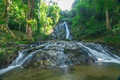
Punyaban is only one corner of Lam Nam Kra Buri National Park, declared on 21 April 1999, with about 2,061,278 rai of land. The Kra Buri (Pak Chan) river forms the Thailand and Myanmar border for about 60 km, with mangroves and islands in the river. The park office is in Ban Hin Chang, Pak Nam sub-district, about 18 km from town: take Highway 4 to kilometre 595, then turn right for about 1 km.
- Fees: Thai adults and children 20 baht; foreign adults 100 baht, children 50 baht.
- Hours: about 08:30 to 16:30 daily. Call 0 7798 9817 before going if you want a long trail or to stay overnight.
- Houses and tents are available. Book ahead.
- A shaded forest path runs through the park. Ask staff which trail is open.
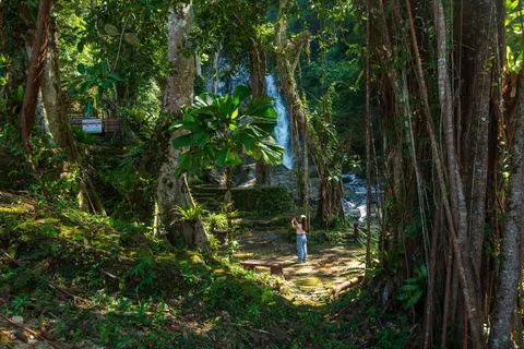
The Khao Khom Ma viewpoint and the mangrove nature trail of the same park start from the same junction at km 595. They are described in islands and Laem Son, which covers Kra Buri, the river mouth and the mangrove boardwalk.
If you want both Punyaban and the park office, visit Punyaban first in the morning, then reach the park office before 16:30.
Ton Phet Waterfall: an 11-tier fall you have to hike to
Ton Phet Waterfall lies inside Khuan Mae Yai Mon Wildlife Sanctuary, in Moo 4, Ratchakrut sub-district, Mueang Ranong, about 29 km from town. It is farther and more tiring than Ngao or Punyaban, so it suits people who want real forest more than a roadside photo stop.
The route
- Drive south on Highway 4 (towards Phang Nga) about 29 km from Ranong town, to kilometre marker 640 to 641.
- Turn left on the signs for the Ranong Scout Camp and Ton Phet.
- Continue about 2 km to Ban Huai Nam Sai village and park where locals direct you.
- Walk the jungle trail for about 1.5 km, around 30 to 45 minutes, with some steep sections, to the first tier.
There is no public bus to the trailhead. Hire a car or drive yourself, and agree on the pick-up time if you hire a driver. The waterfall is about 10 km from Ranong airport, about 18 km from Ngao Waterfall and about 31 km from Raksawarin hot springs.
What the waterfall is like
Ton Phet has 11 tiers over granite. The first tier is about 10 m high with a pool at the bottom. The upper tiers need more walking and climbing, and suit experienced walkers or people with a local guide. Water runs all year, higher in rain but also more slippery and dangerous.
- Swim only near the first tier when the water is clear and calm. No jumping, and do not step on wet rocks.
- Facilities are minimal and no staff walk the trail.
- The entry fee is usually nothing, but ask the community before you go. There are no fixed opening hours, so go in daylight only.
- Bring drinking water, snacks, a dry bag and shoes with good grip. Open sandals are a bad idea.
Ton Phet Green Garden is about 2 km from the trailhead. If you go by motorbike, ask locals about the state of the road into Ban Huai Nam Sai before you set off, because the village road gets slippery in the wet season.
There is no bookable Ton Phet tour. If you have no vehicle, ask your hotel for a driver who knows the way.
Ranong Canyon (Emerald Pond): what "Grand Canyon Ranong" really is
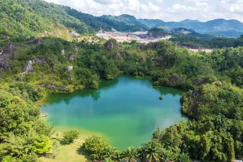
If you search for "Grand Canyon Ranong" you will not find a place by that name in Ranong; results usually lead to places in Chiang Mai, Chonburi or Phatthalung instead. What people mean is Ranong Canyon, or Emerald Pond (Bueng Morakot). It is not a natural gorge. It is a former tin-mine pit that filled with water and became a green pond ringed by rust-coloured rock walls and hills, at Ban Thung Kha, Hat Som Paen sub-district, Mueang Ranong.
How to get there
It is about 15 km from Ranong town, roughly 15 minutes by car. Take the road to Raksawarin hot springs (the Highway 4004 road from the hot spring to Hat Som Paen), pass Wat Hat Som Paen, and climb about 2.5 to 3 km further. Signs are posted along the way. The coordinates are about 9.93506, 98.68582. No direct bus runs there. You can use a songthaew (shared pickup truck) or your own vehicle. In a map app, type "Ranong Canyon".
Hours, entry and what to do
- Open about 05:00 to 18:00 daily. Entry is free and there is parking; check again before you go.
- A viewpoint and a short nature trail up and down the hill. Sandals are hard going.
- Feed the fish (mahseer-type fish, red carp and catfish); fish food is sold from small stalls.
- Pedal duck boats and kayaks are usually available. Ask the price on the spot before boarding.
- Photograph the rusty rock walls, morning mist and sunset.
Allow about 30 minutes to 1 hour. It is mostly a small lake and not worth driving across the province for, but it is a good stop when combined with the hot springs and Wat Hat Som Paen in the same half day. Morning light gives calm water and strong colour, and a sunny day makes the water greenest.
Can you swim?
There is no lifeguard, no depth sign, and the bottom is uneven because it is an old mine pit. Swimming is not confirmed as allowed. It is an open leisure area, but going into the water is at your own risk, and it is not recommended for non-swimmers or small children. If you do go in, stand only in shallow water where you can see the bottom, and skip it after heavy rain, when runoff clouds the water.
Hat Som Paen: an inland tin-mining valley, not a sea village
Hat Som Paen is not a seaside community. It is an inland valley that was mined for tin. Wat Hat Som Paen is a small, well-known temple with a hexagonal chedi more than 100 years old (a new chedi was built over the old one in 1992), a shrine to the revered monk Luang Phor Khlai, and the Hat Som Paen canal runs through the temple, with big mahseer-type fish to feed. It is open about 08:30 to 16:30 daily. The community also has a tin-panning learning centre with old mining tools, and a ceramics group using local kaolin clay, open Monday to Friday about 09:00 to 15:00. Call ahead before you go.
An eastern half day: Raksawarin hot springs for 1 to 2 hours, then Wat Hat Som Paen and Ranong Canyon, then back to town for dinner. More in Ranong town and hot springs.
Chum Saeng (Rainbow) Waterfall in Kra Buri: far, but high
Chum Saeng Waterfall, also called Rainbow Waterfall (Namtok Chum Saeng or Namtok Sai Rung) and formerly Pak Wip Waterfall, is at Ban Pak Chan, Moo 4, Pak Chan sub-district, Kra Buri district (postcode 85110). It is about 80 km from Ranong town, and about 16 km beyond Kra Buri town towards Chumphon. From Highway 4 at about kilometre 529 to 530, opposite the Pak Chan self-help settlement, turn left and drive about 3 km.
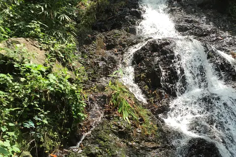
Opening hours and fees are not clear, so phone the Pak Chan sub-district administration on 077 873 502 before you go. The main fall is about 60 m high, with a cliff face about 20 m wide, and has several tiers and pools. It is best from about May to November, and thin in the dry season, so do not expect it to be full in March.
- Open in daylight, about 08:30 to 16:30. Arrive before 15:00 and phone ahead to confirm hours.
- Entry: ask on arrival whether a fee is charged.
- Swim only in the lower pool when the current is gentle. No jumping, and watch children closely.
- The road in is slippery when wet, and you should visit only in daylight.
Other stops nearby include the Ranong and Chumphon provincial border inscription about 3 km away, Wat Suwan Khiri Pak Chan about 7 km, Song Phrak waterfall about 10 km, Bok Krai waterfall about 16 km and the Kra Isthmus about 19 km.
Chum Saeng is too far to drive from Ranong town and back for a single waterfall. It suits people heading north to Chumphon by private car, who can stop on the way. See the Chumphon guide and south Chumphon and caves.
Khlong Nakha Wildlife Sanctuary: river lilies in November and December
Khlong Nakha is in Suk Samran district, about 25 km from Kapoe towards Phang Nga. It covers about 331,456 rai and is one of the richest forests in southern Thailand, bordering Khlong Saeng Wildlife Sanctuary (Surat Thani) and Si Phang-nga National Park. The reason to go is a bamboo raft trip to see the river lily (phlap phluang than, known locally as ya chong), a plant found only in the upper south, in Phang Nga and Ranong. It blooms only in November and December in clear running water less than 2 m deep.
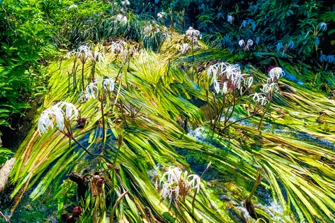
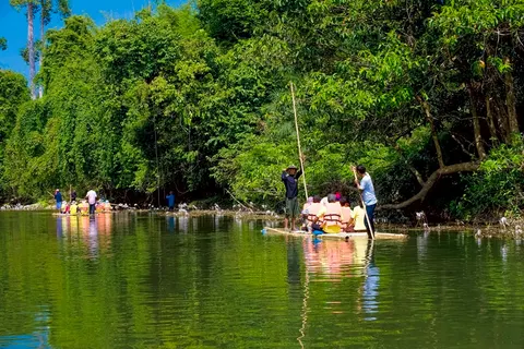
This is not an open-gate national park. Serious visitors must write to the national parks department for permission at least 15 days ahead. Phones are 0 7787 4210 and 0 2579 9446. The headquarters is on Highway 4 at about km 685 to 686: turn left and drive about 200 m. Office hours are about 08:30 to 16:30.
Do not treat Khlong Nakha as a day trip from Ranong town. It is a seasonal extra for people passing through towards Phang Nga, and permission and water conditions should be checked first. See Phang Nga if you continue south.
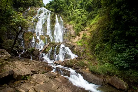
When to go: "eight months of rain, four of sun"
Ranong is known as the province of eight months of rain and four of sun. It faces the Andaman Sea and takes the full southwest monsoon. The town gets about 4,183 mm of rain a year over about 168 rainy days, making it one of the wettest places in Thailand. That means waterfalls run almost all year, but the amount of water and the danger vary a lot by month.
| Month | Average rain in town (mm) | Rainy days | Waterfalls and travel |
|---|---|---|---|
| January | 41 | 3 | Dry and pleasant. Falls run lightly, and trails and roads are dry. Good for views. |
| February | 20 | 2 | Driest month. Easy everywhere. Chum Saeng gets thinner. |
| March | 78 | 5 | Hot and dry. Far falls such as Chum Saeng may be very low. |
| April | 154 | 10 | Season change, afternoon showers begin. Check the forecast before Ton Phet. |
| May | 486 | 20 | Rains set in. Falls get much stronger and forest paths start to slip. |
| June | 638 | 22 | Ngao is at its strongest. Rain almost daily. Watch for flash floods. |
| July | 706 | 23 | Heavy rain, muddy red water. View from safe points only. |
| August | 772 | 24 | Wettest month. Risk of slides on hill roads. Not for Ton Phet. |
| September | 679 | 23 | Still heavy, with rough seas. Stick to roadside and town sights. |
| October | 421 | 19 | Rain easing, water still high. Komasum orchids begin to bloom. |
| November | 130 | 11 | Season change. Water still good, trails drying. One of the most comfortable months. |
| December | 59 | 5 | Dry, pleasant air, falls still flowing. River lilies bloom at Khlong Nakha. |
Rain figures are long-term averages for Ranong town. Real years vary, so check the forecast for the day. Information as of 7 Nov 2026.
In short: November to April suits walkers who want comfortable weather and falls that still flow. May to October gives the fullest Ngao and Punyaban, but you must watch from safe points and have an indoor backup such as the hot springs or the town. For ideas, see the one-day plan for Ranong.
Best time for each place
- Ngao Waterfall: most water around June, comfortable viewing from November to April. Some trails close seasonally.
- Punyaban Waterfall: runs all year and works in almost any month. Avoid it just after very heavy rain.
- Ton Phet Waterfall: runs all year, but the dry season is easier and safer for the walk.
- Chum Saeng Waterfall: best from about May to November. Thin in March.
- Ranong Canyon: a sunny morning gives calm green water. Skip it after heavy rain because the water clouds.
- Khlong Nakha: November and December, when the river lilies bloom.
Is rainy season worth it?
Yes, if you accept that it does not rain all day, every day, and you have a plan B. Rooms in town are cheaper in the wet season, the town is quiet, the forest is greenest and the waterfalls are at their strongest. The sea is rougher though, and boats to the islands can be delayed or cancelled at short notice. If you plan to continue to an island, see Koh Phayam and islands and Laem Son before you lock in dates.
Flash floods, slippery rocks and waterfall safety rules
Almost every waterfall in Ranong is a stream in forested hills, not a pool with a lifeguard. The main danger is not depth but water that rises fast after rain on the mountain above, and rocks that are much more slippery than they look.
Do this every time
- Check the colour of the water before you step in. If it is brown or red, fast, or carries leaves and twigs, stay on the bank.
- If heavy rain falls on the hills above, even if the sky is clear where you stand, the water can arrive within minutes. Leave the stream at once.
- Never step on wet, algae-covered rock. Wear shoes with good grip, not open flip-flops, on forest trails.
- Do not jump into the water from rocks or cliffs, especially at Ton Phet and Chum Saeng, where you cannot see the bottom.
- Keep children within arm's reach and let them play only in shallow water where the bottom is visible.
- Go in daylight and leave before dark. Nobody patrols the trail at Ton Phet.
- Go with at least one other person and tell your hotel where you are going and when you will be back.
- Carry drinking water, a rain jacket, a waterproof bag and cash for fees.
- Do not touch, chase or collect wildlife, including the Chao Fa crab at Ngao.
Roads and landslides
Highway 4 passes through hills. In August 2018 heavy rain sent earth across the road near Punyaban and closed a lane. After heavy overnight rain, check the road status and ask your hotel before leaving. The village road to Ton Phet (Ban Huai Nam Sai) and the road to Chum Saeng are slippery when wet. On a motorbike, always check conditions first.
Ranong Canyon is different
The danger at Ranong Canyon is still, deep water of unknown depth. There is no lifeguard, no depth sign and the bottom is uneven because it is an old mine pit. The fact that pedal boats can be rented does not mean it is safe to swim.
If heavy rain forces you to cancel a waterfall, switch to the hot springs, the city pillar shrine or lunch in town, and try again the next morning if the rain eases.
How to reach each place from Ranong town: by car, motorbike, songthaew and flying in
The key point is that there is no regular bus you can plan around to the trailheads of Ngao, Punyaban, Ton Phet or Chum Saeng. Ton Phet and Chum Saeng need your own vehicle or a hired car. So decide transport before anything else.
Car, own or hired
This is the most convenient option. Highway 4 is the main road past the turn-offs for Ngao to the south and Punyaban to the north, and a map app works fine. If you have no car, ask your hotel about a day hire with a driver. Agree the price, the stops and the waiting time before you set off. Day-hire prices vary by driver and season, so no figure is given here.
Motorbike
Hotels and shops in town rent motorbikes. Rental starts at about 250 baht a day plus fuel, so ask the shop for the price on the day. A motorbike works well for Ngao, Punyaban, Pornrang and Ranong Canyon. But the road into the Ton Phet village and the Chum Saeng road are slippery in the rain, so if you are not experienced, or it is raining, use a car. Always wear a helmet.
Songthaew, taxi and motorbike taxi
A songthaew from Ranong central market to Raksawarin hot springs costs about 20 baht each way and takes about 10 minutes. That suits the town sights, but no route goes to the waterfalls. If you want to reach Pornrang or Ngao without a vehicle, use a taxi or a car arranged by your hotel. Show the place name in Thai script on your phone (your hotel can write it for you), and agree a price that includes waiting for the return.
Flying into Ranong airport
Ranong airport is about 23 to 24 km south of town. There is no public bus from the airport, so use a taxi or your hotel shuttle. A taxi costs about 400 to 600 baht, so agree the price before you get in and check again. Ton Phet is only about 10 km from the airport, so if Ton Phet is your first stop, you could hire a car from the airport to Ton Phet before heading into town.
 12Go
Bangkok to Ranong on 12Go
From US$18 (As of 7 Nov 2026 buses start from about US$18 and flights from about US$81. Prices change by date and departure. Some overnight buses reach Ranong before dawn, so plan where to wait or sleep)
Price as of 7 Nov 2026Overnight buses from the Southern Bus Terminal and Mo Chit to Ranong bus station take about 8 to 14 hours, and flights from Don Mueang to Ranong Airport take about 1 h 20 min. As of 7 Nov 2026 buses start from about US$18 and flights from about US$81. Check the exact boarding point on the booking page.
Bangkok to Ranong KKday
Phuket City - Ranong City Private Transfer
From US$165.46 (As of 7 Nov 2026 from about US$165 per vehicle, more for larger vehicles. Both directions are on the same booking page. Peak-season surcharges apply, and pickup or drop-off at the Koh Phayam ferry pier area in Ranong carries an extra fee paid to the driver. See the booking page)
Price as of 7 Nov 2026Private car with driver from hotels or areas in Phuket town to Ranong town, both directions on the same booking page. Choose from an eco car for 2, a premium sedan for 3, an MPV for 4 or a VIP van for 9. Free cancellation 2 days before. As of 7 Nov 2026 from about US$165 per vehicle.
See Phuket to Ranong car 12Go
Ranong to Phuket on 12Go
From US$16 (As of 7 Nov 2026 buses from about US$16, flights from about US$46, taxis from about US$148 per car. Departures run from about 07:15 to about 20:00. Prices change by date and departure)
Price as of 7 Nov 2026Buses from Ranong bus station to Phuket take about 5 h 30 min, and a few flights run as well. As of 7 Nov 2026 buses from about US$16 and flights from about US$46. Use it when the waterfalls are done and you head on to Phuket.
Ranong to Phuket buses KKday
Hua Hin City to/from Ranong City - Private Transfer
From US$157.86 (As of 7 Nov 2026 from about US$158 per vehicle, more for larger vehicles. Peak-season surcharges apply. Both directions are on the same booking page)
Price as of 7 Nov 2026Private car with driver from hotels in Hua Hin town to Ranong town, both directions on the same booking page. Eco car for 2, premium sedan for 3, MPV for 4 and VIP van for 9. As of 7 Nov 2026 from about US$158 per vehicle.
Hua Hin to Ranong car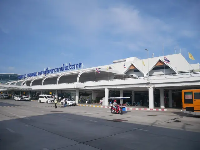 Klook
Phuket International Airport Transfers (private car)
From US$19 (to Patong, Karon, Kata or Old Town)
Price as of 3 Nov 2026Phuket airport transfers by private car, taxi or limousine. Choose the package on the booking page.
Book on KlookFor all bus, plane and boat options, see how to get to Ranong, and for places to sleep near the waterfalls, see where to stay in Ranong.
A one-day waterfall loop from Ranong town
The logic is that Ngao and Pornrang lie south, Punyaban lies north and Ranong Canyon lies east, with the town in the middle. Plan to pass through town at midday and the loop costs the least time. The Ngao park closes about 16:30, but Punyaban stays open until about 19:00, so keep Punyaban for the end of the day.
Loop A: three or four stops in one day (best for most people)
- 07:30 Breakfast in town (Roti Bangnui opens about 06:00 to 16:00 and is closed on Fridays).
- 08:30 Arrive at Ngao Waterfall. Walk the viewpoint trail of about 500 m, about an hour.
- 10:00 Soak at Pornrang hot spring for 1 to 2 hours. Ask about a shared ticket with the park.
- 12:00 Back to town, or eat at a restaurant near Ngao, for lunch.
- 14:00 Head east via Wat Hat Som Paen to Ranong Canyon, 30 minutes to 1 hour.
- 16:30 Drive north to Punyaban Waterfall in the soft late light, about 45 minutes.
- 18:00 Back in town, dinner at the evening market behind the city pillar shrine.
Loop B: add Ton Phet and drop the rest
- 07:00 Leave town south, about 29 km, and turn left at km 640 to 641.
- 08:00 Reach Ban Huai Nam Sai and start the walk of about 1.5 km, 30 to 45 minutes.
- 09:00 Reach the first tier. Rest, take photos, and be back down before about 11:00.
- 11:30 Drive back to Ngao Waterfall (about 18 km) and walk the viewpoint.
- 13:30 Soak at Pornrang and then eat in town.
- If you still have energy, Punyaban in the late afternoon, but do not force it.
Loop C: no vehicle, a half day with the hot springs
Take a songthaew to Raksawarin hot springs, then use a taxi or hired car to Pornrang and Ngao Waterfall. Agree that the driver waits and brings you back. Aim to finish before 16:00, because the park closes and getting a lift back is hard.
On a day of heavy rain, switch to a town route: Raksawarin hot springs, the city pillar shrine and the markets, and try the waterfalls tomorrow morning if the rain has eased.
Sample plans: half day, two days, a rainy day, and north to Chumphon
Half day: Ngao Waterfall and Pornrang (about 4 to 5 hours)
- Leave town about 08:00 to reach Ngao Waterfall when it opens, about 08:30.
- Walk the viewpoint trail of about 500 m and photograph the sign and the waterfall in the mist.
- Soak at Pornrang for 1 to 2 hours, then return to town for lunch.
- Good for anyone short of time, or travelling with children or older people.
One day: three stops either side of town
Use Loop A from the one-day section: Ngao, Pornrang, Ranong Canyon and Punyaban. The entry fees a foreign adult can count on are 100 baht at Pornrang and 100 baht for Lam Nam Kra Buri park if it is charged at Punyaban, plus the Ngao rate to ask at the gate, not counting transport and food.
Two days, one night: hiking and the community
- Day 1 morning: Ton Phet before the heat, then back past Ngao and Pornrang, and sleep in town.
- Day 2 morning: Punyaban and Lam Nam Kra Buri park, arriving before 16:30. Afternoon: Ranong Canyon and Wat Hat Som Paen.
- If you have a Day 3, continue to the islands: see Koh Phayam and the Ranong itinerary.
A day of heavy rain
In heavy rain, skip Ton Phet and do not get into the water anywhere. You can still visit the Ngao and Punyaban viewpoints from beside the road when the rain eases, soak at Pornrang or Raksawarin, and see the city pillar shrine, the evening market and cafes in town. If the rain stops in the evening, Punyaban is open until about 19:00 and works as a fallback.
Heading north to Chumphon: stop at Chum Saeng
If you leave Ranong for Chumphon by private car or hired driver, start early and stop at Punyaban first (about 14 km), then drive on to Chum Saeng (about 80 km). Allow about 1 hour at the falls, then drive on to Chumphon. The bus all the way from Ranong takes about 1 h 30 min to 2 h 30 min, so leave enough time for the rest. A stop at Chum Saeng has to be agreed with a private driver; it is not an option on a scheduled bus or van.
 12Go
Chumphon to Ranong on 12Go
From US$7 (As of 7 Nov 2026 (sample travel date 13 Nov): buses from about US$7, vans from about US$10, taxis from about US$78 per car. Prices change by date and departure)
Price as of 7 Nov 2026Buses and vans from Chumphon bus station to Ranong bus station. The bus takes about 1 h 30 min to 2 h 30 min and the van about 2 h. As of 7 Nov 2026 buses from about US$7, vans from about US$10 and taxis from about US$78 per car. It is for getting between the two towns; for waterfall stops choose a private car.
Chumphon to Ranong buses KKday
Private one-way transfer between Chumphon city and Ranong city by eco car, premium car, MPV or VIP van
From US$82.99 (As of 7 Nov 2026 starting price per vehicle for the eco car. Booking confirmed 1 day after ordering)
Price as of 7 Nov 2026One-way private car with driver between hotels in Chumphon town and Ranong town. Choose an eco car for 2, a premium car for 3, an MPV for 4 or a VIP van for 9. Free cancellation 2 days before. As of 7 Nov 2026 from about US$83 per vehicle for the eco car. If you want a waterfall stop on the way, ask the driver first.
Chumphon to Ranong carPhotos, prices and reviews from Klook
A Lomprayah bus and ferry ticket to Koh Tao, boarding in Chumphon, up the coast from Ranong. Free cancellation up to 24 hours before.
Book on KlookBudget: entry fees, transport and food for the day
| Item | Approximate cost | Note |
|---|---|---|
| Ngao Waterfall | Thai adults about 20 baht, car about 30 baht | Ask at the gate for foreigners; bring cash |
| Pornrang hot spring | Foreigners 100 baht, Thais 20 baht | Ask whether the ticket is shared with Ngao |
| Lam Nam Kra Buri park (includes Punyaban) | Foreign adults 100 baht, children 50 baht, Thais 20 baht | Ask on the spot whether it is charged at the waterfall |
| Ranong Canyon | Free | Pedal boats and fish food are paid separately |
| Ton Phet Waterfall | Usually no fee | Contact the community first; a hired car costs extra |
| Chum Saeng Waterfall | Fee not clear | Ask the Pak Chan sub-district administration |
| Raksawarin hot springs | Park and foot bath free, soaking bath about 40 baht | Details on the Ranong town page |
| Songthaew to Raksawarin | About 20 baht each way | No route goes to the waterfalls |
| Motorbike hire | About 250 baht a day plus fuel as a starting figure | Ask for the price on the day |
| Taxi from Ranong airport | About 400 to 600 baht | Agree before you get in |
On Loop A the entry fees a foreign adult can count on come to about 200 baht (Pornrang plus Lam Nam Kra Buri park, if it is charged at Punyaban), plus the Ngao rate, transport and food. If you travel as a group, the cost of a hired car is shared and works out much cheaper than going alone. Carry cash, because some gates do not accept transfers or cards.
Prices and fees as of 7 Nov 2026. Park fees can change, so check again before you go.
What to eat and where to sleep during a waterfall trip
Where to sleep
The best base is Ranong town: it sits between Ngao to the south and Punyaban to the north and has places to stay at several price levels. See where to stay in Ranong. If you want to sleep in the forest, Ngao Waterfall National Park and Lam Nam Kra Buri National Park have a limited number of houses and camping areas. Book by phone and bring your own food.
 Budget
Narttavee Resort
Phetkasem Road, Ngao (Nga Ngoi waterfall 1.4 km)
On Phetkasem Road in Ngao sub-district, south of town, the same sub-district as the Ngao Waterfall park office. Suits an early start at Ngao and Pornrang.
See prices and availability on the booking page
 Mid-range
Thansila Resort
Phetkasem Road, Bang Rin (Raksa Warin hot spring 440 m)
On Phetkasem Road in Bang Rin, about 440 m from Raksawarin hot springs. Handy for a hot soak in the evening after a waterfall day.
See prices and availability on the booking page
 Budget
Numsai Khaosuay Resort
Khao Niwet, Ranong town centre (bus station 580 m)
In Khao Niwet, central Ranong, about 580 m from the bus station. Suits arrivals by bus who will hire a motorbike or car from town.
See prices and availability on the booking page
What to eat
- The evening market behind the city pillar shrine, beside the Hat Som Paen canal, sells local food, including khanom jeen with crab curry sauce at Je An, where crab, fish-kidney and green curry sauces are on offer.
- Roti Bangnui is open for breakfast about 06:00 to 16:00 and closed on Fridays, with massaman curry. Roti Naritsara in Ban Ngao serves plain roti with condensed milk, massaman chicken or beef roti, and Indian-style salad.
- The old Ranong market runs from early morning to late night, with curry rice, roast pork noodles and khanom jeen with massaman chicken curry.
- A restaurant and toilets sit at the Punyaban car park, good for a light meal.
- Souvenirs are cashew nuts, shrimp paste and dried fish, with shops around Ban Ngao.
 KKday
Kunlin Restaurant (Ranong): sharing sets for 2 to 4 people
From US$24.42 (As of 7 Nov 2026 the set for 2 people starts at about US$24, and the other sets cost more by group size and menu. Book ahead and arrive within 15 minutes of the booked time)
Price as of 7 Nov 2026Seafood-focused sharing sets with a drink at Kunlin restaurant in Khao Niwet, Ranong town: 3 dishes for 2 people, 6 dishes for 3, and lobster sashimi sets for 2 or 4. Open daily 08:30 to 20:00. Book ahead and arrive within 15 minutes of your booked time. As of 7 Nov 2026 the set for 2 starts at about US$24.
Kunlin sets in RanongPhotos, prices and reviews from Klook
A 5G/4G data-only eSIM with hotspot sharing, valid across Thailand except Pattani, Yala, Narathiwat and a few districts of Songkhla. It arrives right after booking, and a full refund is possible before it connects to a network.
Book on KlookMore on markets and restaurants in Ranong town and hot springs.
Common mistakes and a checklist
- Swimming when the water is brown and fast, the cause of most waterfall accidents.
- Believing the "Grand Canyon" name and expecting a gorge. It is an old mine pit with green water and no lifeguard.
- Going to Ton Phet by motorbike without checking the road and the weather.
- Expecting Chum Saeng to be full in March.
- Reaching Ngao Waterfall after 16:30, when the park is closed.
- Not carrying cash for entry fees.
- Wearing open sandals on the Ton Phet trail.
- Thinking Hat Som Paen is a sea village. It is an inland tin-mining valley.
- Assuming "Chao Fa" is a coffee. In Ranong it is the Ngao crab.
- Trying to fit every stop on this page into one day. North and south of town are opposite directions.
- Skipping the weather forecast and having no indoor backup in town.
Checklist
- About 400 to 500 baht in small cash per person for fees and snacks.
- Hiking shoes or trainers, and sandals for the hot spring.
- Rain jacket and a waterproof bag for your phone.
- Drinking water, light snacks, sunscreen and insect repellent.
- A towel if you plan to soak at Pornrang. There are no lockers.
- An offline map, or the Thai place names on your phone to show a driver.
Verdict: what is worth it if time is short
| Place | Verdict | Why |
|---|---|---|
| Ngao Waterfall | Very much worth it | Close, scenic, easy walking, pairs with Pornrang |
| Pornrang hot spring | Worth it | Inexpensive, relaxing, 1 to 2 hours |
| Punyaban Waterfall | Worth it | Roadside, open into the evening, an easy stop |
| Ranong Canyon | Worth it if you are in Hat Som Paen anyway | A small lake, lovely in good sun, not a reason to drive out alone |
| Ton Phet Waterfall | Worth it for hikers | Harder, no staff on the trail, needs a transport plan |
| Chum Saeng Waterfall | Only if you are going to Chumphon | Far, about 80 km from town |
| Khlong Nakha | Only in November and December | Permission is needed in advance |
If you pick only three, choose Ngao Waterfall, Pornrang hot spring and Punyaban Waterfall. If you enjoy hiking, swap Punyaban for Ton Phet. For everything else in the province, see the Ranong guide.
Frequently asked questions
Where is the Grand Canyon in Ranong?
There is no official place called Grand Canyon in Ranong. People mean Ranong Canyon, or Emerald Pond (Bueng Morakot), a flooded former tin-mine pit at Ban Thung Kha, Hat Som Paen, about 15 km from town. Take the road to Raksawarin hot springs and pass Wat Hat Som Paen. There is no lifeguard and no depth sign.
What are the opening hours and entry fee at Ngao Waterfall?
The park office is open daily from about 08:30 to 16:30. Thai adults pay about 20 baht and cars about 30 baht. Ask at the gate for the foreigner rate, check again before you go, and carry cash.
Which waterfalls are there near Ranong and which is easiest?
Ngao, about 13 km south, and Punyaban, about 14 km north, are easiest because they are beside Highway 4. Ton Phet is about 29 km away with a 1.5 km jungle walk. Chum Saeng is in Kra Buri, about 80 km away, and Khlong Nakha needs advance permission.
Can I book a waterfall tour in Ranong?
There is no bookable waterfall or Ranong Canyon tour. Rent a motorbike, hire a car from your hotel, or take a taxi, and agree on a return pick-up. If you are coming from another city, buses, vans and private cars to Ranong can be booked.
Can you swim at the waterfalls in Ranong, and is it safe?
Only in shallow pools when the water is clear and the current is gentle. Do not jump, do not step on wet rock, and stay out if the water is muddy or rising. Rain on the hills can cause a flash flood in minutes. At Ranong Canyon there is no lifeguard, and swimming is at your own risk.
What is the best time to visit the waterfalls in Ranong?
The comfortable window is about November to April, when rain is lighter and trails are drier but falls still run. The rainy season, about May to October, gives the strongest water but brings daily rain and flash flood risk. Chum Saeng is thin in March.
Is Ton Phet Waterfall a hard walk, and can I go by motorbike?
From Highway 4 at km 640 to 641 it is about 2 km to Ban Huai Nam Sai, then a jungle walk of about 1.5 km, around 30 to 45 minutes, with some steep parts. A motorbike can reach the village when the road is dry, but the road is slippery in the rain, so check conditions or hire a car.
What is the Chao Fa crab? Is it a coffee?
It is not a coffee. The Chao Fa crab is a species first found at Ngao Waterfall, with a white body and dark purple legs. Look but do not catch or take it.
How do I reach the waterfalls without a car?
Rent a motorbike in town for a starting figure of about 250 baht a day plus fuel, or hire a taxi or hotel car for Ngao and Pornrang. A songthaew goes only to Raksawarin hot springs, for about 20 baht, not to the waterfalls.
Where the facts come from
- Thai Holiday Guide: Ranong Canyon
- Thai Holiday Guide: Ton Phet Waterfall
- Thai Holiday Guide: Pornrang hot spring
- True ID Travel: Ranong Canyon (Thai)
- Thai PBS: landslide near Punyaban (Thai)
- Manager Online: Ngao Waterfall National Park (Thai)
- Wikipedia: Ngao Waterfall National Park (Thai)
- Wikipedia: Ranong province
Keep planning
 Ranong: hot springs, Koh Phayam, Koh Chang, Laem Son and waterfallsThe whole province by zone, with best months, the rainy-season reality, budgets and transport
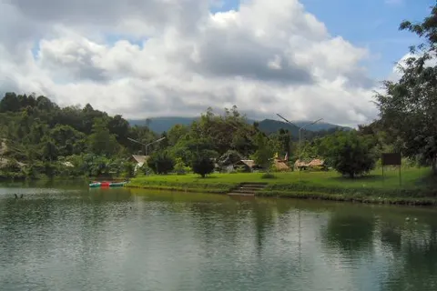 Ranong itinerary: 1 to 3 daysOne day in town, 2 days 1 night on Koh Phayam, 3 days, and a rainy-day plan
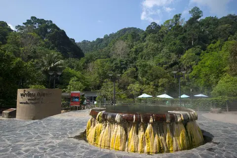 Ranong town and hot springsRaksawarin, Pornrang, the Governor's residence, the palace and the old market
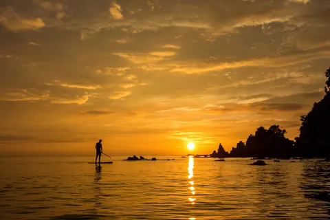 Koh Phayam, RanongBoats, seasons, beaches, where to stay and 1 to 3 day plans
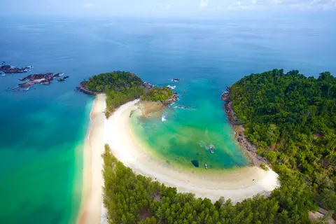 Koh Chang (Ranong), Mu Ko Ranong and Laem SonFees, closed season, Bang Ben beach and Ko Kam
 Crossing to KawthaungThe pier, the longtail boat, documents and what to check before you go
 Getting to RanongBus, flight, van, driving and onward to the piers
 Where to stay in RanongPick the area to match your boat, hot springs and sea
 Ranong dealsTickets, Koh Phayam ferries, private cars, dinner sets and hotels