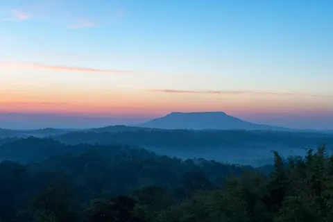
If you plan Phetchabun around only Khao Kho and Phu Thap Boek, you miss the forests and waterfalls further in. Highway 12 from Lom Sak toward Chum Phae runs through Nam Nao National Park for much of its length, and Tat Mok sits east of the town. Both are good for cool air, easy hiking and waterfalls with few people.
This page covers each park and waterfall, when to go, fees, how to get there, stops along the highway by kilometre marker, hiking trails, a plan for days without a car and what to watch out for. For Khao Kho see Khao Kho, for the mountaintop village see Phu Thap Boek, and for Phu Hin Rong Kla and Thung Salaeng Luang see the Phitsanulok section.
We earn a commission if you book through our links. The price you pay does not change. How we choose
At a glance: which place suits whom
| Place | Highlights | Good months | Suits |
|---|---|---|---|
| Nam Nao National Park | Pine forest, caves, waterfalls, campsite, the coldest nights in the province | November to February | Campers and easy hikers |
| Tat Mok National Park | Tat Mok and Song Nang waterfalls, a viewpoint over Phetchabun town | End of the rains to early winter, when water is high | A half-day trip from town |
| Than Thip forest park | A single-drop waterfall about 26 m high and 30 m wide | All year, fullest in the rains | A stop on the way to Khao Kho or Phu Thap Boek |
| Tat Yai waterfall, Nam Nao | Two-level fall with a cliff about 100 m high | Rainy season to early winter (the fall is a curtain of water in the rains) | People who like less crowded spots |
| Nam Nao Canyon | A semicircular cliff like a mini grand canyon, over 300 m deep | Morning, any season | A viewpoint with little walking |
| Loei Dan | Sandstone slab eroded into potholes | April to May, when water is low | Geology fans |
Each national park sets its own hours and fees. Accommodation and tent pitches in the parks are booked through the national parks department system. Check the status before you go, especially in the rains when some trails close.
Bangkok to Lom Sak on 12Go
From US$12 (As of 6 Nov 2026: buses from about US$12. Prices change by date)
Price as of 6 Nov 2026A bus from Mo Chit to Lom Sak, first departure 09:00 and another at 20:00 arriving in the morning, a good base for Nam Nao. From about US$12 as of 6 Nov 2026
Book on 12GoNam Nao National Park: pine forest, caves and the coldest air in Phetchabun
Nam Nao National Park was declared in 1972 and covers about 966 square kilometres across Mueang Phetchabun, Lom Sak and Nam Nao districts, bordering Khon San in Chaiyaphum. It feeds the Pa Sak, Phong and Loei rivers. The highest peak, Phu Pha Chit (Phu Dan E Pong), is about 1,271 m. Forest types include dry dipterocarp, hill evergreen, mixed deciduous, moist evergreen and pine. The average temperature is about 25 degrees, dropping to about 2 to 5 degrees in December and January.
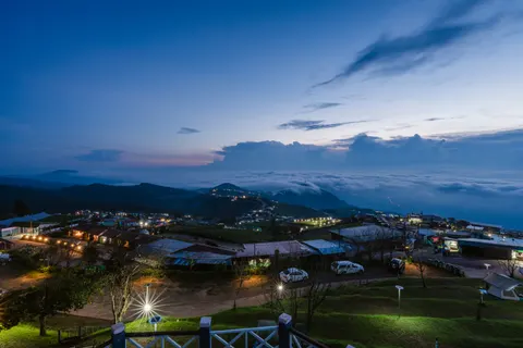
What to see in the park
- Pine woods at Phu Kum Khao and Ban Paek (Dong Paek), about 880 m up, good for strolls and early morning photos.
- Tham Pha Hong cave: 259 steps lead up to a hilltop viewpoint that suits sunset, and from the car park a path runs through bamboo for about 300 m to the cave mouth. At the big cave, Tham Yai Nam Nao (Phu Nam Rin), the part open to walk is about 400 m long and takes about an hour, with lights and a path. Ask the rangers at the park unit to take you in and do not go alone. Beyond that, the cave continues for about 4 km and is not set up for visitors.
- Hew Sai waterfall (about 20 m high, a walk of about 1 km from the road), Sai Thong (about 30 m wide and 4 m high) and Tat Phranba (about 20 m, in two tiers). Check the water level before you go, as flows are low in the dry season.
- Pha Klang Lon, Pha Lom and Pha Kong, cliff-edge viewpoints on the high trails, for people who can hike a bit further.
- The campsite and park houses: pitching a tent costs about 30 baht a person a night and there are about 15 park houses near the headquarters. Check prices and book through the national parks system.
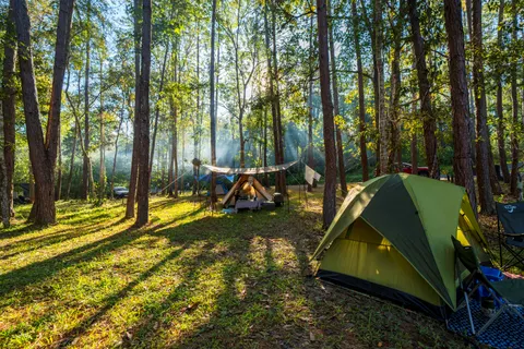
The park is important for wildlife, with about 360 bird species and more than 340 butterfly species, and is part of a tiger conservation area. About 31,840 people visited in 2019, so it is quieter than famous parks near Bangkok. Expect crowds only on long winter weekends. In the rainy season some trails show plenty of elephant footprints.
Fees, hours and how to get there
National park entry is charged at the park's own rate. For adults it is roughly 20 to 40 baht for Thais and roughly 200 to 400 baht for foreigners, and for children roughly 10 to 20 baht for Thais and roughly 100 to 200 baht for foreigners. The gate gives the current rate. The park area is open about 06:00 to 22:00 every day, while the headquarters and each sight keep their own hours, so check before you go, especially on holidays and in the rains when trails may close.
From Phetchabun take Highway 21 toward Lom Sak for about 40 km, turn right onto Highway 12 and go about 50 km to the park headquarters. The main sights are strung along Highway 12 at roughly kilometre 46 to 69 on the Lom Sak to Chum Phae count. From Chum Phae, Khon Kaen or Chaiyaphum use Highway 12 too. The headquarters is where you get the current fee and ask which trails are open.
Driving Highway 12 through Nam Nao: stops by kilometre marker
The best of Nam Nao lies in a line along Highway 12 from Lom Sak toward Chum Phae. The kilometre numbers below follow the road signs and work as a map when mobile signal is weak. They are approximate, so read the signs again as you drive.
- Kilometre 46, Phu Kho viewpoint: the best viewpoint in the park, especially in winter. You can watch the sunrise and see Phu Kradueng and Phu Pha Chit ahead. A nature trail of about 5 km starts here and takes about 2 hours to climb.
- Kilometre 49, Ban Paek pine woods (Dong Paek): drive in about 5 km to the car park, then walk about 500 m into a stand of two-needle pines, with grass and sedge below.
- Kilometre 53, Phu Kum Khao pine woods: a side road of about 14 km leads to dense three-needle pine forest covering about 10 sq km. On the hill the treetops sit at eye level, and Chulabhorn Dam reservoir shows to the south.
- Kilometre 60 on Highway 2216: the turn for Tham Yai Nam Nao. A road of about 3 km reaches the park unit, where you ask a ranger to guide you through the cave.
- Kilometres 63 to 70, changing-colour forest: around December and January the trees along this stretch shed their leaves and change colour.
- Kilometre 64, Sam Phak Khao waterfall: a small fall about 3 m high with a footpath in.
- Kilometre 67, Hew Sai waterfall: a walk of about 1 km to a fall about 20 m high, with a pool and a rock overhang below that shelters from rain. About 500 m further on are Sai Thong waterfall and a spring that bubbles out over the rocks.
- Kilometre 69, Phu Pha Chit (Phu Dan E Pong): the trailhead for the hike to a flat summit plateau, like a smaller Phu Kradueng. The climb takes about 6 to 7 hours and is fairly hard.
Wild elephants may cross Highway 12 in the evening and at night. Drive slowly where the road runs through forest, avoid driving after dark if you can, and never get out of the car to photograph an elephant.
Bangkok to Phetchabun on 12Go
From US$12 (As of 6 Nov 2026: buses from about US$12. Prices change by date)
Price as of 6 Nov 2026A bus from Bangkok to Phetchabun, about 10 hours on the timetable, which gives you the town as a base for driving Highways 21 and 12 to Nam Nao. From about US$12 as of 6 Nov 2026
Book on 12GoHiking in Nam Nao National Park: short and long trails
The park has three short nature trails for most visitors and three long trails for people who come prepared. Distances below are approximate.
- Trail 1, about 5 km, starts at the junction near the headquarters. Good for birds, and in the rains you often see many elephant footprints.
- Trail 2 starts opposite the headquarters and runs through dry dipterocarp forest past salt licks where elephants, deer and other animals come. It ends at the Sam Bon ranger unit, about 8 km.
- Trail 3 starts about 800 m from the headquarters and enters the pine woods, which locals call Pa Paek. You may meet wild elephants, deer and barking deer, and see tiger prints.
- The three long trails: the summit of Phu Pha Chit, about 15 km there and back; Tham Huai Pralat, about 15 km there and back; and the Pha Lom and Pha Kong forest, about 7 km.
The pine-forest trails are fairly flat and much easier than the climb up Phu Pha Chit. If this is your first hike here, start with the pine woods. For the long trails, tell the rangers at the headquarters before you set out and start early.
If you plan a long trail or the big cave, phone the park office a day ahead. The rangers can tell you which trails are open, whether you need a guide and what the forest is like at that time of year.
Tat Mok National Park: Tat Mok and Song Nang waterfalls and a view over Phetchabun
Tat Mok National Park is about 37 km east of Phetchabun town. It is Thailand's 87th national park, declared in 1998, covers about 290 square kilometres (181,250 rai), and is a source of the Pa Sak and Chi rivers and a buffer for Nam Nao, Phu Khiao and Tabo-Huai Yai. It has about 170 bird species and animals such as elephant, gaur and sambar.
Tat Mok waterfall is a big single-tier fall off a high cliff. Spray hits the ground as mist, which is where the name comes from. It lies about 7 km beyond the park office. Song Nang waterfall is on the same trail about 2 km further, a multi-tier fall of about 12 levels, each roughly 5 to 100 m high. A fit visitor can climb past every level in one day. The park office has a viewpoint over Phetchabun town that works for sunset, but the office is open until about 16:30, so ask the rangers whether you can stay on for the evening.
The way from town: leave the provincial hall eastward on Highway 2271 for about 12 km to Ban Chaliang Lap. At the junction turn right toward Ban Nam Ron on Highway 2275 for about 200 m, then turn left up to the park on the Ban Chaliang Lap to Tat Mok road for about 12 km to the visitor centre. Drive on about 7 km to the car park, then walk about 2 km beside the stream to the falls. From the junction to the car park is about 19 km in all.
- Open about 08:00 to 16:30 daily.
- Entry is about 20 baht for Thai adults and 10 for children, and about 100 baht for foreign adults and 50 for children. Check at the gate.
- About 17,872 visitors in 2019, so it is mostly quiet.
- Go from the end of the rains to early winter, roughly September to December, when the falls are fullest and the spray strongest.
- Check trail and access status before you go, because in some wet periods parts are closed or the water is strong.
- Tents to rent sleep 2 to 6 people and cost about 200 to 600 baht a tent. Check the price and book with the park office before you go, tel. 0 5681 0616.
The D257 Hotel
Phetchabun town, Phetchabura Alley
A budget base in Phetchabun town, handy for a half-day trip to Tat Mok
See prices and availability on the booking page
Than Thip, Tat Yai and Nam Nao Canyon
Than Thip waterfall (also called Mu Bud) is in Lom Sak district. It is a large single drop about 26 m high and 30 m wide with water year round, and is the source of the Huai Nam Khla. The stream below has pools and rapids for over 2 km, shady enough for a walk. It is a handy stop between Highway 12 and the climb up Khao Kho or Phu Thap Boek.
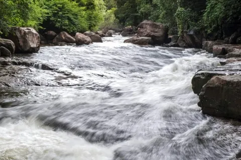
Tat Yai waterfall is at Ban Dong Ma Fai, Khok Mon subdistrict, between Nam Nao district and Phu Pha Man in Khon Kaen. It was voted number 1 in the north and number 2 nationally in the TAT Unseen New Chapters 2023 list. It has two levels: the first is a stepped rock slab about 20 m wide and about 100 m long, then a cliff drop of about 100 m ringed by forest. The rock is fine sediment laid down on the bed of an ancient freshwater lake, and the site is a geological heritage spot of the Khorat group. The fall looks best as a curtain of water in the rainy season, roughly May to August, but the access road is also at its most slippery then. If you would rather not drive on wet roads, go in the late rains, roughly September to October, when the water is still strong. The access road is rural, so ask your lodging or villagers before driving in.
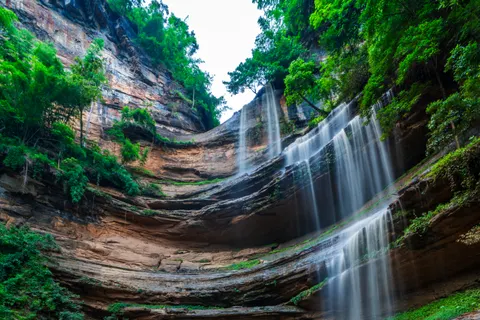
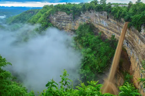
Nam Nao Canyon is at Khok Mon, by Wat Khok Mon about 10 km from Nam Nao town. It is a huge natural semicircular cliff covered with forest, with a gorge over 300 m deep, made of limestone, sandstone and shale that were lifted up by movements of the earth's crust. A lookout means you can see it without much walking, which suits people who do not want to hike. Tat Yai and the canyon are both in Khok Mon subdistrict, so you can combine them in one half-day. Go in the morning, when the light is better.
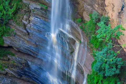
Loei Dan is a sandstone slab at Ban Huai Kapo, Lak Dan subdistrict, where gravel and sand carried by the Loei river have worn five types of potholes: round, oval, pillar, stone bridge and side-cut. April and May, when the water is low, show the rocks best. The dinosaur footprint site lies in a forest reserve next to Nam Nao National Park and needs a walk along a ridge or a four-wheel drive, so avoid it in the rains.
Khao Kho National Park and Thung Salaeng Luang
Khao Kho National Park is the 125th national park in Thailand, covering about 301,698 rai across Lom Kao, Lom Sak, Mueang Phetchabun and Khao Kho districts. The original forest was thick with kho palms, a palm-family tree. The park office is open about 08:30 to 16:30 every day, and the park has nature trails and camping spots. People often use its name for Khao Kho as a whole.
Wang Tum waterfall is at Ban Dong Long, Camp Son subdistrict, about 40 m high, and is used for rappelling, run by the Khao Kho Explorer group together with the local community. It runs on Saturdays and Sundays with 4 rounds a day, at about 08:00, 09:00, 13:00 and 14:00, for about 990 baht a person with a minimum of 4 people, including transfers and safety gear. Check the rounds and price before you go. Anyone not rappelling can sit and watch at the foot of the fall, and a big pool in front of it is a good spot to rest with the family.
Thung Salaeng Luang National Park spreads over Phitsanulok and Phetchabun and is a grassland with pine forest, with Sala Dusita, on the Phetchabun side, as a sunrise viewpoint. See Khao Kho and Thung Salaeng Luang.
 Mid-range
Krin Resort
Camp Son, Khao Kho district
A mid-range resort at Camp Son in Khao Kho district, a base for Wang Tum waterfall and the Khao Kho trails
See prices and availability on the booking page
More nature and farm stops around Nam Nao and Bueng Sam Phan
Beyond the main parks and waterfalls there are small stops that add flavour to a trip, especially if you stay in Lom Sak or Nam Nao for several nights.
- The dinosaur footprints lie in a forest reserve next to Nam Nao National Park: about 300 prints over roughly 120 m, with strides of 2 to 2.5 ft, thought to be from an archosaur about 230 million years old. Take Highway 2216 to between kilometres 19 and 20, turn beside the forest protection unit, go in about 3 km, fork left for about 2 km, then walk along the ridge for about 1 km. Use a four-wheel drive if you drive, and avoid the rains because the track is still rough.
- Suan Phu Phana at Nam Nao is a farm garden that grows many colours of anthurium and pineapple. The owner keeps breeding new varieties, and it suits anyone who likes ornamental plants.
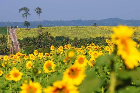
- The Bueng Sam Phan sunflower fields, in Bueng Sam Phan district, are a sea of yellow flowers. Check ahead for when they are in bloom.
- Rai Chanika at Bueng Sam Phan is another farm attraction close to the sunflower fields.
- Ban Khru hot spring and Phu Toei hot spring public park, at Wichian Buri, for a foot soak after a hard day.
 Budget
Lom Sak Nattirat Hotel
Lom Sak town, Khotchaseni Road
In Lom Sak town, a good base for Nam Nao, Tat Yai and Nam Nao Canyon
See prices and availability on the booking page
Plan your park and waterfall days
| Plan | Route | Time |
|---|---|---|
| Half day | Phetchabun town to Tat Mok, see the waterfalls and the town viewpoint, return before dark | About 4 to 5 hours with driving |
| 1 day | Lom Sak, stop at Than Thip, then Highway 12 to Nam Nao National Park for the pine woods and Tham Pha Hong | 7 to 9 hours |
| 2 days 1 night | Day one Nam Nao with a night in a tent, day two Nam Nao Canyon and Tat Yai, then back to Lom Sak | About 4 to 5 hours of driving in all |
Many parks have patchy mobile signal. Download offline maps and tell your lodging when you will be back. If you camp in winter, bring a sleeping bag rated for cold nights.
How to reach Phetchabun by bus, car and plane
Bangkok to Lom Sak on 12Go
From US$12 (As of 6 Nov 2026: buses from about US$12. Prices change by date)
Price as of 6 Nov 2026A Mo Chit to Lom Sak bus, with a morning 09:00 departure and a 20:00 overnight one, as a base for Nam Nao. From about US$12 as of 6 Nov 2026
Book on 12GoVisiting the parks and waterfalls without your own car
The park and waterfall sights sit well off the main roads, so they are harder to do by public transport alone than Khao Kho or Phu Thap Boek. For example, it is about 19 km from the Ban Chaliang Lap junction to the Tat Mok car park, and the Phu Kum Khao pine woods are another 14 km along a side road from Highway 12.
- The easiest way: stay in Phetchabun town or Lom Sak, then ask your lodging to find a driver or a van with driver for the day. Agree the price, the departure time and the stops before you set out.
- If you are one or two people, pick one target a day, such as Tat Mok as a half-day from town, or Than Thip and Nam Nao Canyon on another day, instead of cramming several sights into one.
- If you plan to camp in Nam Nao, ask the park office about public buses that stop at the park entrance and the times of the return bus, and allow time to walk from the main road to the headquarters.
- If you want everything in one car, look at the private car options from Bangkok on the deals and tours page and at how to arrive in getting to Phetchabun.
Phitsanulok to Phetchabun on 12Go
From US$13 (As of 6 Nov 2026: buses from about US$13. Prices change by date)
Price as of 6 Nov 2026A bus from Phitsanulok to Phetchabun, about 2 hours 40 minutes, which puts you in town to go on to Tat Mok or Nam Nao. From about US$13 as of 6 Nov 2026
Book on 12GoCamping in the park: what to prepare
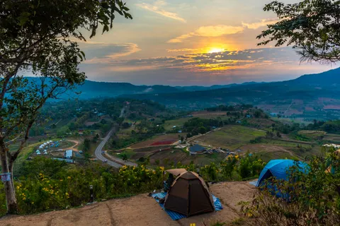
Camping is the most atmospheric way to see Nam Nao, because dawn brings mist in the pine woods and cool air. Pitching a tent in the park costs about 30 baht a person a night, and there are about 15 park houses near the headquarters. Check prices and book through the national parks system before you go.
- A windproof, rainproof tent, a sleeping bag rated for cold nights, a sleeping mat and a warm jacket.
- A torch and spare batteries, because the forest is very dark at night.
- Drinking water and food kept in a sealed box. Do not leave rubbish beside the tent.
- A small stove and a fire pit only where the park allows it. No fires outside the marked spots.
- If you do not have a tent, ask the park office whether you can rent one or stay in a park house.
Bangkok to Lom Sak on 12Go
From US$12 (As of 6 Nov 2026: buses from about US$12. Prices change by date)
Price as of 6 Nov 2026A bus from Mo Chit to Lom Sak, where you change for the way to Nam Nao National Park, with departures at 09:00 and 20:00. From about US$12 as of 6 Nov 2026
Book on 12GoParks and waterfalls by month: what you see when
| Month | Waterfalls and parks | Good to know |
|---|---|---|
| June to August | Waterfalls at their fullest and the forest green. Tat Yai is a curtain of water | Rock and paths are slippery and flash floods are a risk, so do not swim |
| September to October | Water is still high and the rains are fading, with the air starting to cool | Good for Tat Mok and Tat Yai. Check the trails first |
| November to February | Cold, with beautiful pine woods, and the best time to camp at Nam Nao. Forest along Highway 12 between kilometres 63 and 70 changes colour around December and January | Crowded on long holiday weekends, and park accommodation must be booked |
| March to May | Waterfalls are low, but the Loei Dan slab shows clearly | Hot, with some smoke haze |
Families, older visitors and rainy days
Many parks and waterfalls need a walk or a drive on slippery roads. With small children or older people, choose stops where you park and walk only a short way, and add harder ones if everyone is fit.
- Little walking, great views: Nam Nao Canyon (a lookout a short walk from the car park), Phu Kho viewpoint beside Highway 12, and the viewpoint over Phetchabun town at the Tat Mok park office.
- Shady and easy: Than Thip waterfall, where a stream and rock rapids give you a riverside walk. It makes a good half-hour to hour stop on the way up Khao Kho or Phu Thap Boek.
- Swimming: the pool below Hew Sai waterfall can be used for a dip when the water is not strong and the sky is clear. Check the water first every time, and never leave a child alone in it.
- Better skipped with older visitors or small children: the 259 steps up to the Tham Pha Hong viewpoint, the multi-level climb at Song Nang waterfall, the Phu Pha Chit trail and the dinosaur footprints.
- Rainy days: do not swim at waterfalls or walk on rock slabs like Loei Dan. Switch to town and temple stops on the Si Thep and Phetchabun town page, and come back to the falls when the sky clears.
Getting ready and staying safe in the parks
National parks are real forest, not city parks. Prepare for the season and do not take risks with trail or river conditions.
- Rainy season: rock slabs and riverside paths are slippery and flash floods rise fast. Do not swim when the sky is dark or after heavy rain upstream, and follow closure signs.
- Winter: dawn and night are very cold. Bring jackets, gloves, a hat and a cold-rated sleeping bag, and keep food out of tents near the forest.
- Dry season: strong sun and low water at some falls, but the best time for rock slabs such as Loei Dan. Carry at least 1.5 litres of water a person.
- Wildlife: the parks hold large animals. Stay on trails, do not feed anything and carry your rubbish out.
- Communications: signal is weak or absent in places. Use offline maps and tell someone when you will be back.
If you are not sure about a trail or the road, phone the park office the day before. Rangers can tell you which trails are closed, whether a waterfall has water, and if campsites are free.
Common mistakes when visiting the parks and waterfalls
- Cramming several sights into one day. Tat Mok, Nam Nao and Tat Yai lie in different directions and the driving takes longer than you expect, so pick one direction a day.
- Going to Nam Nao on a long winter weekend without booking lodging or a tent pitch. The headquarters is crowded and park accommodation has to be booked ahead.
- Trusting a phone map alone on the way to Tat Yai or the dinosaur footprints. Rural roads and rough tracks change with the season, so ask your lodging or villagers first.
- Visiting Tat Mok in the dry season and expecting full spray. The falls look best from the end of the rains to early winter.
- Going into the big cave without a ranger and lights.
- Driving Highway 12 after dark without care. Wild elephants may cross the road in the evening and at night.
- Reaching the Tat Mok office near closing time, about 16:30, with no time to walk to the falls. Arrive by late morning.
- Wearing flip-flops on rock slabs or beside waterfalls. Use shoes that grip on wet ground.
Frequently asked questions
How cold does Nam Nao National Park get?
December and January are coldest, with nights of about 2 to 5 degrees at times. Bring warm clothes, a cold-rated sleeping bag or blankets if camping.
What is the entry fee for Nam Nao?
Roughly 20 to 40 baht for Thai adults and roughly 200 to 400 baht for foreign adults at the gate rate, with children half price. Camping is about 30 baht a person a night. Tat Mok has lower rates, about 100 baht for a foreign adult. Check before you go.
How far is Tat Mok from Phetchabun town?
About 37 km to the east. You can do it in half a day, with Tat Mok and Song Nang waterfalls and a viewpoint over the town from the park office.
When is the best time for waterfalls?
End of the rains to early winter, roughly September to December, for full water and green forest. From March to May water is low, though sandstone slabs such as Loei Dan show best.
Is Nam Nao Canyon a long walk?
No. A lookout lets you stop and look with a short walk. It is at Khok Mon by Wat Khok Mon, about 10 km from Nam Nao town.
Can I reach Nam Nao National Park by public transport?
On some routes. Buses running between Lom Sak, Chum Phae and Khon Kaen use Highway 12, but sights inside the park are far apart, so a car or a hired vehicle from Lom Sak is more practical.
Can I go into Tham Yai Nam Nao on my own?
No. It needs a ranger guide and proper lights. The part open to walk is about 400 m and takes about an hour, and the cave beyond that is not set up for visitors. Contact the park unit or the park office first.
Is Than Thip waterfall free to enter?
It is a forest park, and the staff can tell you the current fee and hours, so check before you go. In the rains watch for slippery ground.
Is Tat Yai waterfall suitable for children?
Take care. The access road is rural and the cliff is steep, so take children only on clear days, keep them close and check the road first.
Is it safe to drive Highway 12 through Nam Nao in the evening?
Avoid it if you can. Wild elephants may cross the road in the evening and at night, and the stretch through the forest is winding and dark. If you must drive, go slowly, do not get out to photograph elephants and plan to reach your lodging before dark.
Keep planning
 Plan your Phetchabun tripKhao Kho, Phu Thap Boek, Si Thep, national parks, plans, stays and transport
 Phetchabun in 1 to 3 daysPlans for Khao Kho, Si Thep and Phu Thap Boek, with and without a car
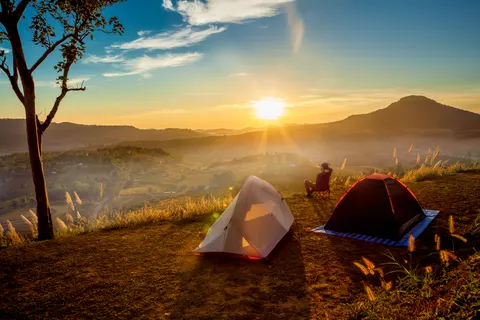 Khao KhoSea of mist, wind farm, Pha Son Kaew temple, the palace and waterfalls
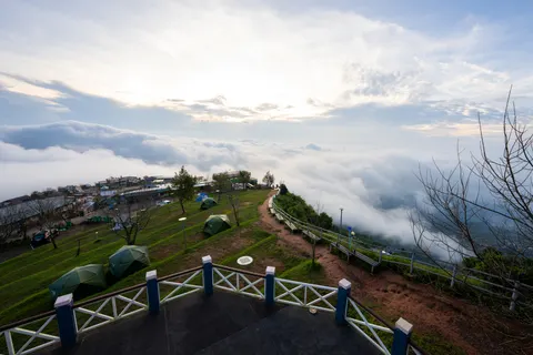 Phu Thap BoekSea of mist, cabbage fields, the road up, lodging and tents
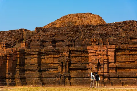 Si Thep and townWorld Heritage park, fees, Phetbura Buddha Park, Lom Sak, Wichian Buri
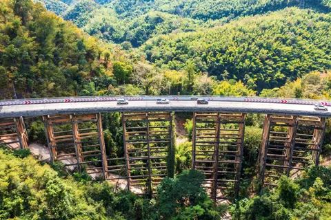 Getting to PhetchabunBuses, private cars, driving and flying to Phitsanulok
 Where to stay in PhetchabunKhao Kho, Phu Thap Boek, Lom Sak, town and Si Thep
 What to book for PhetchabunChartered tours, car hire, bus tickets and hotels