
Most visitors treat Nong Khai as a place to pass through on the way to Laos. The riverside road west of town, Route 211, is the side of the province that gets less attention. It branches off Highway 2 within Mueang Nong Khai district, follows the Mekong west through Tha Bo, Si Chiang Mai and Sangkhom, then carries on into Pak Chom and Chiang Khan in Loei province. The whole road is about 184 km. The part worth a trip from Nong Khai is the stretch to Sangkhom: temples on the river, a glass skywalk on a cliff, waterfalls in the forest and a morning sea of mist.
This page lists the stops in the order you drive past them, with approximate distances from Nong Khai town, opening times, fees, the best season for each, a realistic day plan and a two-day option with a night in Sangkhom. Information is as of 6 Nov 2026. Times and distances marked "about" should be checked before you go. For the town itself see Nong Khai town and the riverside and the one-day and two-day plans.
We earn a commission if you book through our links. The price you pay does not change. How we choose
Read this table first: distances from Nong Khai town and time needed
| Stop | Distance from Nong Khai town | Approx. opening hours | Fee | Time at the stop |
|---|---|---|---|---|
| Krayo rice-sheet village, Tha Bo | About 31 km | No set hours; mornings are when sheets are made | No entry fee | 20 to 40 minutes |
| Wat Hin Mak Peng, Si Chiang Mai | About 65 to 75 km | About 06:00 to 18:00 daily | Free | 45 to 60 minutes |
| Wang Nam Mok waterfall, Si Chiang Mai | About 7 to 8 km off the main road near Wat Hin Mak Peng | About 08:00 to 16:00; check | Free | About 1 hour; rainy season only |
| Wat Pha Tak Suea and skywalk | About 80 to 90 km | About 09:00 to 17:00; check | Free | 1.5 to 2 hours |
| Than Thong waterfall | About 80 to 90 km (about 6 km from Wat Pha Tak Suea) | About 08:30 to 16:30 daily | Free | 45 to 90 minutes |
| Sangkhom town (lunch) | About 90 to 100 km | Restaurants keep their own hours | Pay for food | 45 to 60 minutes |
| Than Thip waterfall | About 100 to 110 km (about 13 km west of Sangkhom town) | About 06:00 to 18:00; check | Free | 1 to 1.5 hours |
| Phu Huai Isan (sea of mist) | About 100 to 120 km (Ban Muang) | Pickups leave before 05:00, November to February only | Village pickup truck 80 baht | Early morning |
| Phu Pha Dak | About 100 to 120 km (Ban Muang) | 05:00 to 09:00 daily, local guide required | Guide 500 baht per group of up to 10 | Early morning |
| Phan Khot Saen Krai (boat) | About 100 to 120 km (Ban Muang) | By phone arrangement | Boat 400 baht per boat, up to 5 people | About 1 hour |
The distances are given as ranges because kilometre signs and side-road turnoffs differ from place to place. Pin each name on a phone map before you set out, and download an offline map for the stretches with weak signal. In short: if you only want Wat Hin Mak Peng and Wat Pha Tak Suea, allow about 1.5 to 2 hours each way and about 3 to 4 hours of stops. The sea of mist, Phan Khot and Than Thip suit people who stay the night in Sangkhom.
Fees and hours above reflect late 2026. Temples and community sites can change hours on major Buddhist days, at festivals or after heavy rain. For the skywalk or Phu Pha Dak, phone before you leave Nong Khai; the numbers are in each section.
What Route 211 is like and which districts it passes
Leaving Nong Khai town westward, Route 211 splits from Highway 2 and keeps beside the Mekong. The districts come in this order: Tha Bo, Si Chiang Mai and Sangkhom, which is the westernmost district of Nong Khai province, and after it Pak Chom and Chiang Khan in Loei. Followed to the end the road is about 184 km, but this page covers Nong Khai to Sangkhom.
The first stretch, from about km 11.5 to km 24.6, was widened to four lanes with a median at the end of 2019, so it is fast and easy. After that the road returns to two lanes with a good surface and light traffic, running between river views, villages and fields. The main road is simple to follow, but the turnoffs to many sights, above all the Wat Pha Tak Suea skywalk and some waterfalls, have few or small signs. Keep a navigation app running.
| Total length | About 184 km, from Nong Khai town to Chiang Khan in Loei |
|---|---|
| Nong Khai to Sangkhom | About 90 to 100 km; 1.5 to 2 hours of driving without stops |
| Surface | Sealed and in good condition with light traffic; some village side roads are narrow or unsealed |
| Road help hotline | Department of Highways, tel. 1586, 24 hours |
| Fuel and cash | Fill the tank and take cash in Nong Khai or Si Chiang Mai before the Sangkhom stretch; community vendors mostly take cash |
Tha Bo: the krayo village, where rice-flour sheets dry on bamboo racks
The first stop that few guides mention is about 31 km from Nong Khai town in Tha Bo district. It is a village of Thai-Vietnamese households that make krayo, thin dried rice-flour sheets used to wrap spring rolls and nem nuong. The batter is spread over cloth stretched across a steaming pot, peeled off by hand once set, and dried in the sun on bamboo racks. The village surrounds a temple. The turnoff is near km 31 on Route 211, then about 1 km down a signed side road.
There is no ticket booth, no fixed opening hours and no cafe or public toilet. Mornings before about 09:00 are when the racks are fullest and the work is easiest to see. If you want to buy sheets, buy from the households with cash; krayo keeps poorly out of the fridge, so bring a cool bag for a long trip home. Pin the village on a phone map, and ask for the krayo village (the rice-sheet village) in Tha Bo if you need directions.
These are working homes, so do not step into kitchens or photograph close-up without asking. Buying a pack is the easiest way to be welcome. Twenty to forty minutes is enough.
Close by: Wat Sri Chomphu Ong Tue
At the same km 31, turn left and drive about 1 km to Wat Sri Chomphu Ong Tue in Ban Nam Mong. It houses Luang Pho Phra Chao Ong Tue, a large cast-gold Buddha with a lap width of about 3.29 m, a height of about 4 m and a weight of about 12,000 kg, with an inscription dated 1562. Open daily about 08:30 to 16:30; check before you go. Skip it if time is short.
Si Chiang Mai and Ban Wang Nam Mok: riverbank with Vientiane across the water
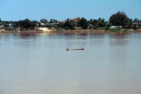
Si Chiang Mai is a Mekong district directly opposite Vientiane, with an area of about 198 sq km. It became a district in 1958 when it was split from Tha Bo. By tradition the town was founded in the time of King Setthathirath of Lan Xang and named after Chiang Mai, the home of his grandmother. From the roadside you see the wide brown river and vegetable plots on the bank, with the Lao shore a thin line beyond. The district is known for spring-roll wrappers like those mentioned above. To watch them being made, visit the Tha Bo village described earlier.
The stop worth making is Ban Wang Nam Mok in Phra Phutthabat subdistrict, a community tourism village that blends Lanna and Lan Xang heritage. It offers homestays, handmade lantern craft, a baisi blessing ceremony and a community meal. The coordination centre can be reached on 08 3357 7035 or 08 6232 5300. The village welcomes visitors about 11:00 to 17:00 daily; check before you go. It suits a late-morning or afternoon stop rather than dawn. In the rainy season the Wang Nam Mok waterfall, about 30 m high, is about 7 to 8 km off the main road near Wat Hin Mak Peng. It is open about 08:00 to 16:00 (check before you go), with no entry fee, though homestays, meals and guides are charged separately. It is best from June to October, and a car or hired van is the practical way to reach it.
If your time is limited and you are not staying in Si Chiang Mai, skip Wang Nam Mok and save the time for Wat Pha Tak Suea and Sangkhom, which are the core of the trip.
Wat Hin Mak Peng: a forest temple on the Mekong and the three stones that named it
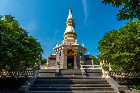
Wat Hin Mak Peng is in Ban Thai Charoen, Phra Phutthabat subdistrict, Si Chiang Mai, about 65 to 75 km from Nong Khai town and about 7 km before Si Chiang Mai town. On the highway it is on the right near km 64 as you head west. The name comes from three stones lined up in the Mekong in front of the temple, shaped like old gold-weighing weights. Locals call them "peng" or "peng yoi", and "mak" is the Isan word for fruit-like things.
The temple was set up as a meditation place for monks, nuns and lay pilgrims by Luang Pu Thet Thesarangsi, a student of Ajahn Sao and Ajahn Mun. It is quiet and shaded, with one side on the Mekong. Inside the grounds are a mondop for Luang Pu Thet, a pagoda used as a relic museum and a wax-figure pavilion, plus a glass skywalk over the river with a view of temples on the Lao side. The temple and skywalk are open about 06:00 to 18:00 daily, with staff at the skywalk, and entry is free; check the hours before you go.
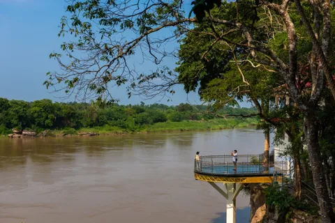
It is a working monastery. Cover your shoulders and knees, keep your voice low and stay out of the monks' living quarters. Early morning, when mist lies on the river and the monks are most active, is the best hour, so if you want that light, sleep near Si Chiang Mai or start very early.
Nearby is Wat Aranyabanphot, where the Phra Suttham Chedi houses relics of Luang Pu Rian Worralapho, who died on 5 June 2005. Add it if you are interested in the forest tradition; check opening times before you go.
Wat Pha Tak Suea and its glass skywalk: the stop most people drive out for
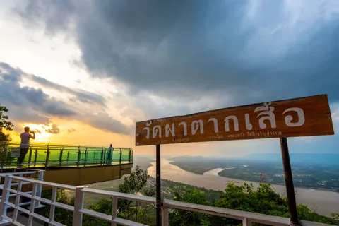
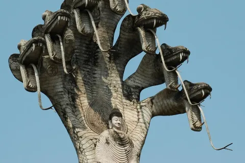
Wat Pha Tak Suea is in Pha Tang subdistrict, Sangkhom district, on Phu Phan Noi, about 80 to 90 km from Nong Khai town and 1.5 to 2 hours by car. The draw is a cliff with the winding Mekong far below. The monk Phra Ajahn Somdet, a student of Luang Pu Rian, climbed the peak to meditate (accounts speak of climbing by rope and vine), and devotees later built a way up. Today there is an ordination hall, a naga staircase, and the skywalk is the main attraction.
What the skywalk is like
The skywalk is a glass-floored walkway reaching out from the cliff. The glass is clear tempered laminated glass 4 cm thick, on a steel frame with glass side barriers, and it takes about 2,500 kg or about 20 people at a time. The glass floor is roughly 15 m long; this figure and how far it projects are approximate. There is no entry fee and no ticket booth, though a small donation for upkeep may be asked, so carry small cash. It opens about 09:00 to 17:00 daily; check before you go. Aim to arrive between 09:00 and 16:00. The local administration's number is 0 4241 4855.

Before stepping out, take off your shoes or put on the covers the temple provides. Do not carry anything that could drop, do not jump, do not tap the glass with hard objects, do not climb the rails and keep children close. The skywalk may close in a storm. Some stone steps on the way up have no handrail, so wear non-slip shoes. Dress modestly because it is a temple: shoulders and knees covered.
The best time is a weekday morning soon after it opens; weekends and holidays bring a queue for the skywalk, and the midday sun in the hot season is fierce. From November to February you may catch morning mist. Allow about 1.5 to 2 hours in total for the stairs, the view and the queue. Parking is on a paved road at the top, and the access road has steep bends that need care in rain. No public transport reaches the temple, so you need your own car, a motorbike, a hired driver or a day tour.
The cliff is high and steep. Always stay behind the barriers, even if a better photo angle tempts you.
Sangkhom: the westernmost district of Nong Khai, a lunch stop and a place to sleep
Sangkhom covers about 450 sq km and borders Si Chiang Mai, Pho Tak, Na Yung in Udon Thani and Pak Chom in Loei. The district office is in Kaeng Kai subdistrict, and the five subdistricts are Kaeng Kai, Pha Tang, Ban Muang, Na Ngio and Sangkhom. It is often called the district with the most sights in the province.
Sangkhom town is about 90 to 100 km from Nong Khai, 1.5 to 2 hours without stops. It is a small Mekong town, good for lunch and a rest before waterfalls or sunrise viewpoints. Near Nong Pla Buek there are roadside restaurants for lunch; check the restaurant and its hours first.
Wat Tham Si Mongkhon (the naga cave)
If you like caves, Wat Tham Si Mongkhon at Ban Dong Tong, Pha Tang, is an earth cave that locals call the naga cave. At the front are naga shrines where visitors ask pardon before entering. Inside it is damp, with flowing water and upright stone pillars. It opens about 08:00 to 16:00; check before you go. Signs are few, so keep a map open. Wear shoes that can get wet. It is for travellers with time to spare, not essential on a first trip.
Than Thong and Than Thip waterfalls: when to go and what to prepare
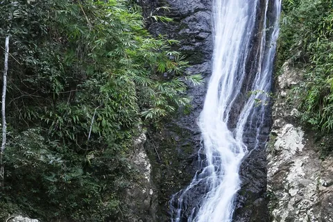
The waterfalls near Sangkhom are rainy-season falls, not places that look good in any month. The two easiest to visit are Than Thong and Than Thip, and neither charges an entry fee.
Than Thong
Than Thong lies in the Than Thong arboretum in Pha Tang, about 6 km from Wat Pha Tak Suea, so the two combine easily in one morning. The stream flows down rock slabs in steps over about 2 km, with a few pools for splashing, and a final drop of about 30 m before it reaches the Mekong. The forest is a mix of dry evergreen and mixed deciduous. The recommended season is June to October, and in some years there is still water into November, depending on rain. It is open about 08:30 to 16:30 daily, with restaurants and shops at the entrance. Weekends are crowded. Ask at the gate whether outside food is allowed, and follow a navigation app to the turnoff from Route 211.
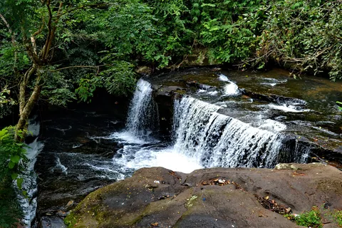
Than Thip
Than Thip is at Ban Muang, about 13 km west of Sangkhom town. It has several tiers: the car park is about 100 m from the lower pools. The second tier is reached by climbing a path and is where most people swim, and the upper tier needs permission from staff. The water is cool for most of the year and strongest from June to November. From February to May it is thinner, but the pools at the base can still be used. Wear non-slip shoes, and note that weekdays are quieter. It is open about 06:00 to 18:00; check before you go, and to be sure plan to arrive between 08:30 and 16:30. Phone 0 4241 4872.
If a local mentions another waterfall in this area, ask about the route, safety and whether it is open to visitors first. Never walk up a stream after heavy rain.
Ban Muang: Phu Huai Isan, Phu Pha Dak and the morning sea of mist
Ban Muang is a subdistrict in the west of Sangkhom, and it is where people stay to see the sea of mist. Getting up in the dark is the reason to sleep in Sangkhom rather than drive out from Nong Khai the same morning.
Phu Huai Isan
Phu Huai Isan is a small hill with views over Sangkhom villages and the islands in the Mekong, with sunrise and mist. The sunrise ride runs only from November to February each year. It is not advised in the rainy season because the track is steep and muddy. Private cars cannot go up: you take a village pickup truck (ee-taek) from Wat Kaeo Set Chai Mongkhon. The fare is 80 baht, be at the pickup point before 05:00, and the ride up takes about 45 minutes. Phone 09 6068 2362.
Phu Pha Dak
Phu Pha Dak is for those who like a little adventure: a walk of about 800 m taking 45 minutes to 1 hour, with a view of about 180 degrees and sea of mist at sunrise, especially in the late rainy season and the cool season. A local guide is required. It is open daily 05:00 to 09:00, and the guide fee is 500 baht per group of up to 10 people. Enquire at the Ban Muang subdistrict office on 0 4241 4871.
With only one morning, choose one. Phu Huai Isan suits anyone who does not want to walk and who comes between November and February. Phu Pha Dak suits those who want to walk and have a group to share the guide fee. Mist does not appear every morning, and nobody can promise it in advance.
Phan Khot Saen Krai: a boat among the rocks of the Mekong

Phan Khot Saen Krai, also called the Nong Khai Grand Canyon, is in Ban Muang. It is a stretch of the Mekong more than 5 km long where, in the dry season, the river level drops and rock outcrops covered in kri, a river-willow shrub, emerge by the thousand. You reach them by boat: up to 5 people per boat, about 1 hour, 400 baht per boat. A sunset viewpoint is out in the middle of the river. Contact 08 1061 0536.
The key point is that the rocks show when the Mekong is low in the dry season, roughly December to May; ask by phone which weeks are best. In the rainy season, roughly June to November, the rocks are often covered or only partly visible, so do not plan a trip around Phan Khot then. If you combine mist and rocks, the cool months early in the year are the only time the two nearly overlap.
When to go: waterfalls in the rains, mist in the cool season
| Period | What is worth the drive | Watch out for |
|---|---|---|
| June to October (rainy season) | Full Than Thong and Than Thip, green forest, mist at Phu Pha Dak late in the season | Slippery access roads, Phu Huai Isan not advised, Phan Khot rocks under water |
| November to February (cool season) | Sea of mist at Phu Huai Isan and Phu Pha Dak, skywalk in the morning, cool and pleasant driving | Very cold before dawn so bring a layer; falls start to thin by late November |
| March to May (hot season) | Phan Khot Saen Krai with the rocks exposed, empty roads | Strong heat at the skywalk and stone steps; thin falls, though the lower pools at Than Thip still work |
In one line: for waterfalls go from June to October, for sea of mist go from November to February. The two seldom overlap in the same year. The skywalk and Wat Hin Mak Peng work all year, and mornings and evenings beat afternoons in the hot season. River levels change through the year, so if you book a riverside room, ask the hotel about the water level for your dates.
A day trip from Nong Khai: a timetable that works
A round trip in a day is possible by car, but it is a long day: about 180 to 200 km in total (about; check on a map before you go) and roughly 3 to 4 hours of driving alone. This schedule allows for photo stops and lunch.
- 07:00 Leave Nong Khai town after filling the tank and getting cash.
- 07:40 Optional stop at the krayo village in Tha Bo (about 30 minutes; best before 09:00).
- 08:30 to 09:30 Wat Hin Mak Peng, about 1 hour, modest dress.
- 10:30 to 11:30 Wat Tham Si Mongkhon or Than Thong waterfall (Than Thong from June to October only), 30 to 60 minutes.
- 11:30 to 13:30 Wat Pha Tak Suea and the skywalk, about 1.5 to 2 hours, then lunch by the river in Sangkhom.
- 14:00 to 16:00 Than Thip (June to November), or the Phan Khot boat in the dry season, or a Mekong viewpoint.
- 16:00 Start back, reaching Nong Khai about 17:30 to 18:00, in time for dinner in town.
If you need to cut, drop in this order: Wat Aranyabanphot, the krayo village and Wat Sri Chomphu Ong Tue, Wang Nam Mok waterfall, then caves with few signs. The best value for your time is Wat Pha Tak Suea, Wat Hin Mak Peng and the drive itself, followed by Than Thong or Than Thip in the rains and the Phu Huai Isan sea of mist in the cool season.
One night in Sangkhom: the relaxed option, with the sea of mist
If you are driving and want an unhurried trip, split it over two days. On day one drive slowly along the river, stopping at the krayo village, Wat Hin Mak Peng and Wat Pha Tak Suea, have lunch in Sangkhom, visit a waterfall or take a boat in the afternoon and check in before dark. You see sunset on the Mekong without driving back in the dusk.
- Day 1: 08:00 leave Nong Khai; krayo village; Wat Hin Mak Peng; Wat Pha Tak Suea skywalk; lunch in Sangkhom; Than Thong or Than Thip in the rains; check in late afternoon.
- Day 2 (November to February): be at the pickup point before 05:00, ride up Phu Huai Isan for the sea of mist, return for breakfast, check out and drive back to Nong Khai between about 10:00 and noon.
- Day 2 (dry season): take the Phan Khot Saen Krai boat for about 1 hour, then drive back, or carry on to Chiang Khan if you are continuing into Loei.
If you do not drive, a hired car with a driver for the whole trip also works as two days and one night. Agree the route, waiting time and price clearly before you leave.
How to reach Sangkhom: drive, hire a car, or join a tour
Do not plan on a public bus to Sangkhom. No public transport reaches Wat Pha Tak Suea or the krayo village either. Most visitors use one of these four options.
- Drive yourself or hire a carMost flexible
You can stop anywhere and shelter from rain. Cars can be hired at Udon Thani airport, about 50 km from Nong Khai, or ask rental shops in Nong Khai town. Check insurance and the deposit before you collect the car.
- Hire a motorbikeAbout 200 baht a day
Guesthouses and rental shops in Nong Khai town rent them, usually asking for a copy of your passport. Check the price and the bike's condition. A helmet is a must. The 90 to 100 km to Sangkhom takes about 2 hours with photo stops, so doing it over two days is less tiring.
- A taxi or van with a driverConvenient for small groups
Ask your hotel or a local van operator in Nong Khai. Agree route, waiting time and the all-in price before you go, because rates differ from one operator to the next.
- A day tourCheck with the operator
Some local van companies run day trips to Wat Pha Tak Suea. Prices and timings differ, so ask for details before you decide.
If you are starting in Bangkok, get to Nong Khai first and arrange transport to Sangkhom for the next day. See getting to Nong Khai for details. For tickets between Bangkok and Nong Khai:
Bangkok to Nong Khai on 12Go
From US$7 (Lowest fare as of 6 Nov 2026)
Price as of 6 Nov 2026Sample listing for 13 Nov 2026, as of 6 Nov 2026: trains from Krung Thep Aphiwat Central Terminal and buses from Mo Chit. The lowest fare is a 3rd class fan seat. The 2nd class air-con sleeper on train 25 is about $38 and buses start at about $15. Prices change by date and train.
Bangkok to Nong KhaiSleeping in Sangkhom: pick the area by what you want to see

The Mekong around Sangkhom has homestays, riverside stays, resorts and camping grounds. The easiest way to choose is by what you plan to see the next morning. For the Wat Pha Tak Suea skywalk and Than Thong, stay around Pha Tang. For Phu Huai Isan or Phu Pha Dak at dawn, stay around Ban Muang. If you just want a quiet riverside night, Sangkhom town is handy for food. If you base yourself in Nong Khai town and make a day trip, see all the options on where to stay in Nong Khai.
 Mid-range
Sand & River Hotel
Pha Tang, Sangkhom, on the Mekong
In Pha Tang subdistrict on the Mekong, the same subdistrict as Wat Pha Tak Suea and Than Thong, so it suits a skywalk visit early, before the crowds. Check room photos and the map location before booking.
See prices and availability on the booking page
Forest Park Resort Sangkhom
Sangkhom-Pak Chom Road, Sangkhom
On the Sangkhom to Pak Chom road, the direction that continues to Chiang Khan and Loei, so it suits a drive that carries on west. Check the distance to Ban Muang on a map before booking.
See prices and availability on the booking page
Room prices, availability and reviews change daily, so check the live price with the buttons above. The Mekong level changes with the season, so ask a riverside property about the water level before you book. The community homestays at Ban Wang Nam Mok in Si Chiang Mai are another option; contact the coordination centre in advance.
What to bring
- Clothes that cover shoulders and knees for Wat Hin Mak Peng, Wat Pha Tak Suea and Wat Tham Si Mongkhon.
- Non-slip shoes for stone steps, waterfall paths and the skywalk, and clean socks for when your shoes come off.
- Small cash: 80 baht for the Phu Huai Isan pickup, 500 baht per group for the Phu Pha Dak guide, 400 baht per boat at Phan Khot, roadside food and donations.
- An offline map, because some junctions have weak signal and few signs.
- Drinking water, a hat, sunscreen and insect repellent, especially in the rains and near waterfalls.
- A warm layer and a torch (or phone light) for the pre-dawn mist trips.
- A small towel and a change of clothes if you plan to swim at a waterfall, and a waterproof pouch for your phone.
- A cool bag if you intend to buy krayo sheets to take home.
Driving the Mekong road safely
- The main road surface is good and traffic is light, but there are bends and steep climbs. Slow down in the rains.
- Village side roads around Si Chiang Mai and Pho Tak can be narrow, partly unsealed and poorly signed. Use a map app and ask locals when unsure.
- Wear a helmet on a motorbike every time, even if you see others without one. Aim to reach your lodging before dark, as the road is dark in many places once the sun sets.
- At the cliff and the skywalk, stay behind the railings, respect the limit per turn, do not jump and keep children close.
- Do not swim or wade in a waterfall after heavy rain or if the water changes colour. Wet rock is slipperier than it looks.
- For road help call the Department of Highways on 1586, 24 hours.
- Fill the tank and take cash in Nong Khai or Si Chiang Mai first; do not count on an ATM or fuel pump in every village.
Frequently asked questions
How far is Sangkhom from Nong Khai and how long does it take?
About 90 to 100 km, roughly 1.5 to 2 hours of driving without stops, along Route 211 beside the Mekong. A round trip that includes Wat Hin Mak Peng, Wat Pha Tak Suea and one waterfall comes to about 180 to 200 km. Check distances on a map before you go.
Can I see Wat Hin Mak Peng and Wat Pha Tak Suea in one day?
Yes. Both are on Route 211. Wat Hin Mak Peng comes first at about 65 to 75 km and Wat Pha Tak Suea is further at about 80 to 90 km. Allow about 3 to 4 hours at the stops in total. Leaving Nong Khai at about 07:00 lets you see both and be back before dark.
Is the Wat Pha Tak Suea skywalk free, and when is it open?
Entry is free and there is no ticket booth, though a small donation may be asked, so carry small cash. Hours are about 09:00 to 17:00 daily; check before you go. Weekday mornings are best because weekends have a queue, and the skywalk may close in a storm.
What should I wear to the temples and the skywalk?
Cover your shoulders and knees, and wear non-slip shoes for the stone steps. On the skywalk you take your shoes off or wear the covers provided, and you must not carry anything that could fall.
Is there a bus from Nong Khai to Sangkhom?
Do not count on a public bus or songthaew, and no public transport reaches Wat Pha Tak Suea. Most visitors drive, hire a car or motorbike, hire a car with a driver, or join a day van tour. Ask your hotel or the Nong Khai bus terminal about current local services.
When are the waterfalls near Sangkhom best?
Than Thong and Than Thip run fullest from about June to October, and Than Thip often still has water into November. From February to May the flow is thinner. Both are free to enter.
When can I see the sea of mist at Sangkhom?
Phu Huai Isan runs its sunrise ride only from November to February, by village pickup truck at 80 baht, and you should be at the pickup point before 05:00. Phu Pha Dak has mist in the late rainy season and the cool season, open 05:00 to 09:00 with a guide at 500 baht per group of up to 10. Mist does not appear every morning.
What is Phan Khot Saen Krai and when can I see it?
A stretch of the Mekong where rocks with shrubs emerge when the river is low in the dry season, about December to May. You go by boat, up to 5 people per boat, about 1 hour, 400 baht per boat. In the rains the rocks are often covered. Phone 08 1061 0536 before you go.
Can I rent a motorbike in Nong Khai and ride to Sangkhom?
Yes. Rates are about 200 baht a day, usually with a copy of your passport; check the price first. The ride of about 90 to 100 km is manageable if you split it over two days. Wear a helmet and fill up in Nong Khai or Si Chiang Mai.
Where is the rice-sheet village in Tha Bo and when should I go?
About 31 km from Nong Khai town. Turn off Route 211 near km 31 and drive about 1 km. Go in the morning before about 09:00 when the sheets are drying. There is no entry fee; buy sheets from the households with cash.
Where the facts come from
- Wat Pha Tak Suea, Sangkhom, Nong Khai (Thai Holiday Guide)
- Wat Hin Mak Peng, Si Chiang Mai (Thai Holiday Guide)
- Than Thip waterfall, Sangkhom (Thai Holiday Guide)
- Krayo pastry-making village, Tha Bo (Thai Holiday Guide)
- Than Thong waterfall, Sangkhom (TrueID Travel)
- Route 211 from Nong Khai to Chiang Khan (Kapook Travel)
- Sangkhom district (Wikipedia)
- Nong Khai (Wikivoyage)
Keep planning
 Plan Nong KhaiSala Kaeo Ku, the Mekong, the road to Sangkhom, naga fireballs, Vientiane
 Nong Khai in 1 day or 2 days 1 nightTimed town plan, the Mekong road to Sangkhom, adding a Vientiane day
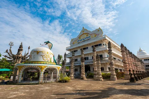 Nong Khai town and riversideSala Kaeo Ku, Wat Pho Chai, Tha Sadet, the promenade, the river stupa, food
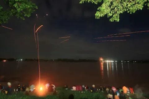 Naga fireballs and Phra That Bang PhuanOk Phansa night, where to watch, what to bring, Phra That Bang Phuan
 Crossing to Laos from Nong KhaiFriendship Bridge, train, bus, visas, what to bring, on to Vientiane
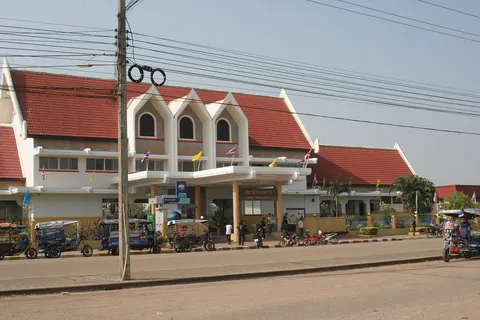 Getting to Nong KhaiTrain, bus, flight to Udon Thani then road, getting around town
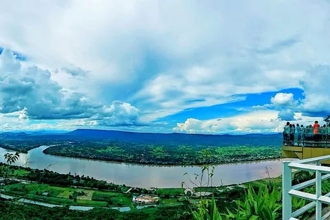 Where to stay in Nong KhaiRiverside, centre, Hat Kham, Sangkhom, Phon Phisai
 Nong Khai dealsTrain, bus and flight tickets, transfers, Vientiane tour