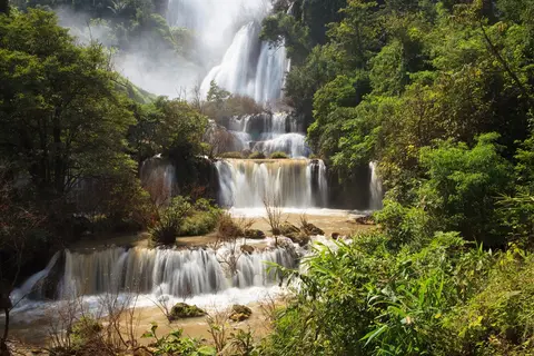
Umphang is the southernmost district of Tak province, on the Myanmar border, and its only road out is Highway 1090 to Mae Sot. People come for three things that rarely sit together: a mountain road famous for its 1,000-plus curves, Thi Lo Su, billed as Thailand's largest waterfall, and the Mae Klong river, where inflatable rafts pass the Thi Lo Jo rainbow waterfall. All of it lies inside a large protected forest that still has tigers and wild elephants. The town is small, rooms and restaurants are limited, and no public bus reaches the waterfall itself.
Facts are as of 13 Nov 2026. Fees, opening dates and vehicle rules change from year to year; figures are given as about, so confirm with the Umphang Wildlife Sanctuary office before you go. For the stretch before Umphang, see Mae Sot and the border area and getting to Tak and Mae Sot.
We earn a commission if you book through our links. The price you pay does not change. How we choose
Umphang and Thi Lo Su at a glance
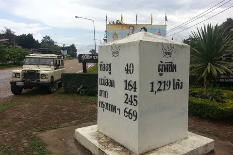
| Where | Umphang district, Tak province, at the end of Highway 1090. About 164 km from Mae Sot and about 670 km from Bangkok. |
|---|---|
| Travel time | Mae Sot to Umphang takes about 4 to 5 hours of driving with short stops. The shared songthaew takes about 5 hours (4 to 6). |
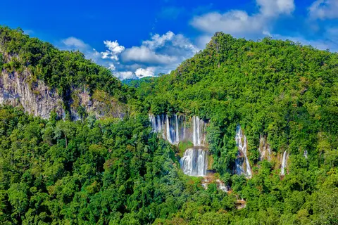
| Thi Lo Su | About 300 m high and 500 m wide, inside Umphang Wildlife Sanctuary. High-clearance 4WD for the last 25 km or so, then a walk of about 1.5 km. |
| Open season | The sanctuary closes the falls and rafting from about 1 July to 31 August each year (2025 and 2026 followed this). It reopened on 1 September 2026. The 2027 notice is not out yet. The road is easiest from about November to April. |
| Fees (about) | Foreign adult about 400 baht, Thai adult about 30 to 40 baht, 4-wheel vehicle about 60 baht. Check before you go. Local 4WD hire and guides are extra. |
| Rafting on the Mae Klong | About 2 to 4 hours from Umphang past Thi Lo Jo. Book with an operator in Umphang: the sanctuary does not run boats. |
| Doi Hua Mot | Sunrise and sea-of-mist viewpoint about 10 km from town. A walk of about 5 to 20 minutes from the car park, depending on the viewpoint. |
| Time needed | 3 to 4 days counting from Mae Sot. Two-day van tours from Bangkok exist but run overnight. |
| Suits | Nature and photography fans who cope with winding roads and do not mind a loose schedule. Not for a one-day visit or for people who get severely carsick. |
Prices and times are approximate as of 13 Nov 2026. Confirm with the sanctuary office or your operator before you go.
Highway 1090, Mae Sot to Umphang: 164 km and Over 1,000 Curves
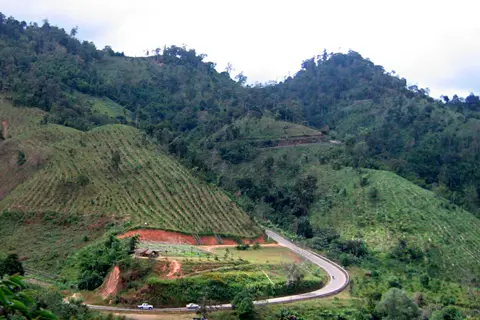
Highway 1090 is a paved two-lane road that climbs along ridges beside the border, through the Phop Phra police checkpoint, mountain passes and Karen villages. The distance from Mae Sot to Umphang is about 164 km, and the road is known for its 1,000-plus curves. A driver who makes only short stops needs about 4 to 5 hours. Most people stop at viewpoints, cafes and waterfalls, so count 6 to 7 hours if you leave Mae Sot in the morning.
Road condition and driving
- The surface is paved and much improved, but still narrow, with tight bends and steep descents. Use a low gear downhill, do not coast in neutral and do not ride the brakes.
- Check brakes, tyres and oil in Mae Sot. An ordinary car can reach Umphang town. The track into Thi Lo Su is a different matter: see the waterfall section.
- If you get carsick, take a tablet about half an hour before and sit in the front.
- Avoid driving at night or in thick fog. Leave Mae Sot before 10:00 so you arrive in Umphang before dark.
Fuel, phone signal and cash
- Fill the tank in Mae Sot: there are few fuel stations on the road. Top up again in Umphang before heading into the forest.
- Phone signal drops in places, especially on ridges and in Karen villages. Download offline maps. Signal at the Thi Lo Su campground is weak or absent, so tell people at home before you go in.
- Carry enough cash. ATMs in Umphang are few and some small shops and community services do not accept transfers, so withdraw cash in Mae Sot before the climb.
Stops on the way
- Blue Cave (Tham Si Fa), about 30 km from Mae Sot town, open about 08:00 to 17:00, call Tak TAT on 0 5551 4341 before you go: blue-tinted rock, a Burmese-style reclining Buddha and an elephant-trunk tunnel. Parts are dark, so bring a torch.
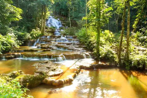
- Pha Charoen Waterfall National Park, a short detour off Highway 1090 at about the km 37 to 40 markers, open about 08:00 to 17:00, entry fee to be checked at the gate: limestone cascades with about 97 tiers and water all year, at its best in the rainy season.
- Ridge viewpoints, cafes and homestays by the road for a rest and a change of driver.
- At the Phop Phra checkpoint keep your passport or ID card within reach.
The road in stages and what to watch for
- About 20 km after Mae Sot the road runs along the Moei valley and is fairly flat. After that it climbs a cliff side with tight bends, no shoulder and few places to pull over.
- The Blue Cave is about 30 km out; the Pha Charoen detour is at about the km 37 to 40 markers. If you leave early you can stop at both.
- The coffee stop and small market at Ton Nam Mae Klong, about 90 minutes beyond Pha Charoen, sell basics and have toilets: rest there before the last stretch.
- Near the town you pass the Ban Mae Klong Mai junction at the km 161 marker, the turn for Thi Lo Su, about 3 km before Umphang.
- Heavy rain can bring landslides. In September 2025 one blocked Highway 1090 at the km 67 to 68 markers in Phop Phra district for a time. After heavy rain, ask your lodging or the Highway Department office in Mae Sot before you set off.
- Highway 1090 is the only road into Umphang. There is no road on to Kanchanaburi (Highway 1117 was never finished), so you return the way you came through Mae Sot.
 Klook
Car rental at Mae Sot Airport (MAQ)
Price Check latest price
Check the latest price on the booking pageCar hire collected at Mae Sot Airport lets you drive Highway 1090 to Umphang on your own timing. A small car reaches the town, but beyond the Huai Nong Luang unit the road to Thi Lo Su needs a high-clearance 4WD from a villager or a tour. Starting prices change by date and car: check the latest price on the booking page.
See Mae Sot car hireGoing without your own car
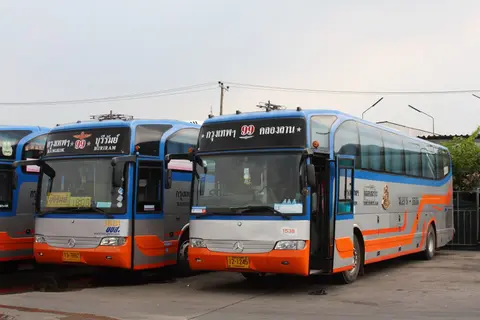
Shared songthaews run from Mae Sot bus terminal to Umphang, with a first departure at about 07:00 to 07:30 and then roughly hourly, and they leave when full. The fare is about 120 to 200 baht and the ride takes about 5 hours (4 to 6); check times and the price at the terminal or with your guesthouse. A chartered songthaew costs about 2,500 baht, to be confirmed before you board. The alternatives are a chartered van or pickup from Mae Sot, or a tour that includes transport. For buses, vans and flights into the area, see getting to Tak and Mae Sot.
Songthaews leave mainly in the morning. If you reach Mae Sot in the afternoon, sleep there and start early the next day.
Umphang town: your base before the forest
Umphang became a district in 1898 under the name Mae Klong, then changed name and province until it settled in Tak in 1926. It covers about 4,325 sq km, and the Karen are the largest ethnic group; many place names come from the Karen language. The town has the guesthouses, the tour operators, the restaurants and the landing where rafts start.
Umphang Local Museum
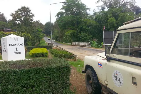
The museum opened on 7 November 2010 (2553 BE). It shows photographs from King Bhumibol's visit to Umphang on 17 June 1970, the history of the district, old coins and banknotes, clothing and the tools local people used for work. Check opening times before you go.
Umphang Walking Street
The walking street runs on Fridays and Saturdays from about 16:00 to 21:00 (check before you go) on Prawet Phairawan Road, near the Government Savings Bank and Wat Phanit Niramon. The subdistrict municipality started it on 21 October 2023. It sells local food, snacks such as sesame sticky rice and dried bananas, and crafts. Go at about 17:00 to 18:00 when stalls are open and it is not yet crowded, and make it your dinner if your trip includes a Friday or Saturday.
Where to eat in town
- Krua Pa Nee: open about 10:00 to 21:30, mains about 100 to 250 baht. Try the Karen-style dry-fried pork, fern salad and spicy pork soup. The lane is hard to find and mosquitoes are plentiful.
- Baan Khru San: a cafe from about 07:30 to 19:00 that also serves dinner from about 17:00 to 23:00 (check before you go).
- Roadside restaurants at the Thi Lo Su turn-off: simple, cheap stir-fries that suit lunch before the forest (hours vary).
Hospital and emergencies
- Umphang Hospital: 0 5556 1270 (check before you go). Emergency 191, tourist police 1155. For cash and phone signal see the Highway 1090 section above.
Getting ready in town
- If you have not booked yet, arrange your guide and 4WD here.
- Fill the tank, buy drinking water and snacks, and pick up personal supplies. A small shop at the Thi Lo Su campground sells simple items; check before you go.
- Rooms in town start at about 400 to 1,500 baht a night depending on type as of 6 Nov 2026. See where to stay in Tak and Mae Sot. Many sell Thi Lo Su packages.
- If you arrive on a tour van, the operator usually takes you straight to the lodging.
Photos, prices and reviews from Klook
AIS 5G eSIM for Thailand: data only, hotspot sharing allowed. Set it up before you leave Mae Sot so maps work wherever there is signal; on the ridges and at Thi Lo Su the signal may be missing on every network. Needs an eSIM-capable phone. Choose the number of days and read the refund terms on the booking page.
See Thailand 5G eSIMThi Lo Su Waterfall: rules, season and how to get in
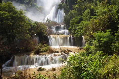
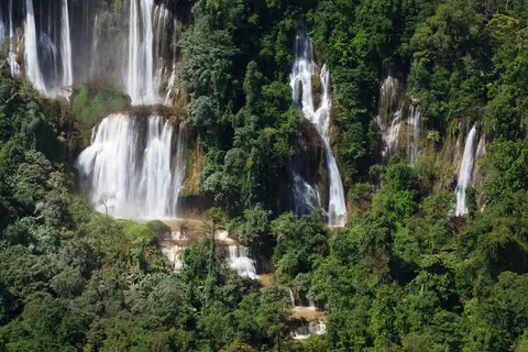
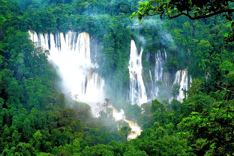
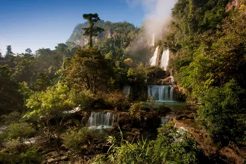
Thi Lo Su is a limestone waterfall about 300 m high and about 500 m wide, stepping down in tiers from the Huai Klo Tho stream at roughly 900 m above sea level. The Karen name means black waterfall. It lies in Umphang Wildlife Sanctuary, declared in 1989 and covering about 2,590 sq km. It is a conservation area, not a resort, so the rules are stricter than in a typical national park.
Open season and route by season
The sanctuary closes the area in the middle of the rains so the forest can recover and to reduce flash-flood risk. In 2026 it was closed from 1 July to 31 August and the nature-study site reopened on 1 September, while rain was still falling; the forest road was wet and slippery and the announcement recommended four-wheel drive. The closure covers the falls and Mae Klong rafting together. The notice usually comes out in late June on the sanctuary's Facebook page, so check it every year before you buy tickets.
| Year | Falls and rafting closed | Good to know |
|---|---|---|
| 2024 | Reopened 1 Sept (4WD only) | Flash flood hit the viewing deck; closed again 22 Sept to 2 Oct |
| 2025 | 1 July to 31 Aug, reopened 1 Sept | Sept landslide on Highway 1090 at km 67 to 68 |
| 2026 | 1 July to 31 Aug, reopened 1 Sept | High-clearance 4WD only; no-swimming signs |
| 2027 | No notice yet | Expect about the same dates; watch the sanctuary page in late June |
While the falls are closed, the town, the museum and the walking street carry on as usual; ask your operator about Doi Hua Mot and other trips. After the 1 September reopening the access road can stay wet until about November, depending on the rain.
| Period (about) | How you get in | Conditions |
|---|---|---|
| November to April | High-clearance 4WD from the Huai Nong Luang unit, about 25 km, then about a 1.5 km walk | Driest road. The fall still runs, with less water from December. |
| September to October | High-clearance 4WD if the road is open. If it is closed: raft from Tha Sai for about 3 hours, then walk about 10 km (about 3 hours) with the sanctuary's permission | Most water, which may be muddy, and a slippery road. |
| May to June | Open as announced; ask the sanctuary before you set out | Rain builds, roads are slippery, rivers change fast. |
| July to August | Closed (2025 and 2026: 1 July to 31 August) | Both the falls and Mae Klong rafting are shut. |
The road in and which vehicles can go
- Leave Highway 1090 at Ban Mae Klong Mai (km 161 marker, about 3 km before Umphang) onto Highway 1288 for about 25 to 30 km to the Dae Lo checkpoint, then turn into the sanctuary: about 50 km from Highway 1090 in all. The last 25 km or so, counted from the Huai Nong Luang unit, is concrete alternating with dirt, slippery in places.
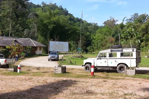
- Beyond the Huai Nong Luang unit only high-clearance 4WD vehicles may enter. Sedans, vans, motorbikes and ordinary pickups are not allowed, and low-slung 4WD SUVs do not pass. Motorbikes can only reach the ticket booth.
- Park a private vehicle at the ticket booth or the Huai Nong Luang ranger unit and hire a villager's vehicle to continue. The price is per trip or per vehicle and agreed with the driver; check before you go.
- Before entering you fill in your details and submit a permit form at the ticket booth, and you must follow the rules.
| Way in | Suits | Good to know |
|---|---|---|
| Your own high-clearance 4WD | Drivers used to slippery tracks | Fill in the form and buy tickets at the Huai Nong Luang unit; a 4-wheel vehicle is about 60 baht |
| Hire a villager's 4WD at the ticket point | Anyone who drove a sedan or van to Umphang | Park at the ticket point; agree the fare first, there is no fixed price |
| Tour from Umphang or Bangkok | Anyone who does not want to organise it, or who wants rafting too | Vehicle, tickets and permit included; van tours often add about 400 baht per foreign visitor |
Tickets, times and fees
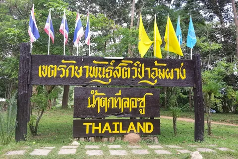
- Buy tickets at the Huai Nong Luang unit. For a day trip buy before 14:00; for an overnight stay buy before 16:30.
- Fees (about): foreign adult about 400 baht, foreign child about 200 baht, Thai adult about 30 to 40 baht, Thai child about 20 baht, 4-wheel vehicle about 60 baht. Check before you go.
- The villagers' 4WD fare and guide fees are not included. Most tours include the sanctuary fee and the vehicle in the package price.
At the waterfall
From the parking area to the viewpoint is about 1.5 km on a concrete path with a few flights of steps, about 20 to 30 minutes. The fall is a long run of tiers, and in wet years spray reaches the viewing area. Signs in 2026 banned swimming at the waterfall: obey the signs and the rangers, do not cross barriers, carry no single-use plastic, do not disturb wildlife and take your rubbish out.
Camping at Thi Lo Su
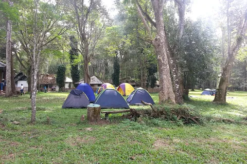
- There is a campground at the Thi Lo Su ranger unit, about 1 km from the falls, with toilets, cooking areas and a small shop selling simple items. There is no electricity and no bungalow, no bins (take your rubbish out), little or no phone signal, and the nights are cold in the cool season: bring a sleeping bag and repellent.
- Overnight stays need advance permission from the sanctuary (allow about 7 days or more) and documents shown at the unit. Campers enter until 16:30.
- A tent fee of about 30 baht per person per night is set by the sanctuary for visitors who bring their own tent, or you can rent a tent from them; check before you go. Bring your own food.
- Sanctuary office: 055 508 780 or 065 002 7637 between 08:30 and 16:30 (check the numbers before you call).
If you are unsure about a high-clearance 4WD and the permit, a tour from Umphang is the simplest way: the operator arranges the vehicle, tickets and permit.
Rafting on the Mae Klong river
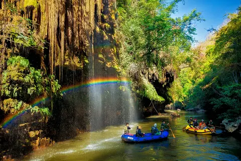
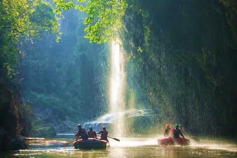
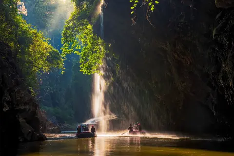
Trips used to run on bamboo rafts; today it is inflatable rafts with paddlers and a guide. The route runs from Umphang down the Mae Klong past limestone walls, Thi Lo Jo (the Rain or Rainbow waterfall), hot-spring stops, the Ta Kho Bi rapids and out to Tha Sai or the landing at the Pha Lueat ranger station, about 14 to 15 km in all. It takes about 2 to 4 hours depending on water level and stops. In the morning, around 09:00 on a sunny day, a rainbow forms at Thi Lo Jo.
| Length | About 2 to 4 hours from Umphang to Tha Sai or the landing, past Thi Lo Jo |
|---|---|
| Who paddles | Most tours supply staff paddlers: guests do not need to paddle |
| Season | Water is highest in the late rains and lowest from late cool season into the hot season. The sanctuary closes rafting from about 1 July to 31 August (2025 and 2026). Your operator can tell you what is possible that year. |
| Bring | Footwear that can get wet, quick-dry clothes, sunscreen and a waterproof bag. Life jackets are provided by the operator. |
| Booking | In Umphang through operators and resorts. The sanctuary itself does not run rafts. |
When the sanctuary closes the road to Thi Lo Su in the rains, rafting from Tha Sai (about 3 hours) followed by a walk of about 10 km is one of the two ways in. It needs the sanctuary's permission and an operator.
What happens on the river
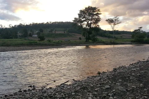
- The raft starts from a landing in town near where the Umphang stream joins the Mae Klong, and passes limestone walls.
- Thi Lo Jo is about 40 minutes downstream. If you set off at about 08:00 you arrive when the rainbow shows (about 09:00 to 10:30 on a sunny day).
- A hot-spring stop follows, with pools of about 40 degrees C, a bamboo walkway, toilets and food stalls, then the Ta Kho Bi rapids.
- The current is strong but manageable, and calmer from November to May.
Before paying a deposit, ask the operator whether life jackets, a local guide and accident insurance are included.
Doi Hua Mot: sea of mist and sunrise
Doi Hua Mot is a long limestone ridge about 10 km from Umphang on the road toward Ban Pa La Tha. It has two viewpoints for sunrise and sea of mist among overlapping ridges, at roughly 920 m. At night you can see stars and the lights of the town far below.
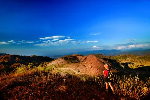
- Viewpoint 1, at the km 9 marker: a climb of about 20 minutes over 1.5 km, a little steep. This is the viewpoint most operators rate best for the sea of mist.
- Viewpoint 2, at the km 10 marker: turn left to the car park, then walk about 300 m (about 5 minutes) to the top.
- The sanctuary provides a tent area. Phone 0 5557 7318 (check the number before you call).
- Opening hours are about 08:00 to 18:00 but tours go up before dawn. For sunrise, leave your lodging at about 05:30; check before you go.
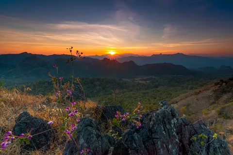
The mist is best from the late rains through the cool season, about October to February. Mornings are cold, so bring a warm layer, a torch and shoes with some grip.
Thi Lo Jo, Thi Lo Re and the nearby falls
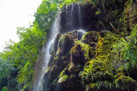
- Thi Lo Jo (Rain Waterfall or Rainbow Falls): about 80 m high; its spray falls onto the Mae Klong like rain, and the rainbow is clearest around 09:00. It is about 3 km from Umphang and reached by boat: about 40 minutes by inflatable raft. A nature trail of about 1.8 km runs through bamboo and mixed deciduous forest with wild ginger flowers.
- Thi Lo Re: an overhanging rock shelf beside the Mae Klong, on the eastern side of Thung Yai Naresuan. It starts at Ban Pa La Tha and takes about 3 days by raft with 2 nights camping. It needs permits from the sanctuary several weeks ahead and suits adventurous travellers who carry their own supplies.
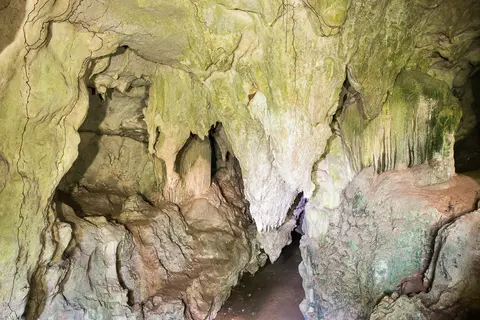
- Ta Kho Bi Cave: a dark cave about 3 km long with a high ceiling and formations, which you can walk through to Ban Mae Klong Mai. It is about 3 km from Umphang on the road toward Thi Lo Su. The sanctuary has a campsite nearby at about 30 baht per person per night; check before you go. Rafting trips pass the Ta Kho Bi rapids.
- Pi Tu Gro (Peto Lo Su): a waterfall about 500 m high on Doi Sam Muen, the source of the Mae Chan. You go with the Ban Kui Lue To community on a walk of about 8 km. It usually opens from about 1 June, with the exact season set by the community, must be booked through an operator and needs a local guide; porters are about 600 baht. Check before you go.
- Kho Tha waterfall (Kota): near Kho Tha village, reached from the Thi Lo Su road (a left turn about 7 km before the Thi Lo Su unit, then about 30 minutes on foot). Go with a local guide.
Booking tours from Umphang: packages and what to compare
Thi Lo Su and the river are hard to do on your own: you need a high-clearance 4WD, a permit and an operator with rafts. Most visitors buy a package in Umphang or a van package from Bangkok. Local operators include the Umphang Tourism and Conservation Club and the resorts in town.
| Package | About price | Usually includes |
|---|---|---|
| 2 days 1 night from Bangkok (overnight van) | about 2,500 to 4,500 baht per person | Van, rafting, 4WD to Thi Lo Su and Doi Hua Mot, sanctuary fees, one night's lodging, some meals. Foreign adults may pay a supplement. |
| 3 days 2 nights from Bangkok (van, evening departure) | about 3,000 to 4,000 baht per person | Rafting, 4WD, sanctuary fee, one night's lodging, some meals; runs when about 9 or more guests join |
| 3 days 2 nights starting in Umphang | about 6,400 to 12,500 baht per person, depending on group size and private or shared | Rafting, tent camp at Thi Lo Su, lodging, guide, meals |
| 4 days 3 nights, trek, raft and a Karen village stay | about 9,500 baht per person (minimum two) | Rafting, trekking, tent and village hut nights, guide |
| Pi Tu Gro, 3 days 2 nights from Bangkok | about 3,500 to 6,000 baht per person | Community, guide, 4WD, camp; porter fee separate |
Prices as of 13 Nov 2026 are rough guides and change with group size, season and length. They are not prices offered on this page. Check with the operator before you pay a deposit.
What to compare
- Who pays the sanctuary fee, and whether the foreign-visitor supplement is included.
- Minimum group size. Some van trips only run with 9 or more people.
- Life jackets, a local guide, accident insurance and the number of meals per day.
Trekking and Karen villages
The Karen have long lived in Umphang and are the largest group in the district. Several operators sell treks with a village night, for example Kho Tha village (a hut to sleep in, a bucket wash). Some villages have no electricity or mobile signal.
- Go with a local guide who helps with language and the route, and ask the operator in advance where you sleep and when the village receives visitors.
- Bring a sleeping bag or blanket, a torch, a power bank, insect repellent and a rain jacket.
- Treks that do not walk back can use a 4WD for a leg for about 1,000 to 2,500 baht extra per vehicle, depending on the leg. Check before you go.
- If you prefer not to sleep in a village, pick a package that returns to a resort in Umphang each night.
Ask your local guide about village customs and about photographing people before you start.
Which months are best
Most rain falls between May and October, and annual rainfall averages about 1,486 mm. August is the wettest month (about 261 mm) and January the driest (about 9 mm). So the choice is between the most powerful waterfall and the easiest travel.
| Months (about) | Thi Lo Su | Best for |
|---|---|---|
| January to February | Dry road, less water, cool pleasant weather, good sea of mist at Doi Hua Mot | Travellers who want good weather and an easy road |
| March to April | Hot and dry, the fall still runs, start early to avoid the sun | Heat-tolerant travellers who want to avoid Thai holiday crowds |
| May to June | Rain builds, roads slippery, open as announced | Travellers with an operator who knows the road and accept a plan that may change |
| July to August | Sanctuary closes the falls and rafting (2025 and 2026), heaviest rain | Not for a waterfall trip; the town itself is still open |
| September to October | Opens as announced (2026: 1 September), lots of water, rain still falling | Those who want the fall at full power and accept a wet road |
| November to December | Still plenty of water, cooler, drier road, Thai crowds at Christmas and New Year | The time most people consider the best and the easiest. Book ahead. |
New Year is crowded. If you can be flexible, go midweek in November or early December.
A 3 to 4 day plan from Mae Sot
This plan assumes you reach Mae Sot the evening before day 1 and have booked a 4WD or tour in advance. On a van tour from Bangkok the operator sets the schedule, with a similar order.
- Day 1: leave Mae Sot at about 08:30 (no later than 10:00). Stop at the Blue Cave or Pha Charoen, have lunch near Pha Charoen and a coffee at Ton Nam Mae Klong. Reach Umphang at about 15:00, see the museum, meet your operator and sleep in town.
- Day 2: raft from Umphang past Thi Lo Jo (about 2 to 4 hours), stop at Ta Kho Bi Cave, then take a 4WD to Thi Lo Su. Walk to the falls in the afternoon and camp at the ground. Buy tickets before 16:30 if staying overnight.
- Day 3: wake at Thi Lo Su and walk to the falls again while it is quiet. Return to Umphang and rest or stroll the town in the afternoon.
- Day 4: get up around 05:00 for sunrise and sea of mist at Doi Hua Mot. Have breakfast and leave Umphang before 10:00 to reach Mae Sot before dark.
If you only have 3 days
Drop the night at Thi Lo Su. On day 2 make a 4WD round trip to Thi Lo Su and sleep in Umphang. On day 3 go up Doi Hua Mot at dawn, raft in the late morning and drive back to Mae Sot in the afternoon. It is tighter than the 4-day plan and you will not sleep at the falls.
See the Tak itineraries that connect to Umphang
Plan a night in Mae Sot before you go: see Mae Sot and the border area, and Tak town and Bhumibol Dam if you want to break the drive back to Bangkok.
Other plans: no rafting, no car, and tours from Bangkok
Self-drive without rafting, 3 days 2 nights
- Day 1: leave Mae Sot at about 08:30 and reach Umphang in the afternoon. Buy water and snacks and arrange a villager's 4WD in advance.
- Day 2: reach the Huai Nong Luang unit in time for a day-trip ticket before 14:00, take a 4WD in, walk to the falls (about 20 to 30 minutes) and be back in town before dark. On a Friday or Saturday evening go to the walking street.
- Day 3: Doi Hua Mot at sunrise (leave at about 05:00 to 05:30), breakfast, then leave Umphang before 10:00 to reach Mae Sot before dark.
No car: songthaew and tours in Umphang
Take a morning songthaew from Mae Sot bus terminal (first departure about 07:00 to 07:30). You arrive around midday to early afternoon. Then book a 2-day rafting and 4WD package with an operator in town; your lodging can arrange it. Go back on a morning songthaew and allow extra time, because it leaves when full.
Van tour from Bangkok, 3 days 2 nights
The van leaves Bangkok at about 20:00 and you sleep on board the first night. The second night is in a resort in Umphang and you are back in Bangkok at about 23:00 on day 3. Departures run in rounds that depend on group size, so ask for the 2027 dates before you book other travel.
If you have 5 days
Add Pi Tu Gro (3 days 2 nights, about 8 km on foot, local guide required, season set by the community), or add a night in Mae Sot for the markets and the river: see Mae Sot and the border area. Sukhothai is about 160 km on from Mae Sot: see Sukhothai or Phitsanulok.
Families, older travellers and rainy days
Small children
- Rafting suits many families with small children; ask the operator about small life jackets before you book.
- Children who can walk can manage the 1.5 km path to the falls viewpoint, but there is no swimming.
Older travellers
- Sleep in town and hire a 4WD for a day trip rather than camping, since nights at the camp are cold in the cool season.
- Pi Tu Gro and Thi Lo Re mean many hours or days of walking and are not suitable. Doi Hua Mot viewpoint 2 (about 5 minutes) is easier than viewpoint 1.
Rainy days
- Heavy rain makes the falls stronger and muddy, and the sanctuary may close the site briefly: in 2024 a flash flood closed it from 22 September to 2 October. Check the notice on the morning you travel.
- If you cannot raft or climb Doi Hua Mot, use the Umphang museum and the town cafes, and the walking street on a Friday or Saturday evening.
Budget for 3 days and 2 nights from Mae Sot
Figures are for two adults and are listed so you can add them up. They are approximate as of 13 Nov 2026.
| Item | About (baht) | How it is worked out |
|---|---|---|
| Songthaew both ways | 480 to 800 | 2 people x 120 to 200 x 2 trips |
| Or a hire car | see booking page | Check the latest price; fuel extra |
| Umphang room, 2 nights, 1 room | 1,000 to 2,600 | 500 to 1,300 a night x 2 |
| Sanctuary fee, 2 Thai adults + car | 120 to 140 | 2 x (30 to 40) + 60 |
| Sanctuary fee, 2 foreign adults + car | 860 | 2 x 400 + 60 |
| Meals for 3 days | 1,200 to 3,000 | 2 people x 2 meals x 3 days x 100 to 250 |
| Villager 4WD, rafting, guide | ask the operator | No fixed price |
By songthaew with two Thai adults the total is about 2,800 to 6,540 baht; with two foreign adults, about 3,540 to 7,260. Neither includes the 4WD and rafting.
A 3-day van tour from Bangkok at about 3,000 to 4,000 baht a person is 6,000 to 8,000 baht for two, and already includes the van, rafting, 4WD and one night's lodging (plus about 400 baht per foreign visitor on many tours).
Transport and rooms for this trip
Prices are starting prices and change by date and option.
 12Go
Bangkok to Mae Sot on 12Go
From US$16 (As of 6 Nov 2026: buses from about US$16, flights from about US$111, private cars from about US$168. Prices change by date and operator)
Price as of 6 Nov 2026Buses and flights from Bangkok to Mae Sot, the start of Highway 1090 to Umphang, from about US$16 as of 6 Nov 2026
Book on 12Go Klook
Car rental at Mae Sot Airport (MAQ)
Price Check latest price
Check the latest price on the booking pageCar hire at Mae Sot Airport, with a free additional driver, unlimited mileage and full-to-full fuel. It takes you to Umphang town; the way into Thi Lo Su still needs a 4WD. Check the latest price on the booking page.
See Mae Sot car hire
Umphangburiresort
90 Moo 6, Umphang-Palatha Road, Umphang
A resort on Moo 6, Umphang-Pa La Tha Road. Ask the lodge about transport into Thi Lo Su, the price and the activities before you book
See prices and availability on the booking page
Vela Resort Umphang
528 Mae Klong, Umphang
A resort in Mae Klong subdistrict. It suits visitors who want to be nearer the way into Thi Lo Su than the town. Check the route in on the map before booking
See prices and availability on the booking page
Baan Bupchat Resort Umphang Tak
501 Umphang subdistrict, Umphang
A resort in Umphang subdistrict, handy if you want to sleep in town and organise your trips from here. Ask about transport into Thi Lo Su before you book.
See prices and availability on the booking page
Common mistakes
- Trying it in one day. A round trip Mae Sot to Umphang costs 8 to 12 hours on the road and leaves little time at the falls.
- Driving a sedan or a van to Thi Lo Su. You can only reach the ticket booth, then you must switch to a high-clearance 4WD.
- Not checking the announcement. In wet years the sanctuary can delay the opening or close the road earlier than expected.
- Not booking a 4WD or lodging for Christmas and New Year, when Thai visitors fill Umphang.
- Going to Thi Lo Su or rafting between 1 July and 31 August, when the sanctuary closes both.
- Planning to carry on from Umphang to Kanchanaburi. There is no road; you return through Mae Sot.
- Setting off after heavy rain without asking about the road. In September 2025 a landslide hit Highway 1090 at the km 67 to 68 markers.
Read next
 Tak: Mae Sot, Umphang, Thi Lo Su, Bhumibol DamAll three zones of Tak, with plans, hotels and how to get there
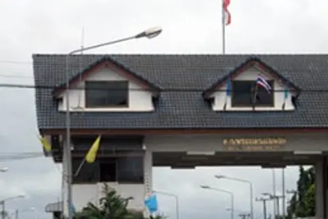 Mae Sot: Rim Moei market, Burmese-style temples and border-town foodRim Moei Market, Wat Thai Wattanaram, Wat Mani Phraison, jade, Burmese, Thai and Chinese food, Tha Song Yang and Mae Usu Cave
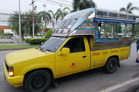 Getting to Tak and Mae SotBuses from Mo Chit, Nok Air flights, driving and songthaews to Umphang, with times and prices
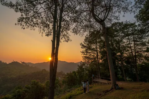 Where to stay in TakPick the area by route, with 20 hotels, nightly price ranges and when to book
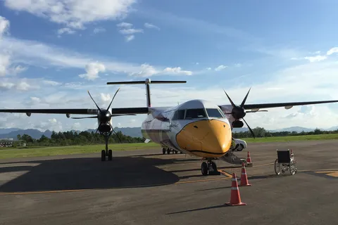 Deals and bookingBuses, flights and private cars to Tak and Mae Sot, with prices and cancellation terms
 Tak in 1 to 4 daysTimed plans for Tak town, Mae Sot and Umphang by bus or car
 Tak Town and Bhumibol DamKing Taksin Shrine, the Ping River bridge, Bhumibol Dam, the giant Krabak tree and Lan Sang waterfall, with hours and fees
Frequently asked questions
How many days do I need for Umphang and Thi Lo Su?
Allow 3 to 4 days counting from Mae Sot. The road takes about 4 to 5 hours each way. A van tour from Bangkok can do it in 2 days and 1 night, but you ride overnight and have little time at the falls.
Can I drive my own car to Thi Lo Su?
You can drive to Umphang town, but beyond the Huai Nong Luang unit only high-clearance 4WD vehicles may enter. Sedans, vans, motorbikes and ordinary pickups are not allowed. Leave your car at the ticket booth or Huai Nong Luang unit and hire a villager's 4WD or take a tour. Check the rules with the sanctuary before you go.
When is Thi Lo Su open?
The sanctuary closes the falls and Mae Klong rafting from about 1 July to 31 August: 2025 and 2026 both followed these dates, and in 2026 it reopened on 1 September. The 2027 notice is not out yet and should be similar; watch the sanctuary's Facebook page in late June. The road is easiest from about November to April.
How much does Thi Lo Su cost?
Fees are about 400 baht for a foreign adult, about 200 baht for a foreign child, about 30 to 40 baht for a Thai adult, about 20 baht for a Thai child and about 60 baht per 4-wheel vehicle. Local 4WD hire and guides are extra. Check before you go.
Can you swim at Thi Lo Su?
In 2026 signs banned swimming at the waterfall. Follow the signs and the rangers. The water can change quickly after rain.
Is there public transport to Umphang?
Yes, to the town. Shared songthaews run from Mae Sot bus terminal, first departure about 07:00 to 07:30, for about 120 to 200 baht and take about 5 hours; check times before you go. From town you need a tour or chartered vehicle to reach Thi Lo Su.
Do I have to paddle on the Mae Klong rafting trip?
Most tours have staff paddlers and no big rapids. The trip takes about 2 to 4 hours. Bring footwear that can get wet.
Is Doi Hua Mot a long walk?
Viewpoint 1 at the km 9 marker is a climb of about 20 minutes over 1.5 km. Viewpoint 2 at km 10 is about 5 minutes, about 300 m from the car park.
What about cash and phone signal in Umphang?
Withdraw enough cash in Mae Sot: ATMs in Umphang are few and some small shops do not take transfers. Signal drops out on Highway 1090 and is weak or absent at the Thi Lo Su campground. Set up an eSIM and download offline maps in Mae Sot.
Do I need to book or get a permit for Thi Lo Su?
For a day trip you fill in the form and buy a ticket at the Huai Nong Luang unit before 14:00. An overnight stay needs advance permission (allow about 7 days or more), with tickets bought before 16:30; call the sanctuary on 055 508 780. At Christmas and New Year book your 4WD and lodging about a month ahead.
Where the facts come from
- Kapook: Thi Lo Su 2026 season (Thai)
- Chiang Mai News: Thi Lo Su season opening 2026 (Thai)
- Khao Chao Baan: Thi Lo Su opens 1 Sep 2026, 4WD only (Thai)
- Bangkok Biznews: Thi Lo Su reopening (Thai)
- Bangkok Biznews: Thi Lo Su fee rates (Thai)
- Maneedee: Umphang and Thi Lo Su 3 day plan (Thai)
- Klukfoon Tour: Thi Lo Su and Doi Hua Mot programme (Thai)
- Wikipedia: Umphang district
- Wikipedia: Umphang Wildlife Sanctuary
- Nation Thailand: Thi Lo Su closed 1 Jul to 31 Aug 2026
- Daily News: Thi Lo Su and Mae Klong rafting closure 2026 (Thai)
- Touch Grass Tour: Driving the Umphang Highway
- Thai Holiday Guide: Thi Lor Su Waterfall
- Chiang Mai News: Umphang Walking Street (Thai)